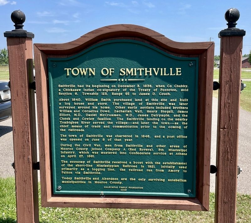
Town of Smithville
About 1840, William Smith purchased land at this site and built a log house and store. The village of Smithville was later surveyed around his home. Other early settlers included brothers William and Cornelius Dowd, Zachariah Wall, Henry Stegall, James Elliott, M.D., Daniel McCrummen, M.D., James Dalrymple, and the Cheek and Cowley families. The Smithville landing on the nearby Tombigbee River served the village---and later the town ---as the chief means of trade and communication prior to the coming of the railroads.
The town of Smithville was chartered in 1846, and a post office was opened on June 8 of that year.
During the Civil War, men from Smithville and other areas of Monroe County joined Company A (Red Rovers), 5th Mississippi Infantry, which was mustered into Confederate service at Athens on April 27, 1861.
The economy of Smithville received a boost with the establishment of the short-line Mississippian Railroad in 1921. Initially used primarily as a logging line, the railroad ran from Amory to Fulton via Smithville.
Today Smithville and Aberdeen are the only surviving antebellum municipalities in
Monroe County.Erected 2009 by Dalrymple Family Foundation.
Topics. This historical marker is listed in these topic lists: Settlements & Settlers • Waterways & Vessels. A significant historical date for this entry is April 27, 1861.
Location. 34° 4.144′ N, 88° 23.85′ W. Marker is in Smithville, Mississippi, in Monroe County. Marker is on Mississippi Route 25 south of Elm Street, on the right when traveling south. Touch for map. Marker is at or near this postal address: 63439 MS-25, Smithville MS 38870, United States of America. Touch for directions.
Other nearby markers. At least 8 other markers are within 8 miles of this marker, measured as the crow flies. Rod Brasfield (approx. 0.4 miles away); Gaines Trace (approx. 0.4 miles away); New Hope Church (approx. 6˝ miles away); Chickasaw Cession (approx. 7.1 miles away); Amory, Mississippi: Blues from a Railroad Town (approx. 7.8 miles away); Amory's Tribute to the Heroes of 1861—1865 (approx. 7.8 miles away); Gilmore Sanitarium (approx. 7.9 miles away); Becker Post Office (approx. 8 miles away). Touch for a list and map of all markers in Smithville.
Also see . . . History of Smithville from its website. (Submitted on May 25, 2021, by Mark Hilton of Montgomery, Alabama.)
Credits. This page was last revised on May 25, 2021. It was originally submitted on May 25, 2021, by Mark Hilton of Montgomery, Alabama. This page has been viewed 402 times since then and 97 times this year. Photos: 1, 2. submitted on May 25, 2021, by Mark Hilton of Montgomery, Alabama.

