Jamestown in James City County, Virginia — The American South (Mid-Atlantic)
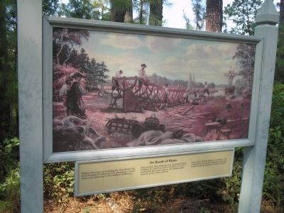
On Roads of Water
Once settled, they gathered raw materials of boat building for export as well as for their own use: hardwoods for masts, staves, and planks; pine trees for pitch, resin, and tar.
From their shallow boats, or “shallops,” the colonists harvested the teeming waters and traded along the shores of coastal Virginia.
Erected by Colonial National Historic Park.
Topics. This historical marker is listed in this topic list: Colonial Era.
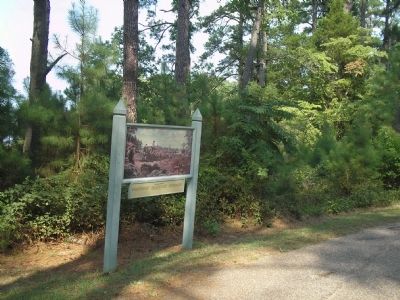
Location. 37° 12.667′ N, 76° 46.414′ W. Marker is in Jamestown, Virginia, in James City County. Marker is on Loop Drive, on the left when traveling east. Marker is on Jamestown Island, along the Loop Drive. Touch for map. Marker is in this post office area: Jamestown VA 23081, United States of America. Touch for directions.
Other nearby markers. At least 8 other markers are within walking distance of this marker. Governor Yeardley’s Lot 1620’s (approx. 0.2 miles away); Colonial Parkway (approx. 0.2 miles away); Tradesmen on Governor Harvey’s Lot 1630s (approx. 0.2 miles away); A Place of Work (approx. 0.2 miles away); Iron and Industry (approx. 0.2 miles away); Efforts to Build a Town 1660-1699 (approx. 0.2 miles away); Pitch and Tar Swamp (approx. 0.2 miles away); Inside a Home (approx. 0.2 miles away).
More about this marker. The top of the marker features a picture of Jamestown colonists constructing a boat.
Related markers. Click here for a list of markers that are related to this marker. Take a virtual tour of markers located along the Loop Drive on Jamestown Island.
Also see . . .
1. Island Loop Drive. Colonial National Historic Park from National Park Service website. (Submitted on March 27, 2009, by Bill Coughlin of Woodland Park, New Jersey.)
2. Historic Jamestowne. Historic Jamestowne is the site of the first permanent English settlement in America. The site is jointly administered by APVA Preservation Virginia and the National Park Service. (Submitted on March 27, 2009, by Bill Coughlin of Woodland Park, New Jersey.)
Credits. This page was last revised on June 16, 2016. It was originally submitted on March 27, 2009, by Bill Coughlin of Woodland Park, New Jersey. This page has been viewed 723 times since then and 12 times this year. Photos: 1, 2. submitted on March 27, 2009, by Bill Coughlin of Woodland Park, New Jersey.

