Brownfield in Terry County, Texas — The American South (West South Central)
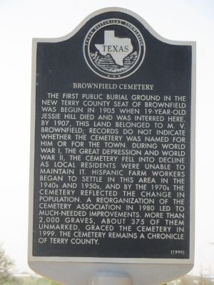
Brownfield Cemetery
Photographed by Bill Kirchner, April 28, 2014
1. Brownfield Cemetery Marker
Erected 1999 by Texas Historical Commission. (Marker Number 12225.)
Topics. This historical marker is listed in this topic list: Cemeteries & Burial Sites. A significant historical year for this entry is 1904.
Location. 33° 11.267′ N, 102° 17.472′ W. Marker is in Brownfield, Texas, in Terry County. It is on North 14th Street (State Highway 137) 0.8 miles north
this page online

Regionally, this marker is on the South Plains. It is also on the American Great Plains and specifically on the Southern Plains. Globally, it is in North America, a Gulf of Mexico state, the Western Hemisphere, the Western World, and the Anglosphere. Historically, it finds itself in what was once New Spain, the Comanchería, the Republic of Texas, and one of the Confederate States of America.
Other nearby markers. At least 8 other markers are within one mile of this marker, measured as the crow flies: Brownfield Municipal Power Plant (approx. ¾ mile away); City of Brownfield (approx. 0.8 miles away); In Honor of Terry Co. Veterans (approx. 0.9 miles away); "Flame of Freedom" (approx. 0.9 miles away); Colonel B. F. Terry / Terry's Texas Rangers (approx. 0.9 miles away); First Baptist Church of Brownfield (approx. one mile away); Flora and Fauna (approx. one mile
Photographed by Bill Kirchner, April 28, 2014
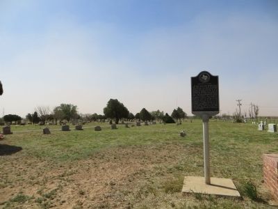
2. Brownfield Cemetery Marker
Regarding Brownfield Cemetery. The marker names "Jessie Hill," but the correct spelling appears to be "Jesse Hill," according to the headstone.
Photographed by Bill Kirchner, April 28, 2014
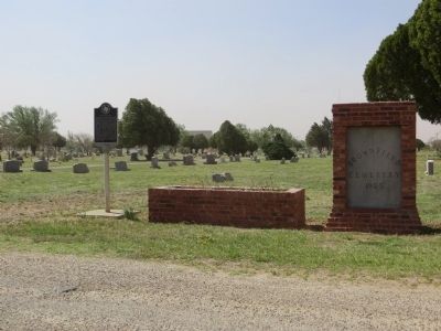
3. Brownfield Cemetery
Credits. This page was last revised on November 28, 2025. It was originally submitted on May 7, 2014, by Bill Kirchner of Tucson, Arizona. This page has been viewed 1,221 times since then and 114 times this year. Last updated on November 27, 2025. Photos: 1, 2, 3. submitted on May 7, 2014, by Bill Kirchner of Tucson, Arizona. • Devry Becker Jones was the editor who published this page.
