Parkers Crossroads in Henderson County, Tennessee — The American South (East South Central)
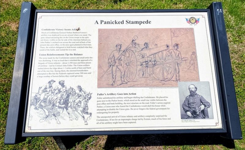
A Panicked Stampede
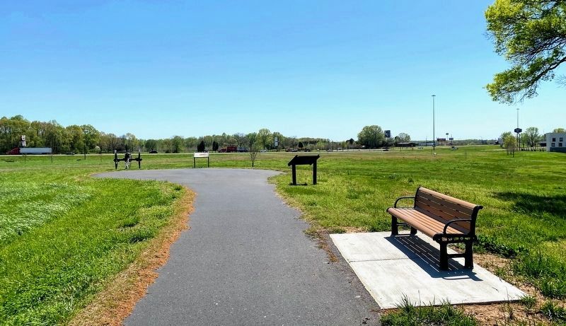
Much of Confederate General Nathan Bedford Forrest's artillery was deployed in an arc around where you stand. The guns rained unceasing fire on Union troops at the split-rail fence, visible on the far side of the interstate behind you. John Parker's orchard was across the road and in back of the present-day post office, in the area again planted in fruit trees. There, the soldiers delegated to hold horses watched what they could of the battle, and waited for it to end.
Union Reinforcements Tip the Balance
The noise made by the Confederate cannon and small arms fire was deafening. It was so loud that it shielded the approach of a brigade of Union infantry—about 1,500 and three pieces of artillery—led by Colonel John Fuller. The Union soldiers rushed down the ridge about 1.3 miles north of here and burst out of the tree line. Seeing them, the alarmed horseholders attempted to flee but the Federals captured some 300 men and a large number of horses before they could get away.
Fuller's Artillery Goes into Action
Fuller unlimbered his artillery and began shelling the Confederates. He placed his guns next to the Parker house, which stood on the small rise visible between the post office and bank building, the next structure on the road. Fuller's actions angered Parker, a Union mane who feared the Confederates would shell his house while attempting to disable the Union guns. He never forgave the federal government for endangering his property.
The unexpected arrival of Union infantry and artillery completely surprised the Confederates. If not for an impromptu charge led by Forrest, much of his force and all of his artillery might have been captured.
(caption)
Col. John W. Fuller, U.S.
Erected 2015 by Parker's Crossroads Battlefield Association.
Topics. This historical marker is listed in this topic list: War, US Civil. A significant historical date for this entry is December 31, 1862.
Location. 35° 47.544′ N, 88° 23.265′ W. Marker is in Parkers Crossroads, Tennessee, in Henderson County. Marker is on Wildersville Road, 0.2 miles Tennessee Route 22, on the right when traveling east. Marker is located along the North Battlefield Trail Extension, south of Wildersville Road. The North Battlefield Trail begins at the Parker's Crossroads City Park: Auto Tour Stop No. 1 of the Parker's Crossroads Battlefield Auto Tour. Touch for map. Marker is in this post office area: Wildersville TN 38388, United States of America. Touch for directions.
Other nearby markers. At least 8 other markers are within walking distance of this marker. Forrest's Artillery Leads the Attack (a few steps from this marker); Manning the Guns (about 300 feet away, measured in a direct line); Civil War Artillery
(about 300 feet away); Dunham's Artillery is Forced to Withdraw (about 400 feet away); Prelude to Battle/December 31, 1862—the Battle/Union and Confederate Forces (about 400 feet away); The Battle Begins (about 600 feet away); Dunham Takes the Offensive (about 600 feet away); Forrest's Big Show (about 600 feet away). Touch for a list and map of all markers in Parkers Crossroads.
Also see . . . Parker's Crossroads Battlefield Association. (Submitted on June 4, 2021.)
Credits. This page was last revised on June 4, 2021. It was originally submitted on May 30, 2021, by Shane Oliver of Richmond, Virginia. This page has been viewed 242 times since then and 51 times this year. Photos: 1, 2. submitted on May 30, 2021, by Shane Oliver of Richmond, Virginia. • Bernard Fisher was the editor who published this page.

