Pontiac in Oakland County, Michigan — The American Midwest (Great Lakes)
Oak Hill Cemetery
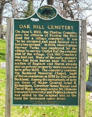
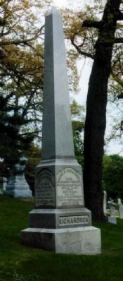
On June 1, 1822, the Pontiac Company gave the citizens of Pontiac the first land for a village cemetery. It was "to be occupied and used forever as a burying ground." In 1839, when Captain Hervey Parke was employed by the village to survey Outlot 9 of the original plat of the village, Oak Hill Cemetery was laid out. Many of the early pioneers who had been buried near the intersection of Saginaw and Huron streets and on private property were reinterred here after 1839. The cemetery contains the Buckland Memorial Chapel, built of Berea sandstone in 1898 by Don Carlos Buckland. Among the monuments of note are those of Major General Israel B. Richardson, Governor Moses Wisner and David Ward. Acreage across Mt. Clemens (renamed University) and Paddock streets was added to the original site as the need for increased space arose.
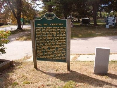
(Back):
Occupying the highest point of land in Pontiac, Oak Hill Cemetery has served the city throughout its history. Colonel Stephen Mack, who managed the Pontiac Company and was in 1818 one of the village's first settlers, was reinterred here, as was his daughter, Lovina, who was the first white settler to die in Pontiac. Mack's grave is one of six belonging to veterans of the American Revolution. Twenty-seven Civil War soldiers also lie here, including Governor Moses Wisner, Major General Israel B. Richardson and Brigadier General Joseph T. Copeland. Other historic figures interred here include the Reverend Isaac Ruggles, a pioneer missionary in Michigan, and lumberman David Ward. In more recent times, World War I Congressional Medal of Honor veteran Dr. Harold A. Furlong was buried here.
Erected 1987 by State of Michigan. (Marker Number L1450.)
Topics and series. This historical marker is listed in these topic lists: Cemeteries & Burial Sites • War, US Civil • War, US Revolutionary • War, World I. In addition, it is included in the Michigan Historical Commission series list. A significant historical date for this entry is June 1, 1822.
Location. 42° 38.521′ N, 83° 17.117′ W. Marker is in Pontiac, Michigan, in Oakland County. Marker is on University Drive (State Highway 59), on the right when traveling west. Touch for map. Marker is at or near this postal address: 216 University drive, Pontiac MI 48342, United States of America. Touch for directions.
Other nearby markers. At least 8 other markers are within walking distance of this marker. Elizabeth Denison Forth (approx. 0.2 miles away); a different marker also named Oak Hill Cemetery (approx. 0.4 miles away); Pontiac Thrived (approx. 0.4 miles away); Pontiac Public Library (approx. 0.4 miles away); Pontiac Monument (approx. 0.4 miles away); Made in Pontiac (approx. 0.4 miles away); First Baptist Church (approx. 0.4 miles away); Inspiration Road (approx. half a mile away). Touch for a list and map of all markers in Pontiac.
Related markers. Click here for a list of markers that are related to this marker. Site of General Richardson's mortal wounding.
Credits. This page was last revised on May 31, 2021. It was originally submitted on December 8, 2008, by Al Barrera of Brownstown, Michigan. This page has been viewed 3,627 times since then and 60 times this year. Last updated on May 30, 2021, by J.T. Lambrou of New Boston, Michigan. Photos: 1, 2. submitted on December 9, 2008, by Al Barrera of Brownstown, Michigan. 3. submitted on January 1, 2009, by Al Barrera of Brownstown, Michigan. 4. submitted on May 28, 2021, by J.T. Lambrou of New Boston, Michigan. • J. Makali Bruton was the editor who published this page.


