Cheltenham in Prince George's County, Maryland — The American Northeast (Mid-Atlantic)
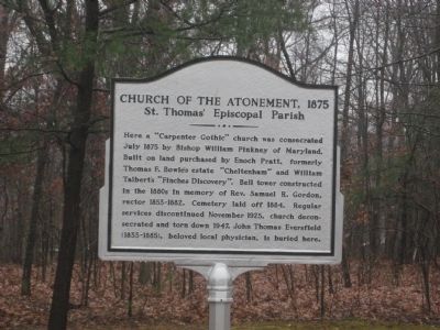
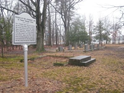
Church of the Atonement, 1875
St. Thomas' Episcopal Parish
Topics. This historical marker is listed in these topic lists: Architecture • Cemeteries & Burial Sites • Churches & Religion • Science & Medicine. A significant historical year for this entry is 1875.
Location. 38° 44.055′ N, 76° 49.455′ W. Marker is in Cheltenham, Maryland, in Prince George's County. Marker is on Frank Tippett Road, 0.1 miles east of Crain Highway (U.S. 301), on the left when traveling south. Marker is at the end of paved road, across the railroad tracks. Touch for map. Marker is in this post office area: Cheltenham MD 20623, United States of America. Touch for directions.
Other nearby markers. At least 8 other markers are within 4 miles of this marker, measured as the crow flies. Cheltenham United Methodist Church (approx. 0.2 miles away); Mount Airy (approx. 2.2 miles away); Bellefields (approx. 2.7 miles away); Stables/Tack House (approx. 2.8 miles away); Slaves’ Infirmary [on His Lordship’s Kindness] (approx. 3.2 miles away); His Lordship’s Kindness (approx. 3.4 miles away); T. B. (approx. 3˝ miles away); St. Simon's Episcopal Mission (approx. 3.6 miles away).
Also see . . . Church of the Atonement Cemetery, Maryland Inventory of Historic Properties. (Submitted on August 8, 2019.)
Credits. This page was last revised on January 12, 2020. It was originally submitted on March 28, 2009, by F. Robby of Baltimore, Maryland. This page has been viewed 1,125 times since then and 15 times this year. Photos: 1, 2, 3. submitted on March 28, 2009, by F. Robby of Baltimore, Maryland.


