Cairo in Alexander County, Illinois — The American Midwest (Great Lakes)
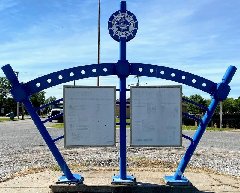
Great River Road Illinois
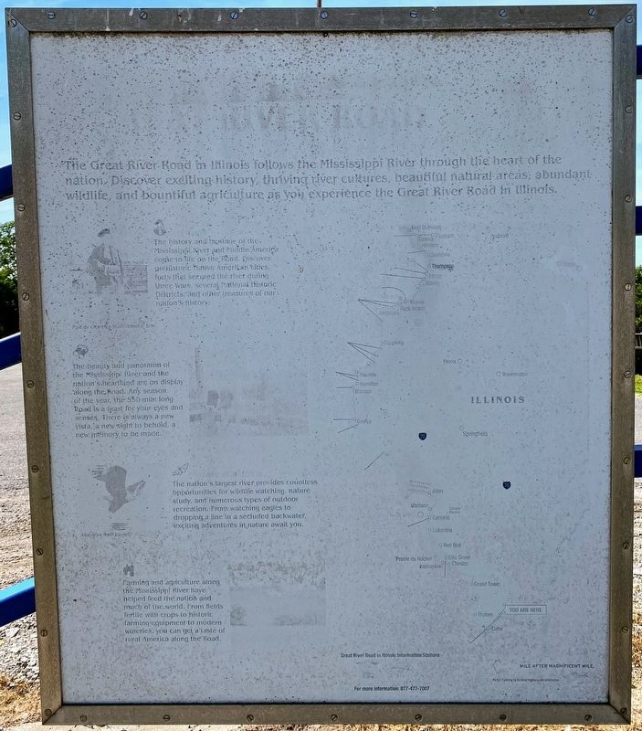
The Great River Road in Illinois follows the Mississippi River through the heart of the nation. Discover exciting history, thriving river cultures, beautiful natural areas, abundant wildlife, and bountiful agriculture as you experience the Great River Road in Illinois.
The history and heritage of the Mississippi River and Middle America come to life on the Road. Discover prehistoric Native American cities, forts that secured the river during three wars, several National Historic Districts, and other treasures of our nation's history.
The beauty and panorama of the Mississippi River and the nation's heartland are on display along the Road. Any season of the year, the 550-mile long Road is a feast for your eyes and senses. There is always a new vista, a new sight to behold, a new memory to be made.
The nation's largest river provides countless opportunities for wildlife watching, nature study, and numerous types of outdoor recreation. From watching eagles to dropping a line in a secluded backwater, exciting adventures in nature await you.
Farming and agriculture along the Mississippi River have helped feed the nation and much of the world. From fields fertile with crops to historic farming equipment to modern wineries, you can get a taste of rural America along the Road.
Great River Road in Illinois Information Stations
For more information: 877-477-7007
MILE AFTER MAGNIFICENT MILE.
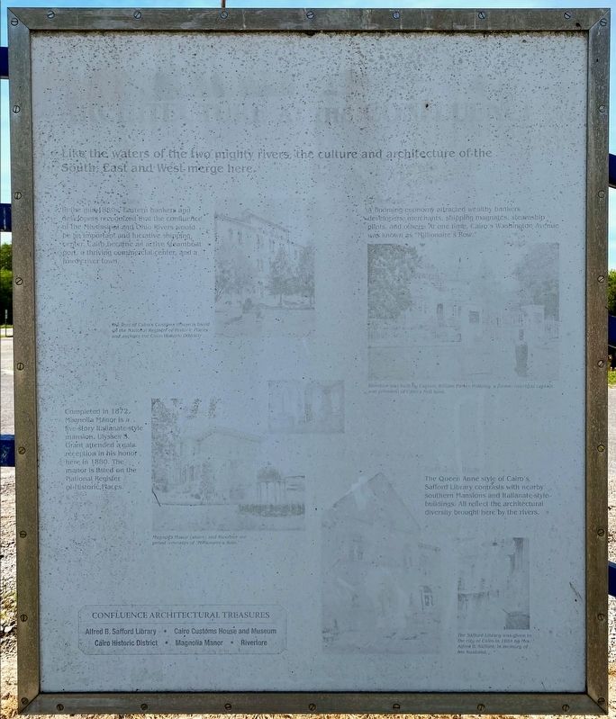
In the mid 1880s, Eastern bankers and developers recognized that the confluence of the Mississippi and Ohio Rivers would be an important and lucrative shipping center. Cairo became an active steamboat port, a thriving commercial center, and a rowdy river town.
Completed in 1872, Magnolia Manor is a five-story Italianate-style mansion. Ulysses S. Grant attended a gala reception in his honor here in 1880. The manor is listed on the National Register of Historic Places.
A Booming economy attracted wealthy bankers, developers, merchants, shipping magnates, steamship pilots, and others. At one time, Cairo's Washington Avenue was known as "Millionaire's Row."
The Queen Anne style of Cairo's Safford Library contrasts with nearby southern Mansions and Italianate-style buildings. All reflect the architectural diversity brought here by the rivers.
Confluence Architectural Treasures
- Alfred B. Safford Library
- Cairo Customs House and Museum
- Cairo Historic District
- Magnolia Manor
- Riverlore
(image captions):
The Port of Cairo's Customs House is listed on the National Register of Historic Places and anchors the Cairo Historic District.
Magnolia Manor (above) and Riverlore are proud remnants of "Millionaire's Row."
Riverlore was built by Captain William Parker Halliday, a former riverboat captain and president of Cairo's first bank.
The Safford Library was given to the city of Cairo in 1884 by Mrs. Alfred B. Safford, in memory of her husband.
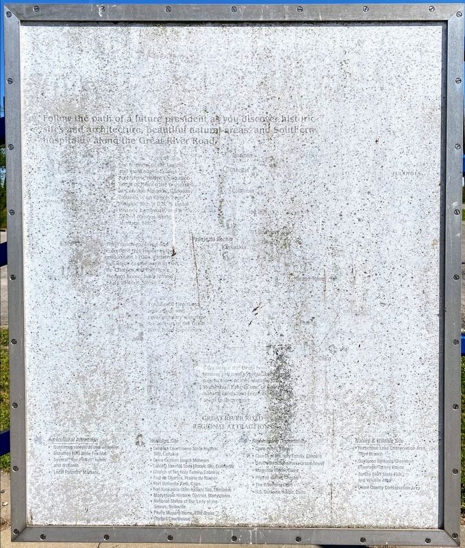
Follow the path of a future president as you discover historic sites and architecture, beautiful natural areas and Southern hospitality along the Great River Road.
The remains of the largest and most sophisticated prehistoric native civilization north of Mexico are preserved at Cahokia Mounds. Cahokia Mounds is an Illinois State Historic Site, a U.S. National Historic Landmark, and a United Nations World Heritage Site.
The French explored and colonized this region in the mid to late 1700s. French influences can be seen in Fort de Chartes and the Pierre Menard home, both Illinois State Historic Sites.
Traditional heartland agriculture and contemporary wineries are all part of the Great River Road experience.
Experience the Deep South among the bald cypress and tupelo trees at this shallow lake. Horseshoe Lake is one of several natural lands and recreational areas in the region.
Great River Road Regional Attractions
Agricultural Attraction
Numerous vineyards and wineries
Shawnee Hills Wine Festival
Several "You-Pick-It" farms and orchards
Local Farmers' Markets
Heritage Site
Cahokia Courthouse State Historic Site, Cahokia
Cairo Custom House Museum
Cahokia Mounds State Historic Site, Collinsville
Church of the Holy Family, Cahokia
Fort de Chartes, Prairie du Roeher
Fort Defiance Park, Cairo
Fort Kaskaskia State Historic Site, Ellis Grove
Maeystown Historic District, Maeystown
National Shrine of Our Lady of the Snows, Belleville
Pierre Menard Home, Ellis Grove
Thebes Courthouse
Sightseeing Opportunity
Cairo Public Library
Church of the Holy Family, Cahokia
Devil's Backbone Park, Grand Tower
Magnolia Manor, Cairo
Popeye Statue, Chester
The Riverlore, Cairo
U.S. Customs House, Cairo
Nature & Wildlife Site
Horseshoe Lake Conservation Area, Olive Branch
Oakwood Bottoms/Greentree Reservoir/Turkey Bayou
Turkey Bluff State Fish and Wildlife Area
Union County Conservation Area
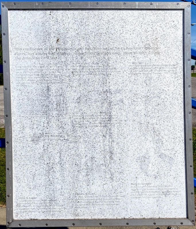
The confluence of the Mississippi and the Ohio, two of North America's greatest rivers, has always had strategic importance, perhaps never more so than during the American Civil War.
Camp Defiance, now known as Fort Defiance, was located at the confluence of the great rivers. The camp served as the staging area for Union troops during the great Western Campaign. Many historians consider the WesternCampaign, which split the Confederacy, and captured Atlanta, the decisive campaign of the Civil War.
Union gunboats based at Camp Defiance maintained control of the nation's waterways. During the Civil War, Union ironclads were built six miles up the Ohio river from here.
During the Civil War, Union ironclads were built six miles up the Ohio River from here. The U.S.S. Cairo, which carried thirteen big guns, was one of seven ironclads named after towns of the Mississippi and Ohio Rivers.
Cairo's harbor was critical to supplying the Western Campaign with soldiers and supplies. The harbor was kept open and safe by patrolling gunboats, including the legendary ironclad, U.S.S. Monitor.
Illinois Heroes
John A. Logan
Logan fought in eight major campaigns including Bull Run and Vicksburg, and commanded all Union forces in the Atlanta Campaign. Many historians consider Logan the premier volunteer general of the Civil War.
Ulysses S. Grant
In 1861, General Grant arrived at Camp Defiance and took command of the Western Campaign. Grant's victories in the Civil War made him a national her and propelled him into the White House.
Mary Bickerdyke
Bickerdyke, affectionately called Mother Bickerdyke by soldiers, earned the respect of generals Grant and Sherman. Bickerdyke tended to the wounded in at least 19 battles and improved conditions in Union hospitals.
Erected by The Great River Road.
Topics. This historical marker is listed in these topic lists: Forts and Castles • Industry & Commerce • War, US Civil • Waterways & Vessels.
Location. 36° 59.275′ N, 89° 9.05′ W. Marker is unreadable. Marker is in Cairo, Illinois, in Alexander County. Marker is at the intersection of Ohio River Scenic Byway (U.S. 60/62) and Fort Defiance Road, on the right when traveling north on Ohio River Scenic Byway. Marker is located at the exhibit kiosk parking lot, near the entrance to Fort Defiance Park. Touch for map. Marker is in this post office area: Cairo IL 62914, United States of America. Touch for directions.
Other nearby markers. At least 8 other markers are within walking distance of this location. Lewis and Clark in Illinois (within shouting distance of this marker); Historical Survey Marker (within shouting distance of this marker); Lewis & Clark (within shouting distance of this
Photographed By Shane Oliver, May 22, 2021
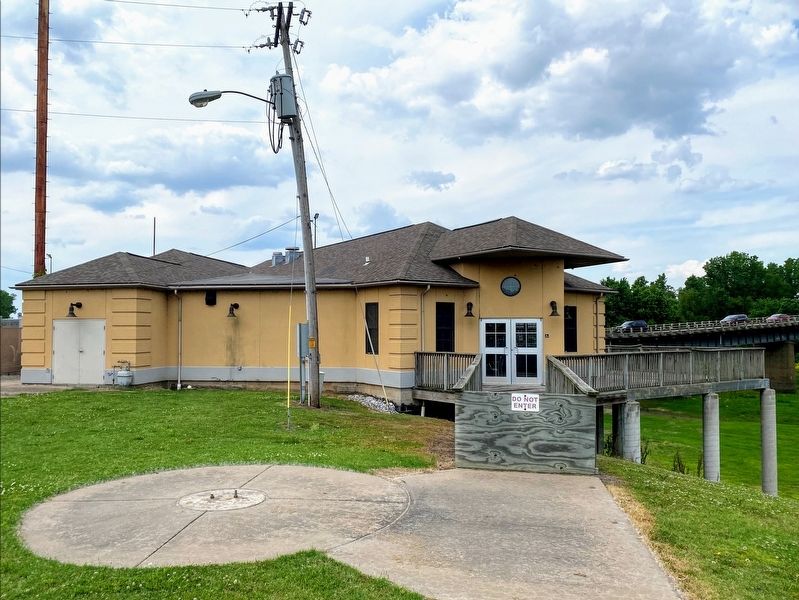
6. Former Fort Defiance Park Visitor Center
This building was once used as a visitor center and museum, back when Fort Defiance was an Illinois State Park. It was shut down sometime between 2013 to 2015, and there are currently no plans to reopen the building. The Illinois State Police also used to have an office in this building, while it operated as a visitor center. The paved circle with the two screws sticking out used to contain a statue of General Ulysses S. Grant.
More about this marker. The Marker itself is severely weathered, and parts of it are unreadable. Much like the rest of Fort Defiance Park, this marker is not well maintained.
Exhibit Panels 1 and 3 feature a map of the State of Illinois, listing all points of interest along the Mississippi River.
Credits. This page was last revised on June 5, 2021. It was originally submitted on June 2, 2021, by Shane Oliver of Richmond, Virginia. This page has been viewed 307 times since then and 11 times this year. Photos: 1, 2, 3, 4, 5, 6. submitted on June 2, 2021, by Shane Oliver of Richmond, Virginia. • Bernard Fisher was the editor who published this page.
