Joy in Livingston County, Kentucky — The American South (East South Central)
Exploring Mantle Rock
Mantle Rock Preserve
— National Park Service, U.S. Department of the Interior —
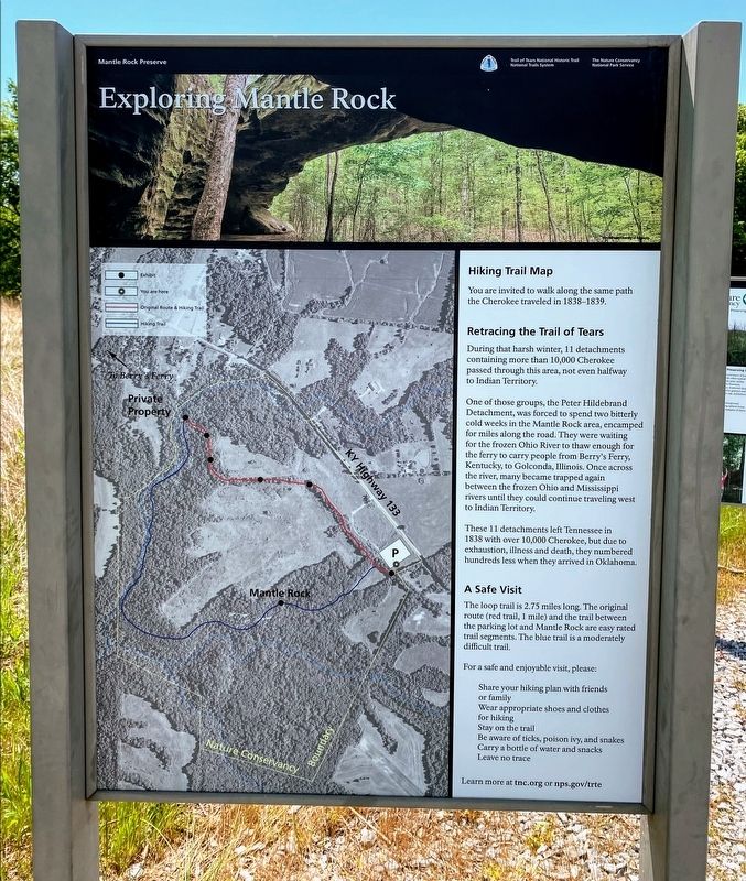
Hiking Trail Map
You are invited to walk along the same path the Cherokee traveled in 1838-1839.
Retracing the Trail of Tears
During that harsh winter, 11 detachments containing more than 10,000 Cherokee passed through this area, not even halfway to Indian Territory.
One of those groups, the Peter Hildebrand Detachment, was forced to spend two bitterly cold weeks in the Mantle Rock area, encamped for miles along the road. They were waiting for the frozen Ohio River to thaw enough for the ferry to carry people from Berry's Ferry, Kentucky, to Golconda, Illinois. Once across the river, many became trapped again between the frozen Ohio and Mississippi rivers until they could continue traveling west to Indian Territory.
These 11 detachments left Tennessee in 1838 with over 10,000 Cherokee, but due to exhaustion, illness and death, they numbered hundreds less when they arrived in Oklahoma.
A Safe Visit
The loop trail is 2.75 miles long. The original route (red trail, 1 mile) and the trail between the parking lot and Mantle Rock are easy rated trail segments. The blue trail is a moderately difficult trail.
For a safe and enjoyable visit, please:
Share your hiking plans with friends or familY
Wear appropriate shoes and clothes for hiking
Stay on the trail
Be aware of ticks, poison ivy, and snakes
Carry a bottle of water and snacks
Leave no trace
Learn more at tnc.org or nps.gov/trte
Erected by National Park Service, U.S. Department of the Interior.
Topics. This historical marker is listed in these topic lists: Native Americans • Roads & Vehicles. A significant historical year for this entry is 1838.
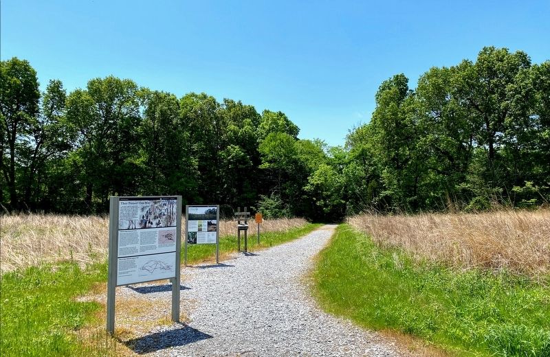
Location. 37° 21.509′ N, 88° 25.302′ W. Marker is in Joy, Kentucky, in Livingston County. Marker is on Lola Road (Kentucky Route 133) 0.8 miles south of Cave Spring Road, on the right when traveling south. The marker is located at the parking lot and trailhead for Mantle Rock Nature Preserve. Touch for map. Marker is at or near this postal address: 1877 Lola Rd, Hampton KY 42047, United States of America. Touch for directions.
Other nearby markers. At least 8 other markers are within walking distance of this marker. They Passed This Way (here, next to this marker); Walk in Their Footsteps… (within shouting distance of this marker); Mantle Rock (1/2 Mile) (approx. 0.2 miles away); Protect / Transform / Inspire (approx. 0.2 miles away); A Changed Landscape (approx. 0.3 miles away); The Real Story of Mantle Rock (approx. 0.3 miles away); Witness to History (approx. 0.3 miles away); A Winter Camp (approx. half a mile away). Touch for a list and map of all markers in Joy.
More about this marker. The Mantle Rock Nature Preserve is owned and operated by The Nature Conservancy, and contains a 2.75-mile walking trail. A portion of the trail follows an old road trace used by the Cherokee during the winter of 1838-1839. The National Park Service helped restore this portion of the trail by erecting interpretive exhibits along the old road trace.
Additional keywords. Forced relocation
Credits. This page was last revised on June 8, 2021. It was originally submitted on June 4, 2021, by Shane Oliver of Richmond, Virginia. This page has been viewed 174 times since then and 29 times this year. Photos: 1, 2, 3. submitted on June 4, 2021, by Shane Oliver of Richmond, Virginia. • Devry Becker Jones was the editor who published this page.


