Swanton Township near Whitehouse in Lucas County, Ohio — The American Midwest (Great Lakes)
A Cross Section Of History
Oak Openings Preserve Metropark
Photographed by Craig Doda, May 26, 2021
1. A Cross Section Of History Marker
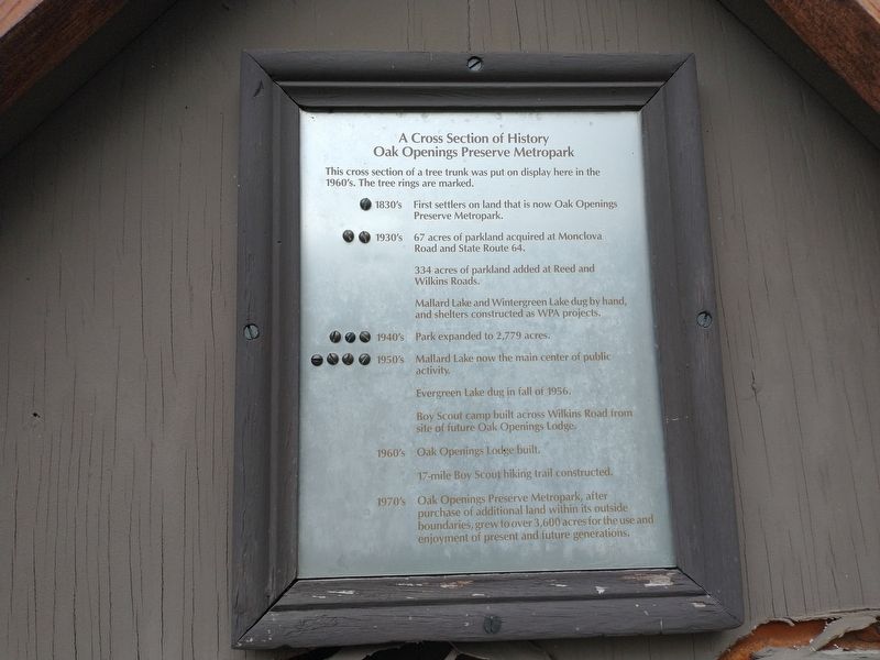
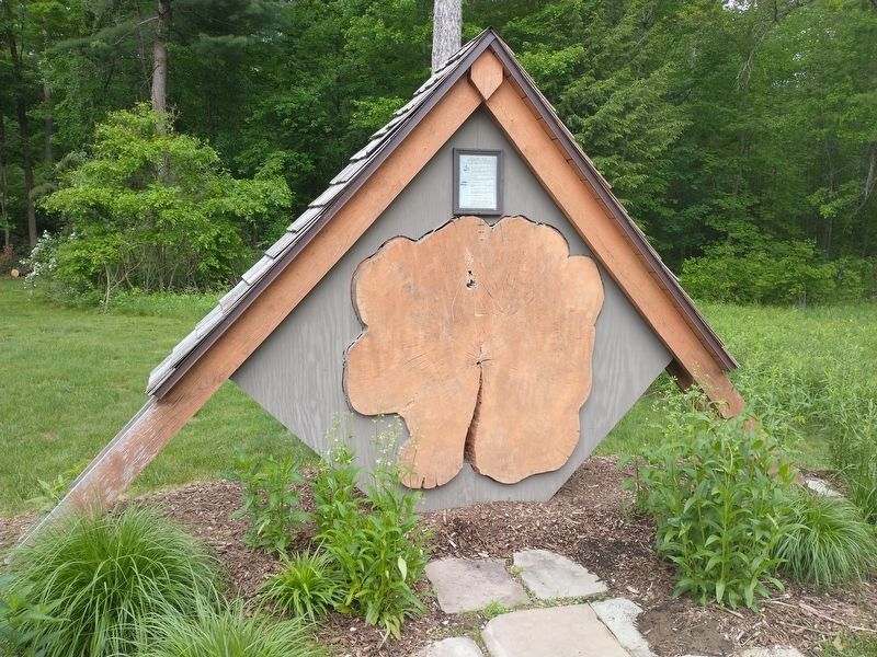
This cross section of a tree trunk was put on display here in the 1960's. The tree rings are marked.
1830's
First settlers on land that is now Oak Openings Preserve Metropark
1930's
67 acres of parkland acquired at Monclova Road and State Route 64.
334 acres of parkland added at Reed and Wilkins Roads.
Mallard Lake and Wintergreen Lake dug by hand, and shelters constructed as WPA projects.
1940's
Park expanded to 2,779 acres.
1950's
Mallard Lake now the main center of public activity.
Evergreen Lake dug in fall of 1956.
Boy Scout camp built across Wilkins Road from site of future Oak Openings Lodge.
1960's
Oak Openings Lodge built.
17-mile Boy Scout hiking trail constructed.
1970's
Oak Openings Preserve Metropark, after purchase of additional land within its outside boundaries, grew to over 3,600 acres for the use and enjoyment of present and future generations.
Topics and series. This historical marker is listed in these topic lists: Charity & Public Work • Horticulture & Forestry • Parks & Recreational Areas. In addition, it is included in the Works Progress Administration (WPA) projects
this page online
Location. 41° 32.631′ N, 83° 50.431′ W. Marker is near Whitehouse, Ohio, in Lucas County. It is in Swanton Township. It is on Oak Openings Parkway 0.1 miles west of Wilkins Road (County Road 108), on the left when traveling east. Touch for map. Marker is at or near this postal address: 5230 Wilkins Rd, Whitehouse OH 43571, United States of America. Touch for directions.

Regionally, this marker is on the Lake Erie Shore and in the Toledo Metropolitan Area. It is also in the American Midwest and in the Corn Belt. Globally, it is in North America, on the Great Lakes, in the Western Hemisphere, in the Western World, and in the Anglosphere. Historically, it finds itself in what was once the Viceroyalty of New France, the Haudenosaunee (Iroquois) Confederacy, the territory of the Mississippian Culture, and the Northwest Territory.
Other nearby markers. At least 8 other markers are within 3 miles of this marker, measured as the crow flies: The Oak Openings Region (approx. 0.6 miles away); Other Military Operations (approx. 2.6 miles away); Gulf Wars & Afghanistan War
Photographed by Craig Doda, May 26, 2021
2. A Cross Section Of History Marker
Credits. This page was last revised on February 6, 2023. It was originally submitted on June 6, 2021, by Craig Doda of Napoleon, Ohio. This page has been viewed 315 times since then and 29 times this year. Photos: 1, 2. submitted on June 6, 2021, by Craig Doda of Napoleon, Ohio. • Devry Becker Jones was the editor who published this page.
