Rockville in Montgomery County, Maryland — The American Northeast (Mid-Atlantic)
Rockville Methodist Episcopal Church - Jerusalem Mount Pleasant United United Methodist Church
Location: 21 Wood Lane
| — | Explore Early Rockville Walking Tour | — |
Photographed by Devry Becker Jones (CC0), June 4, 2021
1. Rockville Methodist Episcopal Church - Jerusalem Mount Pleasant United United Methodist Church Marker
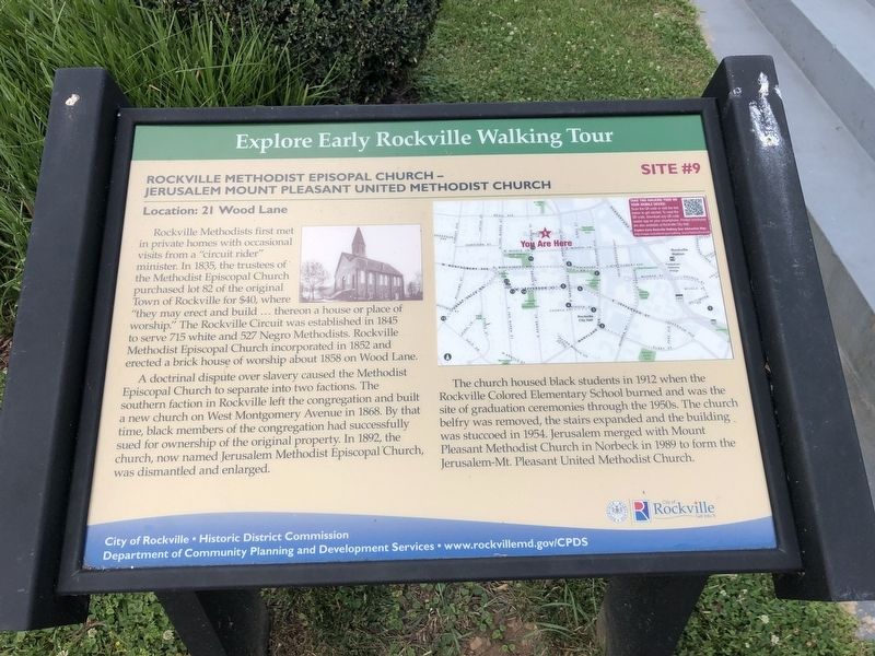
Rockville Methodists first met in private homes with occasional visits from a "circuit rider" minister. In 1835, the trustees of the Methodist Episcopal Church purchased lot 82 of the original Town of Rockville for $40, where "they may erect and build … thereon a house or place of worship." The Rockville Circuit was established in 1845 to serve 715 and 527 Negro Methodists. Rockville Methodist Episcopal Church incorporated in 1852 and erected a brick house of worship about 1858 on Wood Lane.
A doctrinal dispute over slavery caused the Methodist Episcopal Church to separate into two factions. The southern faction in Rockville left the congregation and built a new church on West Montgomery Avenue in 1868. By that time, black members of the congregation had successfully sued for ownership of the original property. In 1892, the church, now named Jerusalem Methodist Episcopal Church was dismantled and enlarged.
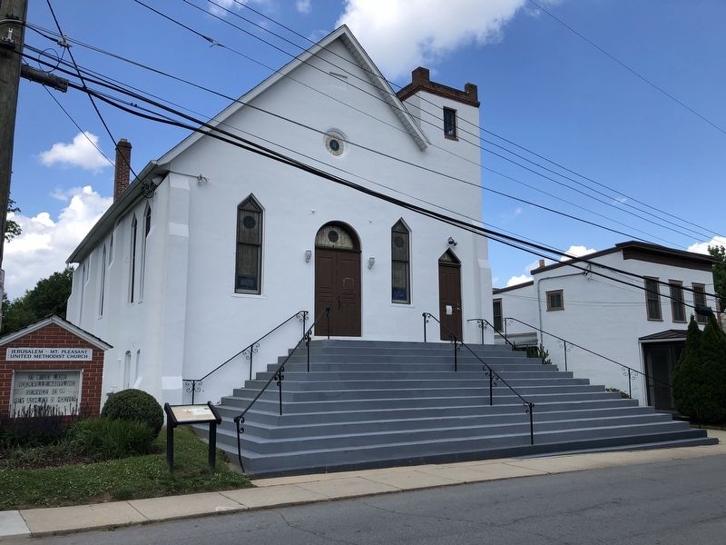
The church housed black students in 1912 when the Rockville Colored Elementary School burned and was the site of graduation ceremonies through the 1950s. The church belfry was removed, the stairs expanded and
this page online
Erected by City of Rockville, Historic District Commission, Department of Community Planning and Development Services. (Marker Number 9.)
Topics. This historical marker is listed in these topic lists: African Americans • Education • Religion & Religious Structures. A significant historical year for this entry is 1835.
Location. 39° 5.152′ N, 77° 9.245′ W. Marker is in Rockville, Maryland, in Montgomery County. It is on Wood Lane just east of North Adams Street, on the right when traveling west. Touch for map. Marker is at or near this postal address: 29 Wood Ln, Rockville MD 20850, United States of America. Touch for directions.

Regionally, this marker is in the Washington Metropolitan Area. It is also in the American Mid-Atlantic. Globally, it is in North America, the Western Hemisphere, the Western World, and the Anglosphere. Historically, it finds itself in what was once one of the original Thirteen Colonies and also the Antebellum South.
Photographed by Devry Becker Jones (CC0), June 4, 2021
2. Rockville Methodist Episcopal Church - Jerusalem Mount Pleasant United United Methodist Church Marker
Other nearby markers. At least 7 other markers are within walking distance of this marker: Jerusalem - Mt. Pleasant Church and Parsonage (within shouting distance of this marker); a different marker also named Hebron House and Print Shop (within shouting distance of this marker); Lucy Simpson's Rockville Institute (within shouting distance of this marker); a different marker also named Galilean Temple (about 300 feet away); Williams-Wilson House (about 300 feet away); Enslaved to Soldier (about 300 feet away); Early Rockville Residential Area (about 300 feet away). Touch for a list and map of all markers in Rockville.
Other markers no longer nearby. Rockville Methodist Episcopal Church - Jerusalem / Mount Pleasant (was within shouting distance of this marker but has been replaced with another marker now near it); a different marker also named Jerusalem - Mt. Pleasant Church and Parsonage (was within shouting distance of this marker but has been replaced with another marker now near it); Hebron House and Print Shop (was within shouting distance of this marker but has been replaced with another marker now near it); Galilean Temple (was about 300 feet away, measured in a direct line but has been replaced with another marker now near it); Higgins House (was about 300 feet away but has been confirmed missing); North Adams Street and Middle Lane Residential Area (was about 300 feet away but has been permanently removed); Mr. T’s (was about 300 feet away but has been replaced with another marker now near it); Beall-Dawson House and Park (was about 400 feet away but has been permanently removed); Rockville's First Colored School / Rockville's Second Colored School (was about 400 feet away but has been replaced with another marker now near it).
Related marker. Click here for another marker that is related to this marker. This marker has replaced the linked marker.
Credits. This page was last revised on June 6, 2021. It was originally submitted on June 6, 2021, by Devry Becker Jones of Washington, District of Columbia. This page has been viewed 364 times since then and 23 times this year. Photos: 1, 2. submitted on June 6, 2021, by Devry Becker Jones of Washington, District of Columbia.
