Fourth Ward
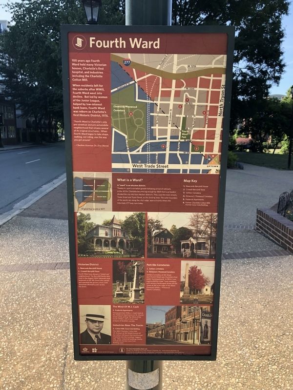
100 years ago Fourth Ward held many Victorian houses, Charlotte's first hospital, and industries including the Charlotte Cotton Mill.
When residents left for the suburbs after WWII, Fourth Ward went into decline. But led by women of the Junior League, helped by low-interest bank loans, Fourth Ward was reborn as Charlotte's first Historic District, 1976.
"Fourth Ward is Charlotte's only pre-streetcar and pre-automobile neighborhood that retains several of its original structures… When Fourth Ward began to take shape, walking, not riding, was the way you got around."
Charlotte historian Dr. Dan Morrill
What is a Ward?
A "ward" is an election district.
Thanks to rapid population growth following arrival of railroads in the 1850s, Charlotte became big enough by 1869 that local leaders divided the city into four election districts. They used the main streets, Trade Street and Tryon Street, as the dividing lines. The outer boundary of the wards ran along the city's edge, approximately where the Interstate 277 loop runs today.
Victorian District
1. Newcomb-Berryhill House
2. Crowell-Berryhill Store
Fourth Ward was always a "mixed use" neighborhood. The Berryhill family who lived in the elegant 1884 Italianate style landmark on
Park-like Cemeteries
3. Settlers Cemetery
4. Elmwood / Pinewood Cemetery
Settlers Cemetery at 5th Street and Church Street was Charlotte's first public burying ground. In 1853 it was superseded by a new "rural cemetery" with winding landscaped drives off 6th Street at the outer edge of the Ward: Elmwood (white) / Pinewood (black) Cemetery.
The Mind of W.J. Cash
5. Frederick Apartments
Newspaperman Wilbur J. Cash lived at the Frederick Apartments on N. Church Street while writing The Mind of the South (1940), still a much-read analysis of Southern society.
Industries Near The Tracks
6. Cotton Mill, Coca-Cola Bottling
The 1880 Charlotte Cotton Mill (N. Graham at 5th Street) kicked off the cotton mill boom that transformed Charlotte into the Carolina's biggest city. Other industrial buildings nearby include the former Coca-Cola Bottling plants.
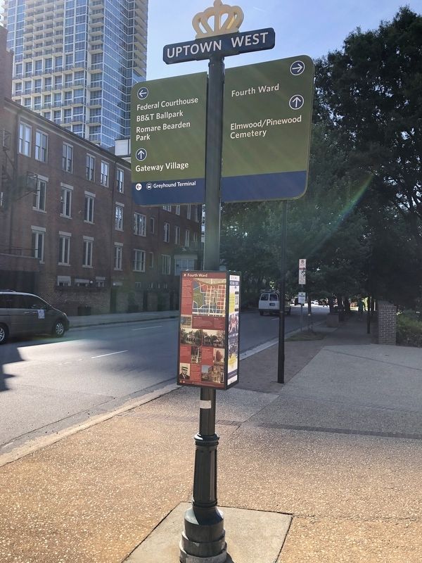
Erected by City of Charlotte, North Carolina.
Topics. This historical marker is listed in these topic lists: Architecture • Arts, Letters, Music • Cemeteries & Burial Sites • Political Subdivisions. A significant historical year for this entry is 1976.
Location. 35° 13.843′ N, 80°
Other nearby markers. At least 8 other markers are within walking distance of this marker. Fourth Ward Historic District (a few steps from this marker); Visit of General George Washington (about 500 feet away, measured in a direct line); The Bagley-Mullen House (about 500 feet away); The First Carolinians (about 500 feet away); The Eighteenth Century Piedmont (about 500 feet away); Establishing A New Life (about 500 feet away); The Origin Of Our Names (about 500 feet away); The Mecklenburg Declaration of Independence (about 500 feet away). Touch for a list and map of all markers in Charlotte.
Credits. This page was last revised on February 3, 2023. It was originally submitted on June 20, 2021, by Devry Becker Jones of Washington, District of Columbia. This page has been viewed 249 times since then and 16 times this year. Photos: 1, 2. submitted on June 20, 2021, by Devry Becker Jones of Washington, District of Columbia.

