Fort Abercrombie
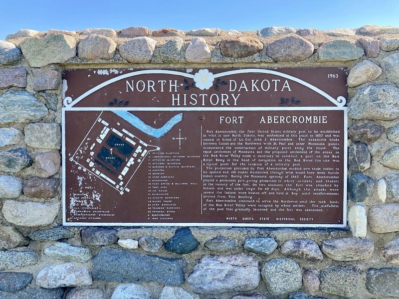
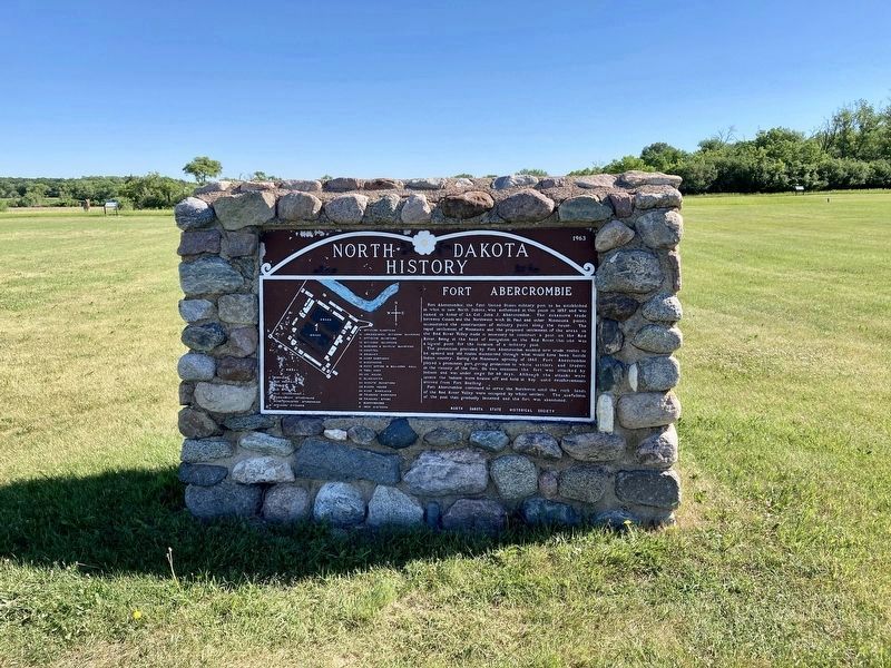
Th protection provided by Fort Abercrombie enabled new trade routes to be opened and old routes maintained through what would have been hostile Indian country. During the Minnesota uprising of 1862, Fort Abercrombie played a prominent part, giving protection to white settlers and traders in the vicinity of the fort. On two occasions the fort was attacked by Indians and was under siege for 60 days. Although the attacks severe the Indians were beaten off and held at bay until reinforcements arrived
this page online
Fort Abercrombie continued to serve the Northwest until the rich lands
of the Red River Valley were occupied by white settlers. The usefulness
of the post then gradually lessened and the fort was abandoned.
Erected 1963 by State Historical Society of North Dakota.
Topics. This memorial is listed in these topic lists: Forts and Castles • Settlements & Settlers • Wars, US Indian. A significant historical year for this entry is 1857.
Location. 46° 26.693′ N, 96° 43.117′ W. Memorial is in Abercrombie, North Dakota, in Richland County. It is on Broadway North (County Road 4) 0.2 miles south of Abercrombie Street, on the left when traveling south. Touch for map. Memorial is at or near this postal address: 935 Broadway N, Abercrombie ND 58001, United States of America. Touch for directions.
Regionally, this memorial is in the Red River Valley and in Greater Fargo Area. It is also in the American Lewis & Clark Corridor, on the prairies, and on the Northern Plains. Globally, it is in North America, the Western Hemisphere, the Western World, and the Anglosphere. Historically, it finds itself
Other nearby markers. At least 8 other markers are within walking distance of this marker: Guardhouse (within shouting distance of this marker); Headquarters (within shouting distance of this marker); Commissary Storehouse (within shouting distance of this marker); Hospital / Lieutenant’s Quarters (within shouting distance of this marker); Quartermaster Storehouse (within shouting distance of this marker); Barracks (within shouting distance of this marker); Surgeon’s & Chaplain’s Quarters (about 300 feet away, measured in a direct line); Hospital (about 300 feet away). Touch for a list and map of all markers in Abercrombie.
Also see . . .
1. Fort Abercrombie State Historic Site. (Submitted on June 20, 2021, by Connor Olson of Menomonee Falls, Wisconsin.)
2. Fort Abercrombie. (Submitted on June 20, 2021, by Connor Olson of Menomonee Falls, Wisconsin.)
Credits. This page was last revised on June 21, 2021. It was originally submitted on June 20, 2021, by Connor Olson of Menomonee Falls, Wisconsin. This page has been viewed 611 times since then and 92 times this year. Photos: 1, 2, 3. submitted on June 20, 2021, by Connor Olson of Menomonee Falls, Wisconsin. • Mark Hilton was the editor who published this page.
