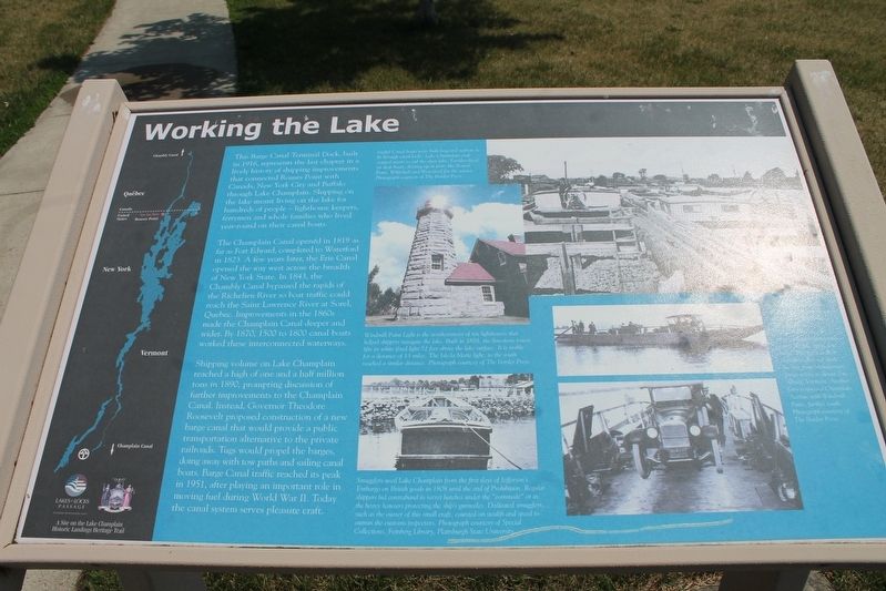
Working The Lake
The Champlain Canal opened in 1819 as far as Fort Edward, completed to Waterford in 1823. A few years later, the Erie Canal opened the way west across the breadth of New York State. In 1843, the Chambly Canal bypassed the rapids at the Richelieu River so boat traffic could reach the Saint Lawrence River at Sorel, Quebec. Improvements in the 1860s made the Champlain Canal deeper and wider. By 1870, 1500-1800 canal boats worked these interconnected waterways.
Shipping volume on Lake Champlain reached a high of one and a half million tons in 1890, prompting the discussion of further improvements to the Champlain Canal. Instead Theodore Roosevelt proposed a construction of a new barge canal that would provide a public transportation alternative to the private railroads. Tugs would propel the barges, doing away with tow paths and sailing canal boats. Barge Canal traffic reached its peak in 1951, after playing an important role in moving fuel during World War II. Today
the canal system serves pleasure craftsTopics. This historical marker is listed in these topic lists: Industry & Commerce • Waterways & Vessels. A significant historical year for this entry is 1916.
Location. 44° 59.634′ N, 73° 21.751′ W. Marker is in Rouses Point, New York, in Clinton County. Marker is on Montgomery Street, on the right when traveling east. Touch for map. Marker is at or near this postal address: 24 Montgomery Street, Rouses Point NY 12979, United States of America. Touch for directions.
Other nearby markers. At least 8 other markers are within 4 miles of this marker, measured as the crow flies. Site of Delaware and Hudson Railroad Station (approx. 0.4 miles away); Fort Montgomery (approx. half a mile away); David Mayo's Sail Ferry (approx. ¾ mile away); Site of First School House (approx. ¾ mile away); Ezra Thurber’s Home (approx. one mile away); Site of Joel Smith's Home (approx. 1.2 miles away); Historic Lake Islands - Samuel De Champlain (approx. 3.3 miles away in Vermont); Missile Site (approx. 3.3 miles away in Vermont). Touch for a list and map of all markers in Rouses Point.
Credits. This page was last revised on June 24, 2021. It was originally submitted on June 21, 2021, by Robert Rusaw of Massena, New York. This page has been viewed 157 times since then and 16 times this year. Photo 1. submitted on June 21, 2021, by Robert Rusaw of Massena, New York. • Bill Pfingsten was the editor who published this page.
