
Rock Hill in York County, South Carolina — The American South (South Atlantic)
From Mall To Main
The Rebuilding of Main Street… celebrating the work of David L. Rogers, a developer with dreams
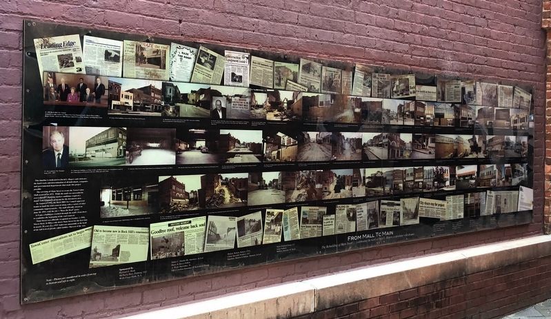
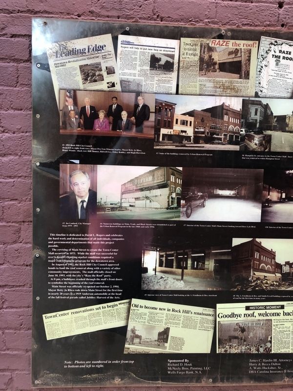
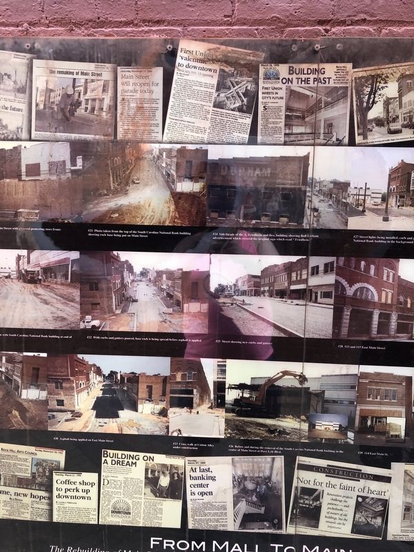
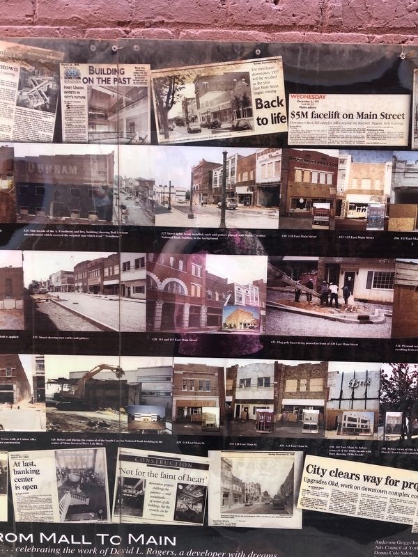
This timeline is dedicated to David L. Rogers and celebrates the hard work and determination of all individuals, companies and governmental departments that made this project possible.
The covering of Main Street to create the Town Center Mall occurred in 1975. While the mall was successful for over a decade, changing market conditions required a major redevelopment program for the downtown area.
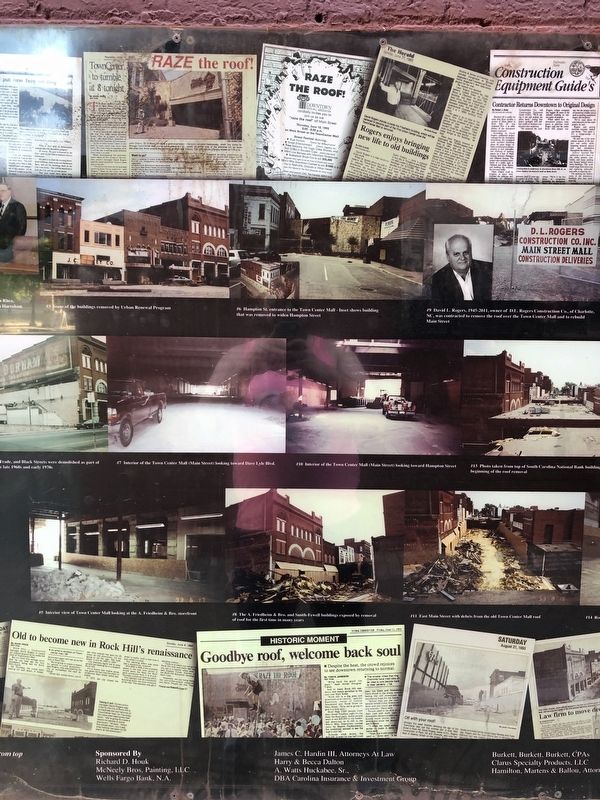
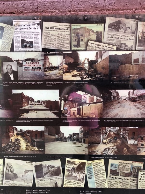
In August of 1992, the Rock Hill City Council approved bods to found the roof removal along with a variety of other community improvements. The mall officially closed on June 10, 1993, with the city's "Raze the Roof" party.
At 8 pm, a bulldozer crashed through the mall's front doors to symbolize the beginning of the roof removal.
Main Street was officially re-opened on October 2, 1994. Mayor Betty Jo Rhea rode down Main Street for the first time in nearly 20 years in a 1919 Anderson automobile at the head of the fall festival parade called Jubilee: Harvest of the Arts.
Topics. This historical marker is listed in these topic lists: Industry & Commerce • Roads & Vehicles. A significant historical date for this entry is June 10, 1993.
Location. 34° 55.552′ N,
this page online

Regionally, this marker is in the Midlands and in the Olde English District. It is also in the American South and specifically in the Deep South. Globally, it is in North America, the Western Hemisphere, the Western World, and the Anglosphere. Historically, it finds itself in what was once the original Cherokee Nation, the territory of the Mississippian Culture, one of the original Thirteen Colonies, one of the Confederate States of America, and the Antebellum South.
Other nearby markers. At least 8 other markers are within walking distance of this marker: The A. Friedheim & Bro. And Smith-Fewell Buildings (a few steps from this marker); Jewish Merchants of Rock Hill / A. Friedheim & Bro. (within shouting distance of this marker); The Dalton Building (within shouting distance of this marker); Rock Hill's Sit-in Movement
Credits. This page was last revised on July 20, 2025. It was originally submitted on June 22, 2021, by Devry Becker Jones of Washington, District of Columbia. This page has been viewed 1,978 times since then and 113 times this year. Photos: 1, 2, 3, 4, 5, 6. submitted on June 22, 2021, by Devry Becker Jones of Washington, District of Columbia.
