Homosassa in Citrus County, Florida — The American South (South Atlantic)
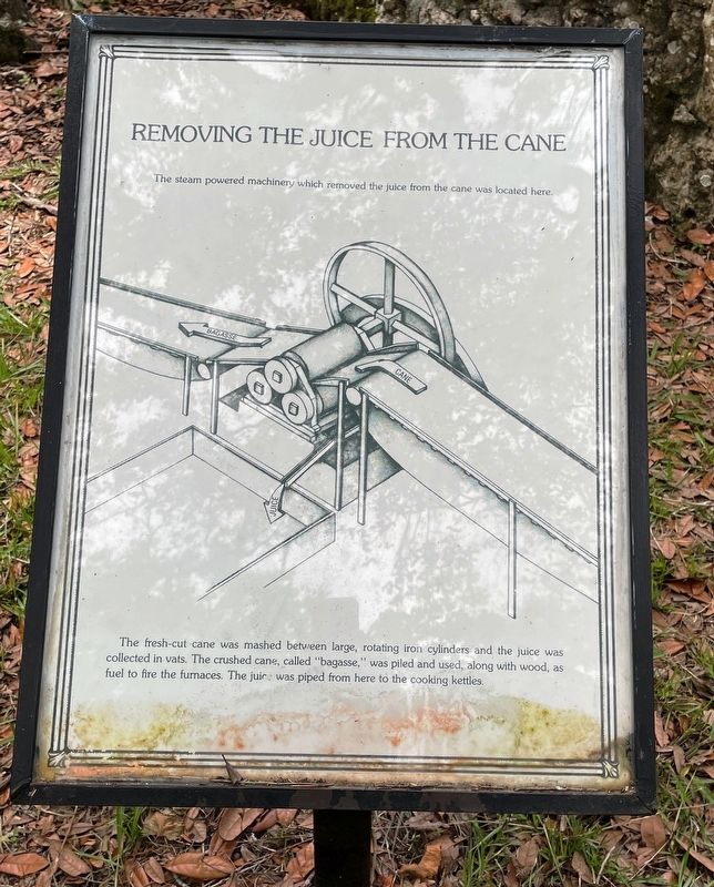
Removing the Juice from the Cane
Yulee Sugar Mill Ruins
Photographed by Brandon D Cross, June 22, 2021
1. Removing the Juice from the Cane Marker
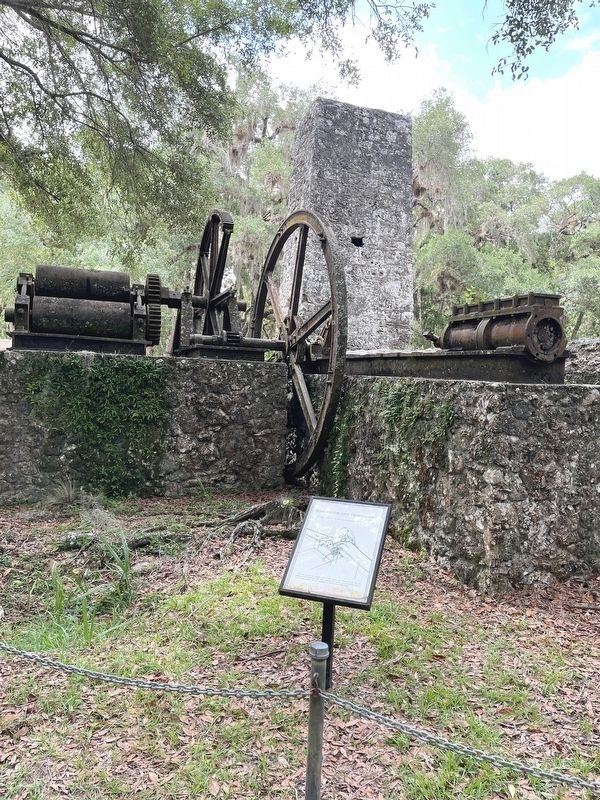
The steam powered machinery which removed the juice from the cane was located here.
The fresh-cut cane was mashed between large, rotating iron cylinders and the juice was collected in vats. The crushed cane, called “bagasse,” was piled and used, along with wood, as fuel for the furnaces. The juice was piped from here to the cooling kettles.
Topics. This historical marker is listed in these topic lists: Agriculture • Industry & Commerce • Settlements & Settlers.
Location. 28° 47.058′ N, 82° 36.469′ W. Marker is in Homosassa, Florida, in Citrus County. It can be reached from West Yulee Drive 0.1 miles north of West Bresler Court, on the right when traveling south. The marker stands within a small roadside state roadside park. Touch for map. Marker is at or near this postal address: 10407 W Yulee Dr, Homosassa FL 34448, United States of America. Touch for directions.

Regionally, this marker is on Florida’s Gulf Coast. It is also in the American South and on the Gulf Coast. Globally, it is in the North Atlantic Region, North America, a Gulf of Mexico
this page online
Other nearby markers. At least 8 other markers are within 8 miles of this marker, measured as the crow flies: Steam Engine and Gears (here, next to this marker); David Levy Yulee (a few steps from this marker); Kettles and Operation (a few steps from this marker); Old Homosassa Veterans Memorial (approx. 0.4 miles away); Stage Stand Cemetery (approx. 2.2 miles away); Florida Boom Sidewalk (approx. 2.4 miles away); Bicentennial Park War Memorial (approx. 6.3 miles away); Kings Bay Park (approx. 7.8 miles away). Touch for a list and map of all markers in Homosassa.
Also see . . . Yulee Sugar Mill Ruins. (Submitted on June 24, 2021, by Brandon D Cross of Flagler Beach, Florida.)
Photographed by Brandon D Cross, June 22, 2021
2. Removing the Juice from the Cane Marker
Photographed by Brandon D Cross, June 22, 2021
3. Yulee Sugar Mill Ruins sign
Credits. This page was last revised on June 25, 2021. It was originally submitted on June 24, 2021, by Brandon D Cross of Flagler Beach, Florida. This page has been viewed 300 times since then and 26 times this year. Photos: 1, 2, 3. submitted on June 24, 2021, by Brandon D Cross of Flagler Beach, Florida. • Devry Becker Jones was the editor who published this page.
