Deltaville in Middlesex County, Virginia — The American South (Mid-Atlantic)
Oyster Tongs
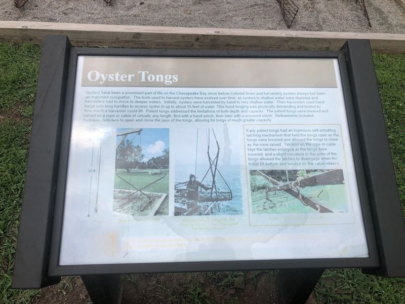
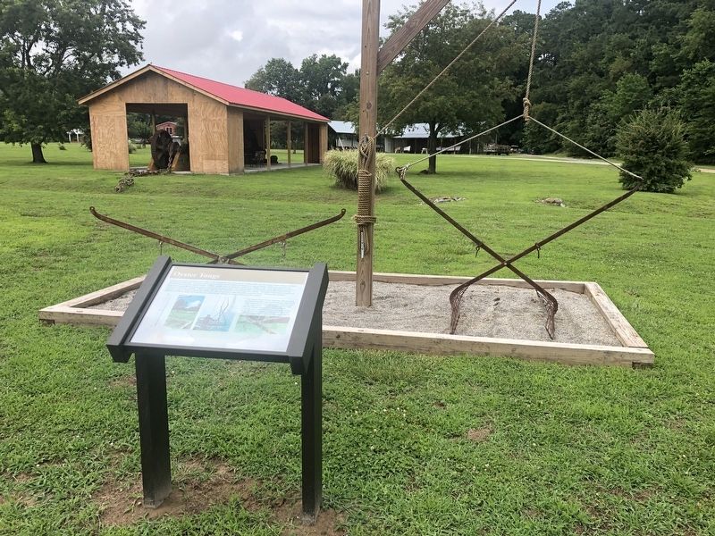
Oysters have been a prominent part of life on the Chesapeake Bay since before Colonial times and harvesting oysters always has been an important occupation. The tools used to harvest oysters have evolved over time, as oysters in shallow water were depleted and harvesters have to move to deeper water. Initially, oysters were harvested by hand in shallow water. Then harvester used hand tongs with long handles to access oyster in up to about 15 feet of water. This hand tonging was physically demanding and limited by how much a harvester could lift. Patent tongs addressed the limitations of both depth and capacity. The patent tongs were lowered and raised on a rope of cable virtually any length, first with a hand winch, then later with a powered winch. Refinement included hydraulic cylinders to open and close the jaws of the tongs, allowing for tongs of much greater capacity.
[Sidebar:]
Early patent tongs had an ingenious self-actuating latching mechanism that held the tongs open as the tongs were lowered and allowed the tongs to close as they were raised. Tension on the rope or cable kept the latches engaged as the tongs were lowered, and a slight curvature in the arms of the tongs allowed the latches to disengage when the tongs hit bottom and tension on the cable relaxed.
Erected by
Topics. This historical marker is listed in these topic lists: Animals • Industry & Commerce • Waterways & Vessels.
Location. 37° 33.115′ N, 76° 19.485′ W. Marker has been reported damaged. Marker is in Deltaville, Virginia, in Middlesex County. Marker can be reached from Jackson Creek Road (Virginia Route 660) 0.2 miles north of Orchard Lane, on the right when traveling north. Touch for map. Marker is at or near this postal address: 287 Jackson Creek Rd, Deltaville VA 23043, United States of America. Touch for directions.
Other nearby markers. At least 8 other markers are within walking distance of this location. Boarding Cutter (a few steps from this marker); Confederate Boarding Cutter (a few steps from this marker); Marine Railway (a few steps from this marker); Deltaville Dollies (within shouting distance of this marker); Pette Spansell Clark (1908-2000) (within shouting distance of this marker); Explorer (within shouting distance of this marker); Flagpole and Flag Etiquette (within shouting distance of this marker); Ruark Sculpture Garden (about 300 feet away, measured in a direct line). Touch for a list and map of all markers in Deltaville.
More about this marker. Unfortunately the marker appears to have weathered.
Credits. This page was last revised on June 27, 2021. It was originally submitted on June 27, 2021, by Devry Becker Jones of Washington, District of Columbia. This page has been viewed 256 times since then and 26 times this year. Photos: 1, 2. submitted on June 27, 2021, by Devry Becker Jones of Washington, District of Columbia.

