Solvay in Onondaga County, New York — The American Northeast (Mid-Atlantic)
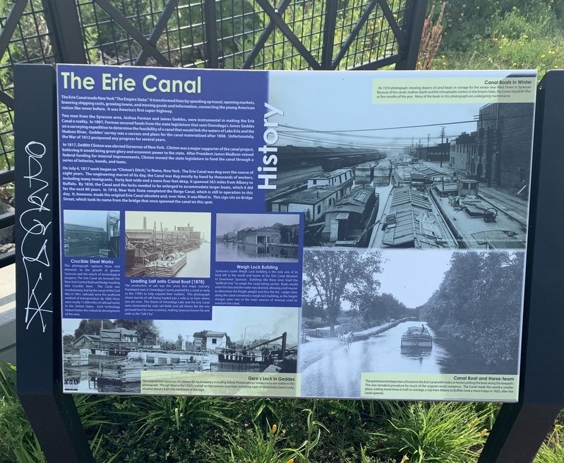
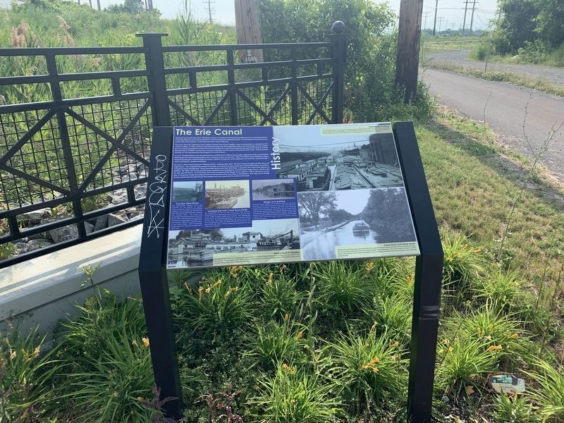
The Erie Canal
History
The Erie Canal made New York “The Empire State.” It transformed lives by speeding up travel, opening markets, lowering shipping costs, growing towns, and moving goods and information, connecting the young American nation like never before. It was first super-highway.
Two men from the Syracuse area, Joshua Forman and James Geddes, were instrumental in making the Erie Canal a reality. In 1807, Forman secured funds from the state legislature that sent Onondaga's James Geddes on a surveying expedition to determine the feasibility of a canal that would link the waters of Lake Erie and the Hudson River. Geddes' survey was a success and plans for the canal materialized after 1808. Unfortunately, the War of 1812 postponed any progress for several years.
In 1817, DeWitt Clinton was elected Governor of New York. Clinton was a major supporter of the canal project, believing it would bring great glory and economic power to the state. After President James Madison vetoed federal funding for internal improvements, Clinton moved the state legislature to fund the canal through a series of lotteries, bonds, and taxes.
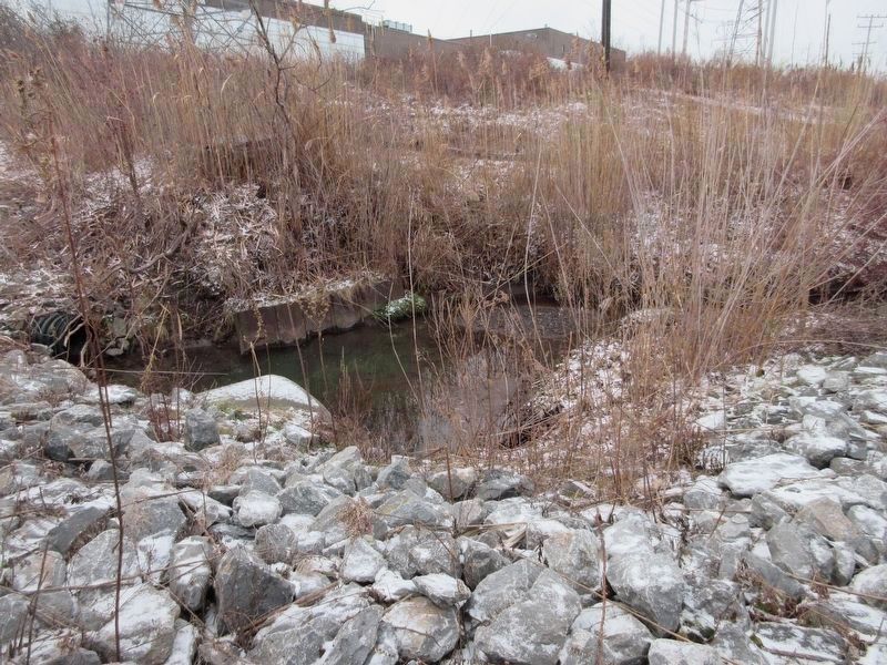
On July 4, 1817 work began on "Clinton's Ditch,” in Rome, New York. The Erie Canal was dug over the course of eight years. The engineering marvel of its day, the Canal was dug mostly by hand by thousands of workers, including many immigrants. Forty feet wide and a mere four feet deep, it spanned 363 miles from Albany to Buffalo. By 1836, the Canal and the locks needed to be enlarged to accommodate larger boats, which it did for the next 80 years. In 1918, New York State completed the Barge Canal, which is still in operation to this day. It, however, made the original Erie Canal obsolete and, over time, it was filled in. This sign sits on Bridge Street, which took its name from the bridge that once spanned the canal on this spot
[Upper Right Photo:]
Canal Boats in Winter
An 1910 photograph showing dozens of canal boats in storage for the winter near West Street in Syracuse. Because of the canals shallow depth and the inhospitable winters in the Empire State, the Canal closed for four or five months of the year. Many of the boats in this photograph are undergoing maintenance.
[Middle Photos, from Left to Right:]
Crucible Steel Works
This photograph captures three vital elements to the growth of greater Syracuse and the march of technological progress. The Erie Canal sits beneath the New York Central Railroad Bridge heading into Crucible Steel. The Canal was revolutionary, but by the onset of the Civil War in 1861, railroads were the preferred method of transportation. By 1860, there were nearly 11,000 miles of railroad tracks in the United States. Each technology helped foster the industrial development of the area.
Loading Salt onto Canal Boat (1878)
The production of salt was this area's first major industry. Prominent men in Onondaga County pushed for a canal as early as the 1790's to help expand their markets. This photograph shows barrels of salt being loaded just a mile or so from where you are now. The shores of Onondaga Lake and the Erie Canal were dominated by solar salt fields and salt blocks like the one pictured here for over a century, making Syracuse known far and wide as the "Salt City."
Weigh Lock Building
Syracuse's iconic Weigh Lock building is the only one of its kind left in the world and home of the Erie Canal Museum in Downtown Syracuse. Buildings like these once lined the "artificial river” to weigh the cargo being carried. Boats would enter the lock and the water was drained, allowing a toll-master to determine the freight weight and thus the fee. Larger cities along the canal contained a weigh lock building, as the freight charges were one of the main sources of revenue used to maintain the canal.
[Bottom Left Photo:]
Gere's Lock in Geddes
The original Erie Canal was the lifeline for local industry including Solvay Process whose smokestacks are visible in this photograph. Though filled in the
1920's, a small section remains near here, including a pair of stone locks (Gere's Lock), situated about a half mile northwest of this sign.
[Bottom Right Photo:]
Canal Boat and Horse-Team
The quintessential depiction of travel on the Erie Canal with mules or horses pulling the boat along the towpath. This was standard procedure for much of the original canal's existence. The Canal made the world a smaller place, cutting travel times in half on average; a trip from Albany to Buffalo took a mere 6 days in 1825, after the canal opened.
All images [on marker] are from the collections of the Onondaga Historical Association
Erected by Onondaga Historical Association.
Topics. This historical marker is listed in this topic list: Waterways & Vessels. A significant historical date for this entry is July 4, 1817.
Location. 43° 3.848′ N, 76° 13.025′ W. Marker is in Solvay, New York, in Onondaga County. Marker is on Bridge Street (New York State Route 297) 0.1 miles north of Milton Avenue, on the left when traveling north. Touch for map. Marker is in this post office area: Syracuse NY 13209, United States of America. Touch for directions.
Other nearby markers. At least 8 other markers are within 2 miles of this marker, measured as the crow flies. Solar Salt (a few steps from this marker); School House No. 2 (about 700 feet away, measured in a direct line); The Great New York State Fair (approx. 0.4 miles away); Crucible Industries (approx. 0.4 miles away); The Solvay Process Company (approx. 0.7 miles away); James Geddes 1798 (approx. 1.6 miles away); George Geddes Farm (approx. 1.7 miles away); Heritage Monument Founders 1997 (approx. 2 miles away). Touch for a list and map of all markers in Solvay.
Credits. This page was last revised on February 12, 2023. It was originally submitted on June 27, 2021, by Steve Stoessel of Niskayuna, New York. This page has been viewed 168 times since then and 22 times this year. Photos: 1. submitted on June 27, 2021, by Steve Stoessel of Niskayuna, New York. 2. submitted on June 28, 2021, by Steve Stoessel of Niskayuna, New York. 3. submitted on February 11, 2023, by Mira Earls of Cortland, New York. • Michael Herrick was the editor who published this page.


