Central Oklahoma City in Oklahoma County, Oklahoma — The American South (West South Central)
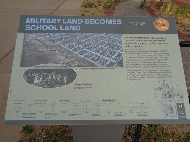
Military Land Becomes School Land
Oklahoma City 1889-1894
— The '89er Trail —
Just before the Run of '89, the federal government reserved 160 acres east of the Santa Fe Railroad for troops to maintain law and order. Known as the Military Reservation, the area's function became obsolete when soldiers turned over peace keeping to civilian authorities in 1890.
To meet the needs of a bustling community, women's organizations joined forces to secure the acreage of schools. They turned to Sidney Clarke, chairman of the city council and a former congressman from Kansas, and Dennis Flynn, the Oklahoma Territory congressional delegate. Flynn attached a rider to an appropriation bill passed by Congress in August, 1894. The bill authorized the release of the Military Reservation to the city of Oklahoma City for public school purposes.
The four-room log house formerly used as barracks was converted to a high school - the city's first - until Irving High could be built nearby. The city was divided into four wards with a school to be located in each. Land purchase and school construction were funded by the sale of bonds, which were retired by the proceeds of lot sales in the former Military Reservation.
(timeline at bottom:)
May 1, 1889 - The first formal election is held. A mayor and city council are chosen.
May 23-24, 1889 - Cheyenne and Arapahoe leaders meet with federal officials to discuss the sale of land claims outside the Unassigned Lands.
July 16, 1889 - Election to adopt Kickapoo dissenters' new city charter is shut down by the mayor.
August 29, 1889 - A new city charter written by supporters of the mayor is overwhelmingly rejected at the polls.
September 17, 1889 - Six congressmen visit the city for a first-hand look at Oklahoma country.
September 21, 1889 - Another Kickapoo charter election is broken up by the U.S. military.
November 11, 1889 - Mayor W.L. Couch resigns after months of political unrest.
November 27, 1889 - Dr. A.J. Beale, a Kickapoo leader, is elected to replace Mayor Couch.
December 1889 - Federal officials order Mayor Beale to stop challenges to existing property ownership, effectively shutting down city government.
May 2, 1890 - The Oklahoma Organic Act sets federal rules to establish territorial government.
July 15, 1890 - Oklahoma City incorporated
August 9, 1890 - W.J. Gault is elected the first mayor of Oklahoma City after incorporation.
(photo captions:)
·The military barracks that would later serve as the first Oklahoma City high school just east of Third Street.
·The first class to graduate from the Oklahoma City high school located on the site of the former military barracks.
Erected 2018 by Oklahoma City Community Foundation. (Marker Number 21.)
Topics and series. This historical marker is listed in these topic lists: Education • Native Americans • Women. In addition, it is included in the The '89er Trail series list. A significant historical month for this entry is August 1894.
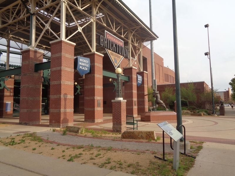
Location. 35° 27.928′ N, 97° 30.538′ W. Marker is in Oklahoma City, Oklahoma, in Oklahoma County. It is in Central Oklahoma City. Marker is on South Mickey Mantle Drive north of Johnny Bench Drive, on the right when traveling north. Marker is in front of the west entrance of Bricktown Ballpark. Touch for map. Marker is at or near this postal address: 111 S Mickey Mantle Dr, Oklahoma City OK 73104, United States of America. Touch for directions.
Other nearby markers. At least 8 other markers are within walking distance of this marker. William B. Tietgens (a few steps from this marker); Allie Pierce Reynolds (a few steps from this marker); Bobby Murcer (a few steps from this marker); John L.R. "Pepper" Martin (within shouting distance of this marker); Carl Owen Hubbell (within shouting distance of this marker); Paul Glee Waner (within shouting distance of this marker); Lloyd James Waner (within shouting distance of this marker); Wilber Joe Rogan (within shouting distance of this marker). Touch for a list and map of all markers in Oklahoma City.
Credits. This page was last revised on July 17, 2023. It was originally submitted on July 1, 2021, by Jason Voigt of Glen Carbon, Illinois. This page has been viewed 144 times since then and 12 times this year. Photos: 1, 2. submitted on July 1, 2021, by Jason Voigt of Glen Carbon, Illinois.

