Petersburg, Virginia — The American South (Mid-Atlantic)
Battle of Petersburg
25 April 1781
| — | East Hill | — |
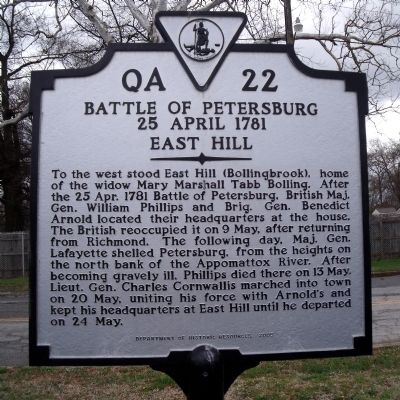
Photographed by Bernard Fisher, March 29, 2009
1. Battle of Petersburg Marker
Erected 2005 by Department of Historic Resources. (Marker Number QA-22.)
Topics and series. This historical marker is listed in these topic lists: Colonial Era • War, US Revolutionary. In addition, it is included in the Virginia Department of Historic Resources (DHR) series list. A significant historical date for this entry is April 25, 1781.
Location. 37° 13.852′ N, 77° 23.858′ W. Marker is in Petersburg, Virginia. It is on North Madison Street 0.1 miles north of East Washington Street
this page online

Regionally, this marker is in Central Virginia. It is also in the American South and specifically in the Upper South. Globally, it is in North America, the Western Hemisphere, the Western World, and the Anglosphere. Historically, it finds itself in what was once the territory of the Mississippian Culture, one of the original Thirteen Colonies, one of the Confederate States of America, and the Antebellum South.
Other nearby markers. At least 8 other markers are within walking distance of this marker: A different marker also named Battle of Petersburg (a few steps from this marker); East Hill (about 700 feet away, measured in a direct line); Lincoln In Petersburg (approx. 0.2 miles away); Petersburg Volunteers 1812 (approx. 0.2 miles away); a different marker also named Battle of Petersburg (approx. ¼ mile away); Ladies Confederate Hospital (approx. ¼ mile away); William Langhorne Bond (1893-1985)
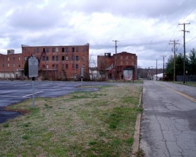
Photographed by Bernard Fisher, March 29, 2009
2. Battle of Petersburg Marker on N Madison St (facing north)
More about this marker. The marker is situated on what used to be East Hill. The YMCA just west of the marker was built in 1969 on the East Hill/Bollingbrook homesite, or perhaps a little further east (East Hill/Bollingbrook was 200 yards immediately east of Centre Hill Mansion). However, the elevation is much lower than the hill was originally; the hill was largely carved out to reduce the grade and simultaneously, using fill dirt from the hill, level the ground where I-95 now runs (while also creating the Washington Street Interchange around it). Very little of the hill itself remains, the obvious segments lining the back of the YMCA's lot.
Related markers. Click here for a list of markers that are related to this marker.
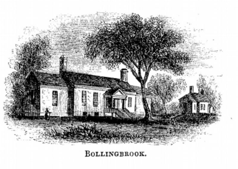
Benson John Lossing, in The Pictorial Field-Book of the Revolution, circa 1851
3. Bollingbrook
This illustration shows the two houses that stood together on East Hill, known as Bollingbrook. There is some conflicting information as to the date of origin on these structures, but both existed by the 1750s when Robert Bolling III occupied the site. The eastern one may have been built by the Byrd family in the 1720s. Neither building still stands; the eastern one burned down in 1855, the western one served as a Confederate hospital during the Civil War but was eventually abandoned and torn down ca. 1925. The hill itself also no longer stands, having been largely graded down in 1958 to accommodate the construction of the Washington Street Interchange on I-95. The 1970 Tri-Cities YMCA building now occupies the site, but at a much lower elevation than Bollingbrook would have been.
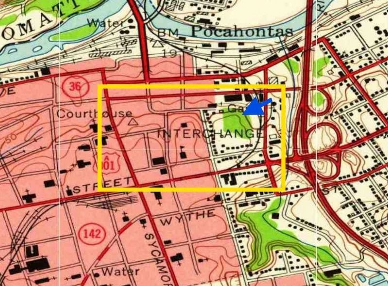
Photographed by Evan Dwyer
4. East Hill Site
The yellow square shows the three hills the Bollings built upon to overlook their warehouses and trading center along the river. The site of East Hill is indicated by the blue arrow. Note the elevation curve showing the hill. This is from a 1954 USGS topographical map, created about four years prior to the hill's destruction. The curves showing Centre Hill and West Hill (the latter being where the Courthouse stands) are apparent to the left of East Hill. When the town of "Bollingbrook" was laid out in 1783 between the original towns of Blandford (east of Lieutenant Run) and Petersburg (west of Sycamore Street, at the time Halifax Road), the basis for the current roads were put in place; the Bollings' trio of hills were bounded by Madison Street to the east, Sycamore Street to the west, Henry Street to the north, and Franklin Street to the south. Adams street divided West Hill from Centre Hill, while Jefferson Street divided Centre Hill from East Hill/Bollingbrook. Tabb street was a later addition to the area. West Hill occupied the area just south of the current Hustings Courthouse, immediately north of Tabb St. Robert Bolling IV provided the land for the courthouse square.
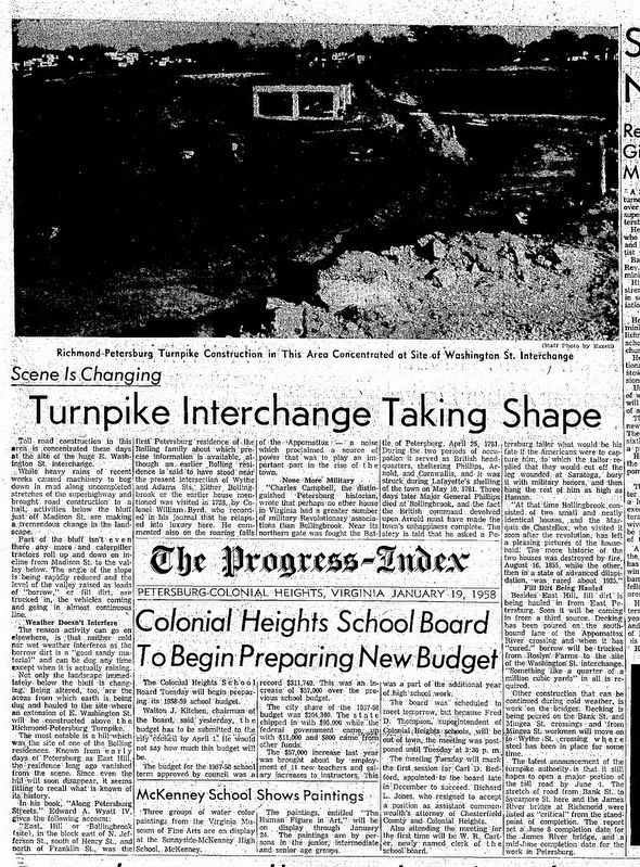
Photographed by Progress-Index Staff Photographer Ezzell, January 1, 1958
5. Progress-Index Article on Destruction of East Hill
This snip from the January 19th, 1958 edition of the Progress-Index describes the grading away of the hill itself, and mentions its history. The photograph is hard to make out but essentially shows machinery scooping out portions of the hill.
Credits. This page was last revised on August 23, 2026. It was originally submitted on April 4, 2009, by Bernard Fisher of Richmond, Virginia. This page has been viewed 1,668 times since then and 53 times this year. Photos: 1, 2. submitted on April 4, 2009, by Bernard Fisher of Richmond, Virginia. 3, 4, 5. submitted on August 23, 2026, by Evan Dwyer of Richmond, Virginia.
