Oldtown in Allegany County, Maryland — The American Northeast (Mid-Atlantic)
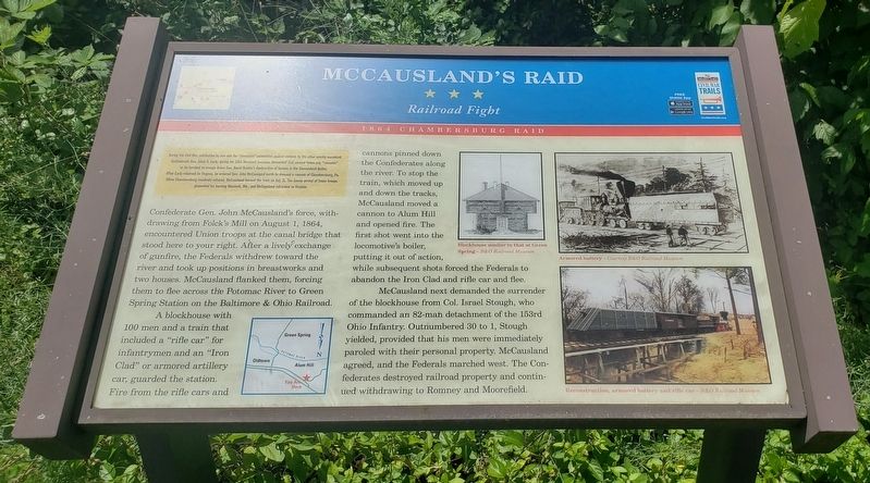
McCausland's Raid
Railroad Fight
— 1864 Chambersburg Raid —
During the Civil War, retribution by one side for "atrocities” committed against civilians by the other quickly escalated. Confederate Gen. Jubal A. Early, during his 1864 Maryland invasion, demanded that several towns pay "ransoms" or be torched to avenge Union Gen. David Hunter's destruction of houses in the Shenandoah Valley. After Early returned to Virginia, he ordered Gen. John McCausland north to demand a ransom of Chambersburg, Pa. When Chambersburg residents refused, McCausland burned the town on July 31. The timely arrival of Union troops prevented his burning Hancock, Md., and McCausland retreated to Virginia.
(main text)
Confederate Gen. John McCausland's force, withdrawing from Folck's Mill on August 1, 1864, encountered Union troops at the canal bridge that stood here to your right. After a lively exchange of gunfire, the Federals withdrew toward the river and took up positions in breastworks and two houses. McCausland flanked them, forcing them to flee across the Potomac River to Green Spring Station on the Baltimore & Ohio Railroad.
A blockhouse with 100 men and a train that included a "rifle car” for infantrymen and an "Iron Clad” or armored artillery car, guarded the station. Fire from the rifle cars and cannons pinned down the Confederates along the river.
McCausland next demanded the surrender of the blockhouse from Col. Israel Stough, who commanded an 82-man detachment of the 153rd Ohio Infantry. Outnumbered 30 to 1, Stough yielded, provided that his men were immediately paroled with their personal property. McCausland agreed, and the Federals marched west. The Confederates destroyed railroad property and continued withdrawing to Romney and Moorefield.
(captions)
Blockhouse similar to that at Green Spring - B&O Railroad Museum
Armored battery - Courtesy B&O Railroad Museum
Reconstruction, armored battery and rifle car - B&O Railroad Museum
Erected by Maryland Civil War Trails.
Topics and series. This historical marker is listed in these topic lists: Railroads & Streetcars • War, US Civil. In addition, it is included in the Maryland Civil War Trails series list. A significant historical date for this entry is August 1, 1864.
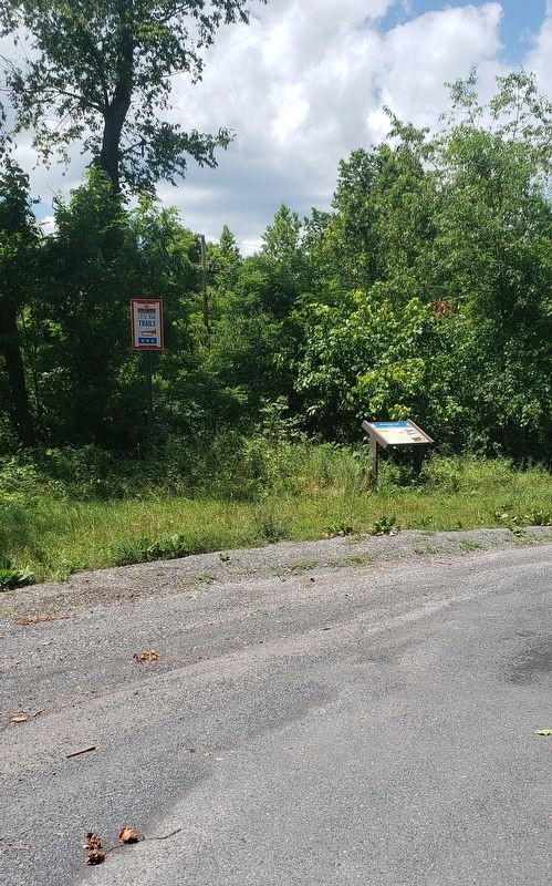
Location. 39° 32.733′ N, 78° 37.471′ W. Marker is in Oldtown, Maryland, in Allegany County. Marker is on Old Braddock Trail south of Opessa Street, on the left when traveling west. Marker is approximately 200 feet south of Opessa Street at a pulloff on the left side of Old Braddock Trail. Touch for map. Marker is in this post office area: Oldtown MD 21555, United States of America. Touch for directions.
Other nearby markers. At least 8 other markers are within 3 miles of this marker, measured as the crow flies. VFW Post 9451 Memorial (approx. 0.2 miles away); Memorial (approx. 0.6 miles away); In Memory Of Col. Thomas Cresap (approx. 0.6 miles away); Michael Cresap (approx. ¾ mile away); Maryland’s Liberty Tree (approx. ¾ mile away); Oldtown and Lock 70 (approx. ¾ mile away); Old Town (approx. one mile away); Turner Ashby’s Attack (approx. 3 miles away). Touch for a list and map of all markers in Oldtown.
Credits. This page was last revised on July 2, 2021. It was originally submitted on July 2, 2021, by Bradley Owen of Morgantown, West Virginia. This page has been viewed 606 times since then and 60 times this year. Photos: 1, 2. submitted on July 2, 2021, by Bradley Owen of Morgantown, West Virginia. • Bernard Fisher was the editor who published this page.

