SWAN (Southwest Area) in Grand Rapids in Kent County, Michigan — The American Midwest (Great Lakes)
Noahquageshik
Ogema (Chief) of the Grand River Band of Ottawa Indians
| — | ca 1770-1840 | — |

Photographed by J.T. Lambrou, July 3, 2021
1. Noahquageshik Marker
He and fellow Ogemuk assembled a Grand Council of all Ottawa bands and they agreed they would not sell their land or leave West Michigan. However, the number of American settlers grew rapidly and, faced with a U.S. government threat to move them to Kansas, the Ogemuk were forced to relinquish much of their vast territory. After the dispossession of their lands, all that remained for the Ottawa Anishinabek were several small west Michigan land reserves, including one near Manistee that remains theirs today. Grand River Ottawa Anishinabek continue to live there and in other
this page online
Topics. This historical marker is listed in these topic lists: Indigenous Peoples and Communities • War of 1812. A significant historical year for this entry is 1770.
Location. 42° 57.875′ N, 85° 40.614′ W. Marker is in Grand Rapids, Michigan, in Kent County. It is in the SWAN (Southwest Area). It is on Front Avenue Northwest 0.2 miles east of Mount Vernon Avenue Northwest, on the right when traveling east. Marker is just west of the Blue Bridge. Touch for map. Marker is at or near this postal address: 301 Fulton Street West, Grand Rapids MI 49504, United States of America. Touch for directions.

Regionally, this marker is in West Michigan. It is also in the American Midwest. Globally, it is in North America, the Western Hemisphere, the Western World, and the Anglosphere. Historically, it finds itself in what was once the Northwest Territory.
Other nearby markers. At least 8 other markers are within walking distance of this marker: Valley City Milling Company (a few steps from this marker); Furniture Industry (about 500 feet away, measured
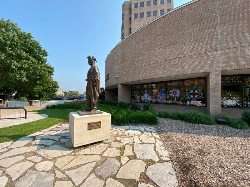
Photographed by J.T. Lambrou, July 3, 2021
2. Noahquageshik Marker
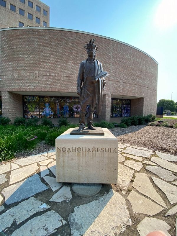
Photographed by J.T. Lambrou, July 3, 2021
3. Noahquageshik
Credits. This page was last revised on July 8, 2021. It was originally submitted on July 5, 2021, by J.T. Lambrou of New Boston, Michigan. This page has been viewed 2,783 times since then and 141 times this year. Photos: 1, 2, 3. submitted on July 5, 2021, by J.T. Lambrou of New Boston, Michigan. • Bill Pfingsten was the editor who published this page.
