Francis Lightfoot Lee's Menokin
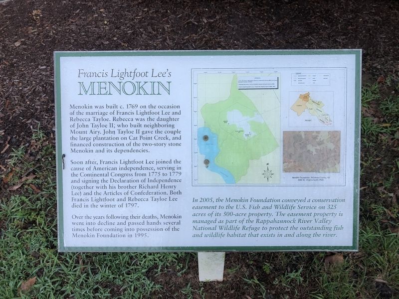
Menokin was built c. 1769 on the occasion of the marriage of Francis Lightfoot Lee and Rebecca Tayloe. Rebecca was the daughter of John Tayloe II, who built neighboring Mount Airy. John Tayloe II gave the couple the large plantation on Cat Point Creek, and financed construction of the two-story stone Menokin and its dependencies.
Soon after, Francis Lightfoot Lee joined the cause of American independence, serving in the Continental Congress from 1775 to 1779 and signing the Declaration of Independence (together with his brother Richard Henry Lee) and the Articles of Confederation. Both Francis Lightfoot and Rebecca Tayloe Lee died in the winter of 1797.
Over the years following their deaths, Menokin went into decline and passed hands several times before coming into possession of the Menokin foundation in 1995.
In 2005, the Menokin Foundation conveyed a conservation easement to the U.S. Fish and Wildlife Service on 325 acres of its 500-acre property. The easement property is managed as part of the Rappahannock River Valley National Wildlife Refuge to protect the outstanding fish and wildlife habitat that exists in and along the river.
Topics and series. This historical marker is listed in these topic lists: Colonial Era • Environment
Location. 38° 0.399′ N, 76° 47.906′ W. Marker is near Warsaw, Virginia, in Richmond County. Marker can be reached from Menokin Road (Virginia Route 690) 1.7 miles south of Piney Grove Road (Virginia Route 637), on the right when traveling south. Touch for map. Marker is at or near this postal address: 4037 Menokin Rd, Warsaw VA 22572, United States of America. Touch for directions.
Other nearby markers. At least 8 other markers are within 4 miles of this marker, measured as the crow flies. The Remembrance Structure (about 400 feet away, measured in a direct line); The Terraces (approx. 0.3 miles away); Outbuildings (approx. 0.3 miles away); Exterior Design (approx. 0.3 miles away); Menokin (approx. 0.6 miles away); Nomini Baptist Meetinghouse (approx. 3.4 miles away); Warsaw (approx. 4 miles away); Richmond County Courthouse (approx. 4 miles away). Touch for a list and map of all markers in Warsaw.
Credits. This page was last revised on July 5, 2021. It was originally submitted on July 5, 2021, by Devry Becker Jones of Washington, District of Columbia. This page has been viewed 184 times since then and 14 times this year. Photos: 1, 2. submitted on July 5, 2021, by Devry Becker Jones of Washington, District of Columbia.

