Near Marietta in Cobb County, Georgia — The American South (South Atlantic)
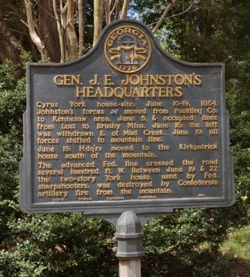
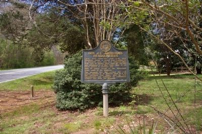
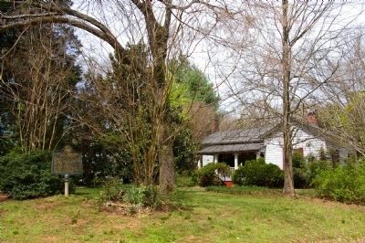
Gen. J. E. Johnstonís Headquarters
June 19: Hdqírs moved to the Kirkpatrick house south of the mountain.
The advanced Fed. line crossed the road several hundred ft. W. Between June 19 & 27, the two-story York house, used by Fed. sharpshooters, was destroyed by Confederate artillery fire from the mountain.
Erected 1953 by Georgia Historical Commission. (Marker Number 033-18.)
Topics and series. This historical marker is listed in this topic list: War, US Civil. In addition, it is included in the Georgia Historical Society series list. A significant historical date for this entry is June 10, 1874.
Location. 33° 57.847′ N, 84° 36.017′ W. Marker is near Marietta, Georgia, in Cobb County. Marker is at the intersection of Burnt Hickory Road NW and Carnes Road NW on Burnt Hickory Road NW. Touch for map. Marker is at or near this postal address: 1670 Burnt Hickory Road NW, Marietta GA 30064, United States of America. Touch for directions.
Other nearby markers. At least 8 other markers are within walking distance of this marker. Loganís 15th A.C. Line (approx. 0.3 miles away); US Regulars Monument (approx. 0.4 miles away); Kennesaw Battlefield (approx. 0.4 miles away); Undercooks, Nurses, and Freedom (approx. 0.4 miles away); Assault on Pigeon Hill (approx. 0.4 miles away); Run, Johnny, Run! (approx. 0.4 miles away); General Leonidas Polk's Headquarters (approx. 0.4 miles away); Kennesaw Spur (approx. half a mile away). Touch for a list and map of all markers in Marietta.
Credits. This page was last revised on June 16, 2016. It was originally submitted on April 4, 2009, by David Seibert of Sandy Springs, Georgia. This page has been viewed 1,507 times since then and 25 times this year. Photos: 1, 2, 3. submitted on April 4, 2009, by David Seibert of Sandy Springs, Georgia. • Craig Swain was the editor who published this page.


