Near Stratford in Westmoreland County, Virginia — The American South (Mid-Atlantic)
American Indians at Stratford
Living Near Springs of Fresh Water
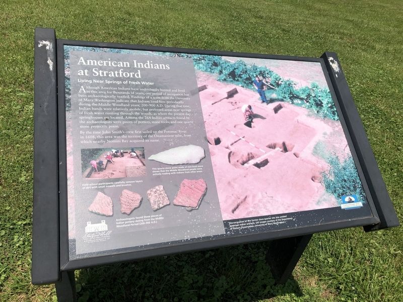
Although American Indians have undoubtedly hunted and lived in this area for thousands of years, one period of occupation has been archaeologically verified. Findings of a team from the University of Mary Washington indicate that Indians lived here periodically during the Middle Woodland years, 200-900 A.D. During that time, Indian bands were relatively mobile, but preferred areas near springs of fresh water running through the woods, as where the present-day springhouses are located. Among the 264 Indian artifacts found by the archaeologists were pieces of pottery, stone tools, and one quartz stone projectile point.
By the time John Smith's crew first sailed up the Potomac River in 1608, this area was the territory of the Onamanient tribe, from which near Nomini Bay acquired its name.
[Captions:]
This quarts stone point made of non-local stone shows that the Middle Woodland people were actively trading with Indians from other areas.
Field school participants carefully remove layers of dirt with small trowels and brushes.
Archaeologists found these pieces of Indian pottery dating from the Middle Woodland Period (200-900 A.D.).
The excavation of this former slave quarter site also yielded American Indian artifacts.
Erected by
Topics. This historical marker is listed in these topic lists: Anthropology & Archaeology • Native Americans • Settlements & Settlers. A significant historical year for this entry is 200 CE.
Location. 38° 9.169′ N, 76° 50.336′ W. Marker is near Stratford, Virginia, in Westmoreland County. Marker can be reached from Great House Road, 0.9 miles east of Stratford Hall Road (Virginia Route 214), on the left when traveling east. Touch for map. Marker is at or near this postal address: 483 Great House Rd, Montross VA 22520, United States of America. Touch for directions.
Other nearby markers. At least 8 other markers are within walking distance of this marker. Stratford Hall (about 800 feet away, measured in a direct line); Oval Site (approx. ¼ mile away); Slave Cemetery (approx. ¼ mile away); a different marker also named Slave Cemetery (approx. ¼ mile away); Clifts Plantation Burial Ground (approx. half a mile away); Clifts Plantation Site (approx. half a mile away); a different marker also named Stratford Hall (approx. 0.6 miles away); To Keep in Perpetual Remembrance the Name of Thomas Lee (approx. 0.6 miles away). Touch for a list and map of all markers in Stratford.
Credits. This page was last revised on July 5, 2021. It was originally submitted on July 5, 2021, by Devry Becker Jones of Washington, District of Columbia. This page has been viewed 219 times since then and 24 times this year. Photos: 1, 2. submitted on July 5, 2021, by Devry Becker Jones of Washington, District of Columbia.

