Presidio of San Francisco in San Francisco City and County, California — The American West (Pacific Coastal)
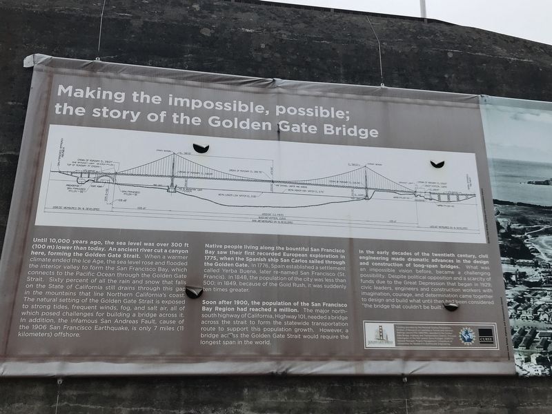
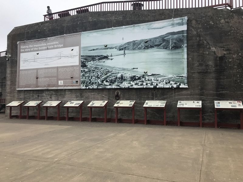
Making the Impossible, Possible: The Story of the Golden Gate Bridge
Inscription.
Until 10,000 years ago, the sea level was over 300 ft (100 m) lower than today. An ancient river cut a canyon here, forming the Golden Gate Strait. When a warmer climate ended the Ice Age, the sea level rose and flooded the interior valley to form the San Francisco Bay, which connects to the Pacific Ocean through the Golden Gate Strait. Sixty percent of all the rain and snow that falls on the State of California still drains through this gap in the mountains that line Northern California's coast. The natural setting of the Golden Gate Strait is exposed to strong tides, frequent winds, fog, and salt air, all of which posed challenges for building a bridge across it. In addition, the infamous San Andreas Fault, cause of the 1906 San Francisco Earthquake, is only 7 miles (11 kilometers) offshore.
Native people living along the bountiful San Francisco Bay saw their first recorded European exploration in 1775, when the Spanish ship San Carlos sailed through the Golden Gate. In 1776, Spain established a settlement called Yerba Buena, later re-named San Francisco (St. Francis). In 1848, the population of the city was less than 500; in 1849, because of the Gold Rush, it was suddenly ten times greater.
Soon after 1900, the population of the San Francisco Bay Region had reached a million. The major north-south highway of California, Highway 101, needed a bridge across the strait to form the statewide transportation route to support this population growth. However, a bridge across the Golden Gate Strait would require the longest span in the world.
In the early decades of the twentieth century, civil engineering made dramatic advances in the design and construction of long-span bridges. What was an impossible vision before, became a challenging possibility. Despite political opposition and a scarcity of funds due to the Great Depression that began in 1929, civic leaders, engineers and construction workers with imagination, courage, and determination came together to design and build what until then had been considered "the bridge that couldn't be built."
Erected by Golden Gate Bridge, Highway and Transportation District.
Topics. This historical marker is listed in these topic lists: Bridges & Viaducts • Waterways & Vessels.
Location. 37° 48.488′ N, 122° 28.548′ W. Marker is in San Francisco, California, in San Francisco City and County. It is in Presidio of San Francisco. Marker can be reached from Coastal Trail. Marker is in the Battery Lancaster exhibit area of the Golden Gate Bridge Vista Point South. Touch for map. Marker is in this post office area: San Francisco CA 94129, United States of America. Touch for directions.
Other nearby markers. At least 8 other markers are
within walking distance of this marker. Engineering the Design (here, next to this marker); Working Under Water (here, next to this marker); Bridging the Gate — the Beginning (here, next to this marker); A Bathtub for the South Tower (here, next to this marker); World's Tallest Bridge Towers (here, next to this marker); Fort Point Arch (here, next to this marker); Spinning the Main Cables (here, next to this marker); Hanging the Roadway Deck (here, next to this marker). Touch for a list and map of all markers in San Francisco.
Credits. This page was last revised on February 7, 2023. It was originally submitted on July 6, 2021, by Duane and Tracy Marsteller of Murfreesboro, Tennessee. This page has been viewed 287 times since then and 28 times this year. Photos: 1, 2. submitted on July 6, 2021, by Duane and Tracy Marsteller of Murfreesboro, Tennessee.

