
Near Dinwiddie in Dinwiddie County, Virginia — The American South (Mid-Atlantic)
Gravelly Run Quaker Meeting House
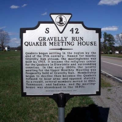
Photographed by Bernard Fisher, March 29, 2009
1. Gravelly Run Quaker Meeting House Marker
Erected 2000 by Department of Historic Resources. (Marker Number S-42.)
Topics and series. This historical marker is listed in these topic lists: Abolition & Underground RR • Religion & Religious Structures • Settlements & Settlers. In addition, it is included in the Quakerism, and the Virginia Department of Historic Resources (DHR) series lists. A significant historical year for this entry is 1767.
Location. 37° 8.245′ N, 77° 31.598′ W. Marker is near Dinwiddie, Virginia, in Dinwiddie County. It is at the intersection of Boydton Plank Road (U.S. 1) and Quaker Road, on the right
this page online

Regionally, this marker is in Virginia’s Piedmont, in Southside Virginia, and specifically in Central Virginia. It is also in the American South and specifically in the Upper South. Globally, it is in the North Atlantic Region, North America, the Western Hemisphere, the Western World, and the Anglosphere. Historically, it finds itself in what was once the territory of the Mississippian Culture, one of the original Thirteen Colonies, one of the Confederate States of America, and the Antebellum South.
Other nearby markers. At least 8 other markers are within 2 miles of this marker, measured as the crow flies: Raceland (here, next to this marker); Quaker Road Engagement (approx. 0.8 miles away); Cattle (Beefsteak) Raid (approx. 0.9 miles away); White Oak Road (approx. 0.9 miles away); Burgess Mill (approx. 1.2 miles away); Hatcher's Run (approx. 1.2 miles away); White Oak Road Engagement (approx. 1.6 miles away); Hatcher's Run Battlefields (approx. 1.7
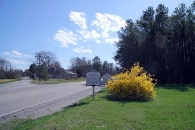
Photographed by Bernard Fisher, March 29, 2009
2. Gravelly Run Quaker Meeting House (S 42) and Raceland (S 46) Markers.
Other markers no longer nearby. The Battle of White Oak Road (was approx. 1.4 miles away but has been confirmed missing); a different marker also named The Battle of White Oak Road (was approx. 1.4 miles away but has been confirmed missing); a different marker also named The Battle of White Oak Road (was approx. 1½ miles away but has been confirmed missing); a different marker also named The Battle of White Oak Road (was approx. 1½ miles away but has been confirmed missing); a different marker also named The Battle of White Oak Road (was approx. 1.6 miles away but has been confirmed missing); a different marker also named The Battle of White Oak Road (was approx. 1.6 miles away but has been confirmed missing); a different marker also named The Battle of White Oak Road (was approx. 1.6 miles away but has been permanently removed).
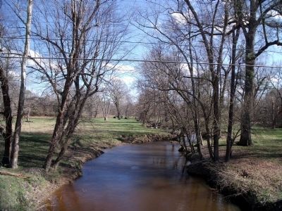
Photographed by Bernard Fisher, March 29, 2009
3. Gravelly Run is 1.5 miles south of the marker.
Credits. This page was last revised on February 3, 2020. It was originally submitted on April 5, 2009, by Bernard Fisher of Richmond, Virginia. This page has been viewed 2,449 times since then and 59 times this year. Photos: 1, 2, 3. submitted on April 5, 2009, by Bernard Fisher of Richmond, Virginia.
