Aztalan in Jefferson County, Wisconsin — The American Midwest (Great Lakes)
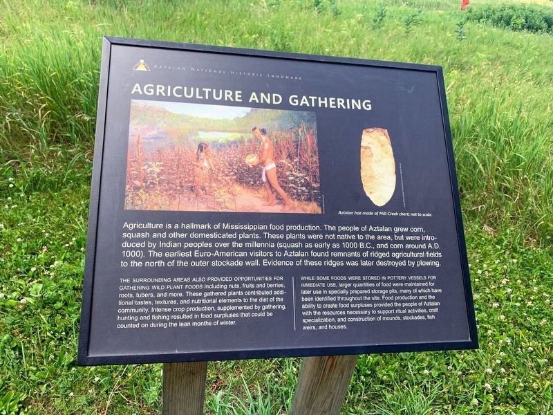
Agriculture and Gathering
Aztalan National Historic Landmark
The surrounding areas also provided opportunities for gathering wild plant foods including nuts, fruits and berries, roots, tubers, and more. These gathered plants contributed additional tastes, textures, and nutritional elements to the diet of the community. Intense crop production, supplemented by gathering, hunting and fishing resulted in food surpluses that could be counted on during the lean months of winter.
While some foods were stored in pottery vessels for immediate use, larger quantities of food were maintained for later use in specially prepared storage pits, many of which have been identified throughout the site. Food production and the ability to create food surpluses provided the people of Aztalan with the resources necessary to support ritual activities, craft specialization, and construction of mounds, stockades, fish weirs, and houses.
Photo caption (right): Aztalan hoe made of Mill Creek chert; not to scale
Topics. This historical marker is listed in this topic list: Native Americans.
Location. 43° 3.984′ N, 88° 51.569′ W. Marker is in Aztalan, Wisconsin, in Jefferson County. Marker can be reached from County Road Q. Touch for map. Marker is at or near this postal address: N6200 County Road Q, Jefferson WI 53549, United States of America. Touch for directions.
Other nearby markers. At least 8 other markers are within walking distance of this marker. House Structures (about 400 feet away, measured in a direct line); Conical Mounds (about 500 feet away); Other Artifacts (about 600 feet away); Prehistoric Pottery (about 600 feet away); Stone Tools (about 600 feet away); Leisure Activities (about 600 feet away); Appearance and Manner of Dress (about 700 feet away); Social Organization (approx. 0.2 miles away). Touch for a list and map of all markers in Aztalan.
More about this marker. The marker is along the trail that runs throughout Aztalan State Park. The marker is along the eastern section of the trail.
Credits. This page was last revised on July 14, 2021. It was originally submitted on July 8, 2021, by Devon Polzar of Port Washington, Wisconsin. This page has been viewed 92 times since then and 14 times this year. Photos: 1, 2. submitted on July 8, 2021, by Devon Polzar of Port Washington, Wisconsin. • Mark Hilton was the editor who published this page.

