Fairdale in Raleigh County, West Virginia — The American South (Appalachia)
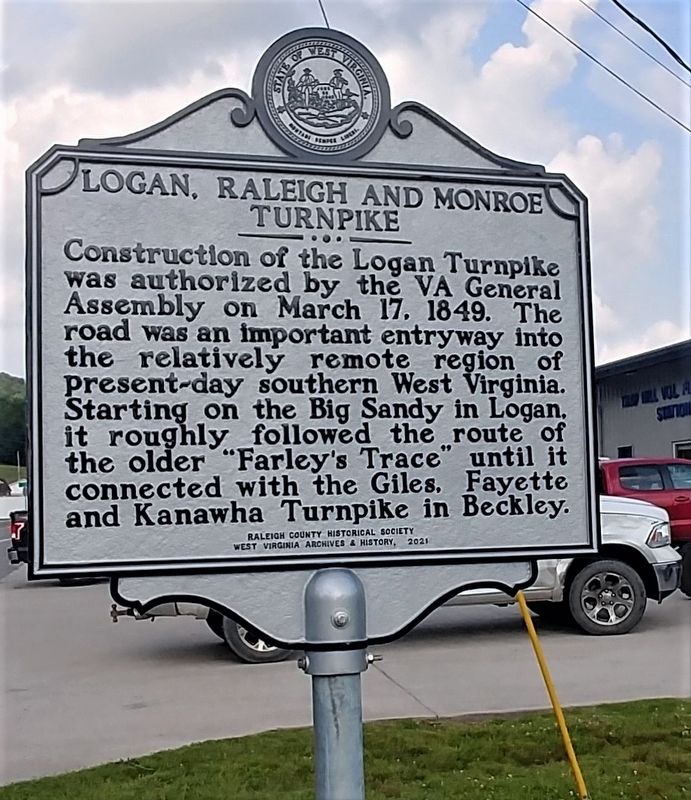
Logan, Raleigh and Monroe Turnpike
Erected 2021 by Raleigh County Historical Society, West Virginia Archives and History.
Topics and series. This historical marker is listed in these topic lists: Roads & Vehicles • Settlements & Settlers. In addition, it is included in the West Virginia Archives and History series list. A significant historical date for this entry is March 17, 1849.
Location. 37° 46.808′ N, 81° 21.984′ W. Marker is in Fairdale, West Virginia, in Raleigh County. Marker is on Bolt Road (West Virginia Route 99) 0.1 miles Rockhouse Fork (County Road 15/8), on the left when traveling west. The marker stands near Trap Hill Volunteer Fire Department. Touch for map. Marker is at or near this postal address: 773 Bolt Rd, Fairdale WV 25839, United States of America. Touch for directions.
Other nearby markers. At least 8 other markers are within 9 miles of this marker, measured as the crow flies. First Church in Raleigh County (approx. 1.1 miles away); James Cecil “Little Jimmy” Dickens (approx. 2˝ miles away); The Big Tunnel Fight (approx. 4.9 miles away); Site of Mark Twain High School (approx. 7.8 miles away); Korean War Memorial (approx. 8 miles away); Mortality (approx. 8.3 miles away); From Agriculture to Mining (approx. 8.3 miles away); The Indian Path (approx. 8.3 miles away).
Credits. This page was last revised on July 12, 2021. It was originally submitted on July 10, 2021, by Merle T. Cole of Daniels, West Virginia. This page has been viewed 225 times since then and 43 times this year. Photo 1. submitted on July 10, 2021, by Merle T. Cole of Daniels, West Virginia. • Devry Becker Jones was the editor who published this page.
