Harbor in Curry County, Oregon — The American West (Northwest)
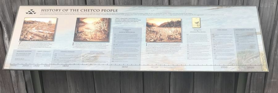
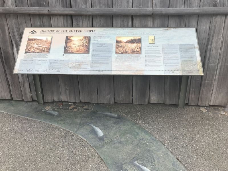
History of the Chetco People
Photographed by Duane and Tracy Marsteller, June 30, 2021
1. History of the Chetco People Marker
"From the numerous miners and settlers that are pressing into their country they are suffering many grievous wrongs that call for the immediate interference of the Government. Within the last six months four of their villages have been burned by the whites … Many of them have been killed merely on suspicion that they would arise and avenge their own wrongs, or in petty threats that have been made against lawless white men for debauching their women; and I believe in no single instance have the Indians been the first aggressors." — J.L. Parrish, Indian Agent. Letter to Joel Palmer: 10 July 1854
"When I visited Chetko I found things in a bad state; the Indians were scattered and living in great fear, and drove from their fisheries." — Ben Wright, Special Sub Indian Agent. Letter to Joel Palmer, 17 September, 1854
Captions (left to right)
• The Chetco people have lived on the Oregon coast for thousands of years. As early as the 1500s, Spanish explorers visited the Pacific Northwest. Europeans had increasing contact with Oregon's coastal tribes into the 1800s, bringing trade, disease, and new settlements of people.
• In
this page online
• In 1856, the U.S. Army forcibly removed the Chetco people to the Siletz Reservation. The Chetco had to travel two hundred miles north over rough terrain and swim the rivers with their children and elderly in tow. Some were abused by soldiers, and many died on the long, grueling march. Families were not allowed to stop to bury their loved ones and were forced to keep moving. The journey brought heartbreak and trauma to those who survived.
Timeline:
Photographed by Duane and Tracy Marsteller, June 30, 2021
2. History of the Chetco People Marker
• 1850 — Oregon Indian Treaty Act authorizes commissioners to negotiate land treaties. These treaties will extinguish tribal land claims in western Oregon and, if possible, remove the tribes from the area.
• 1850
Photographed by Duane and Tracy Marsteller, June 30, 2021
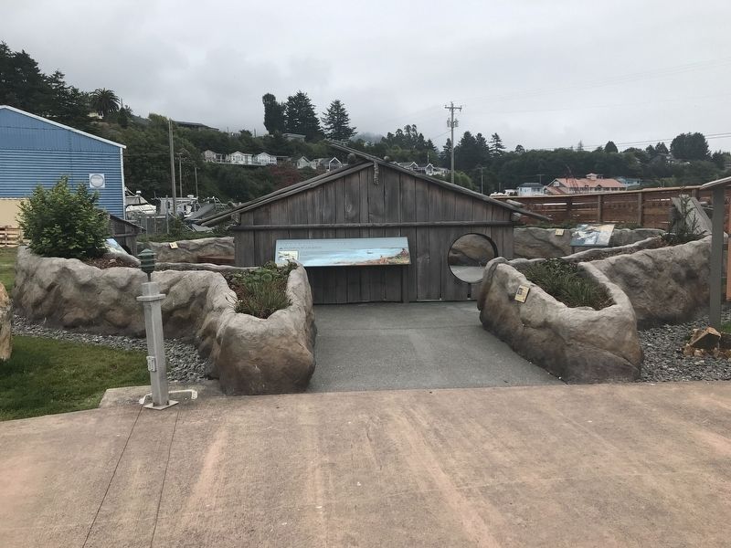
3. The Chetco Indian Memorial
• 1851-1856 — The Rogue River Wars bring major hostilities between incoming settlers and local tribes on the Upper Rogue. The war expands to the south coast. The Indians realize that their lands and traditional ways of life are under attack.
• 1854 — Miners clash with the Chetco people over access to resources. A.F. Miller attempts to take over the vessels of an Indian ferry now profitable due to the mining, but the Chetco ferry operators refuse. Miller leads a raid and burns both villages at the mouth of the Chetco River. Twenty-three Chetco men and several women are killed.
• 1855 — Chetco representatives sign the Coast Treaty with Superintendent of Indian Affairs Joel Palmer and are promised a permanent homeland and compensation in exchange for giving up their land claims. Congress never ratifies the treaty.
• 1855 — The Coast Reservation is established. It would later be divided into the Siletz and Alsea Reservations.
• 1856 — The Rogue River Wars come
Photographed by Duane and Tracy Marsteller, June 30, 2021
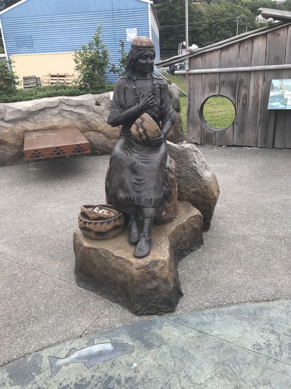
4. Statue of Lucy Dick
She was believed to be the last full-blooded Chetco Indian living in the tribe's original homeland when she died in 1940.
• 1859 — Oregon enters the nation as a state.
• 1865 — President Johnson removes the valuable Yaquina Bay region from the reservation and opens it to non-Indian settlement.
• 1875 — Contrary to what was promised in the Coast Treaty, Oregon Legislature approves the removal of 700,000 acres from the Siletz Reservation for non-Indian settlement.
• 1876 — Lucy Dick receives permission from the Indian Agency at Siletz to return to her Chetco homestead.
• 1887 — The Dawes Act (General Allotment Act) furthers divides the Siletz Reservation into individual lots for tribal members, paving the way for the sale of "surplus" land and further reduction of the reservation.
• 1892 — More than 191,000 acres of prime "surplus" reservation land are opened to incoming settlers and sold for 74 cents an acre.
• 1940 — Lucy Dick dies in Harbor, Oregon. She is buried at the Oceanview Cemetery and her Chetco name is forgotten.
• 1954 — President Eisenhower signs the Western Oregon Transportation Act into law, which ends federal recognition of many Oregon tribes. This act severs the existing treaty relationships and also removes the final remaining parcels of reservation land from tribal members.
• 1957-59 — The Port District of Brookings-Harbor is created.
• 1960 — The remaining area containing the shell deposits at Chit-xu village is bulldozed during construction.
• 1977 — The Brookings-Harbor School District launches its Indian Education program to supplement the educational and cultural needs of Native American students.
• 1977 — President Carter signs the Siletz Restoration Act into law on November 18th. The Siletz people regain federal recognition of their tribal status and treaty rights after years of effort.
• 1980 — A small scattered land base is returned to the Siletz people as an initial reestablished reservation.
• 2009 — The Port of Brookings-Harbor donates this site to the Chetco Indian Memorial.
• 2011 — A tsunami hits the Port of Brookings-Harbor. The tsunami uncovers Chit-xu villages.
• 2018 — The Chetco people and other western Oregon bands who form the Confederated Tribes of Siletz are a self-governing people who have survived devastating losses and are proud of who they are. Today there are thousands of people with Chetco ancestry in Oregon and around the world.
The Brookings-Harbor School District continues to support Native American students in its Indian Education program
Erected 2019 by Chetco Indian Memorial Project.
Topics. This historical marker is listed in these topic lists: Disasters • Indigenous Peoples and Communities • Settlements & Settlers. A significant historical date for this entry is July 10, 1854.
Location. 42° 2.974′ N, 124° 16.062′ W. Marker is in Harbor, Oregon, in Curry County. It can be reached from Harbor Drive west of Lower Harbor Road, on the right when traveling west. Marker is in the Chetco Indian Memorial at the Port of Brookings-Harbor. Touch for map. Marker is at or near this postal address: 16282 Lower Harbor Road, Brookings OR 97415, United States of America. Touch for directions.

Regionally, this marker is in Southern Oregon and specifically on the Oregon Coast. It is also on the American Pacific Coast, in the Pacific Northwest, and in the Lewis & Clark Corridor. Globally, it is in North America, in the Cascade Range, on the Ring of Fire, on the Pacific Rim, in the Western Hemisphere, in the Western World, and in the Anglosphere. Historically, it finds itself in what was once New Spain.
Other nearby markers. At least 4 other markers are within 11 miles of this marker, measured as the crow flies: Chetco Memorial — Chit-xu Village Site (here, next to this marker); March 11, 2011 Tsunami (about 600 feet away, measured in a direct line); The Japanese Attack on Oregon (approx. half a mile away); Memorial (approx. 11 miles away).
Credits. This page was last revised on December 13, 2024. It was originally submitted on July 10, 2021, by Duane and Tracy Marsteller of Murfreesboro, Tennessee. This page has been viewed 3,033 times since then and 198 times this year. Photos: 1, 2, 3, 4. submitted on July 10, 2021, by Duane and Tracy Marsteller of Murfreesboro, Tennessee.
