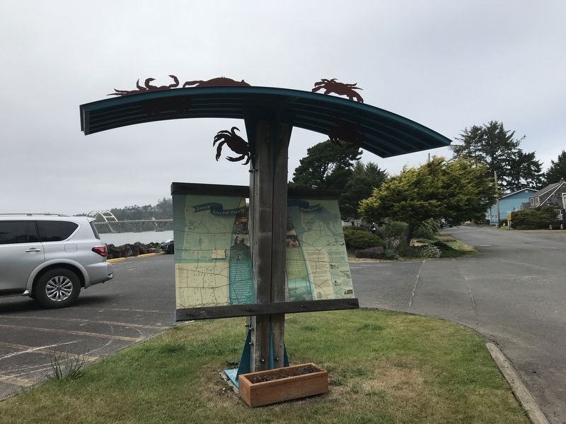
Waldport in Lincoln County, Oregon — The American West (Northwest)
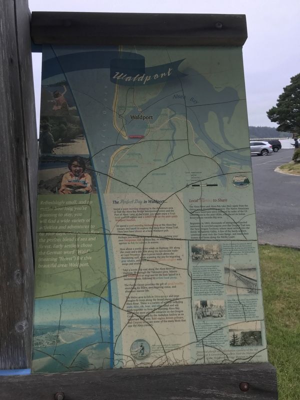
Waldport
Local Stories to Share
The Alsea River and Alsea Bay take their name from the native word Alsi (meaning peace). The Native Americans who once lived here were removed by order of the US Government in the mid-1850s, and placed on Indian Reservations outside this area.
Beginning in 1843, thousands of immigrants traveled westward in covered wagons over the Oregon Trail into the New Oregon Territory, where most settled into the fertile Willamette Valley. A few of the hardy settlers continued west over the Coast Range, and made their homes and farms along the Pacific Coast.
Captions (right side, top to bottom)
• The city of Waldport was platted in 1884 by David and Orlena Ruble who had received a federal land plat. By using star observations they laid out the city street patterns near Alsea Bay — these are still in use today. The Rubles gathered at a family reunion (left) circa 1930.
• The Alsea Southern Railroad (right) was initiated by the army during WWI to supply spruce lumber for airplanes. Three days after the completion, the Armistice was signed and the demand for spruce vanished. C.D. Johnsen purchased the rail lines for $500 and changed the name to Pacific Spruce. The railroad was used for logging and a few cars were adapted to carry mail and passengers. The railroad sold again in 1933, and was gone by the summer of 1936, the year the original Alsea Bay Bridge opened. At low tide, you can still see some of the pilings from the old rail lines.
• About 1885 a fish cannery was established in Waldport along Alsea Bay. Chinese laborers came to work at the cannery to help with a strong salmon run, and brought with them all their supplies, including the tin used in the canning process. They had to work fast to process the fish since there was no refrigeration at that time (left) Alsea Fishermen's Canning Association, circa 1925.
• The City of Waldport was incorporated in 1911 and established a mayor and city council form of government. Since incorporation in 1911, many residential areas have expanded toward the south and east of the historic downtown area. These residential areas provide a quiet and peaceful quality of life for folks who call Waldport home. Waldport's first home (right) was located 100 yards south of here and belonged to the Keady family.
(left column)
Refreshingly small, and no matter how long you're planning to stay, you will find a wide variety of activities and adventures to fill your days. Our town offers the perfect blend of sea and forest. Early settlers chose the German word "Wald" (meaning "forest") for this beautiful area: Waldport.
(center column)
The Perfect
Day in Waldport …
Spend a quiet morning shopping in the downtown area or visit the Alsea Bay Bridge Interpretive Center and the Port of Alsea. Later at day's end, you might enjoy a fresh local seafood supper and a sunset walk on the wide sandy Waldport beaches.
Or spend a cool morning birdwatching at the Alsea Bay estuary and kayak to explore the Alsea River Water Trail. Then later have dinner at a local Waldport pub.
Perhaps you would rather spend the day catching your own Dungeness crab in Alsea Bay, or steering a drift boat upriver to fish for salmon in season.
How about a scenic drive south on Highway 101 along the coast and a day hike along the spectacular trails at Cape Perpetua. Have a picnic lunch above the thundering surf, while scanning the sea for migrating gray whales, and then an evening beach campfire with songs and stories.
Take a scenic rip east along the Alsea River on Highway 34 through the Tidewater area. Admire the wildflowers or stop and let the kids splash in a swimming hole, followed by a river bank picnic.
The Pacific Ocean provides the gift of sandy beaches stretching for miles, awe-inspiring vistas, and abundant marine life.
The entire area is rich in Sitka spruce and large Douglas-fir trees along the broad sweep of the Alsea River. There is a variety of wildlife including seals, deer, elk, bear, and otter. Land and sea work together to form the stunning Alsea Bay, one of the most pristine estuaries on the Oregon Coast — designated by the Audubon Society as an important bird area. Bald eagles, brown pelicans, and Caspian terns are some of the many birds that use the Alsea estuary.
Topics. This historical marker is listed in these topic lists: Industry & Commerce • Native Americans • Railroads & Streetcars • Settlements & Settlers. A significant historical year for this entry is 1911.
Location. 44° 25.452′ N, 124° 4.199′ W. Marker is in Waldport, Oregon, in Lincoln County. Marker is on SW Maple Street north of U.S. 101, on the right when traveling south. Marker is in William P. Keady State Wayside. Touch for map. Marker is at or near this postal address: 210 SW Maple Street, Waldport OR 97394, United States of America. Touch for directions.
Other nearby markers. At least 8 other markers are within 14 miles of this marker, measured as the crow flies. Seal Rock (approx. 5.1 miles away); Alsea Sub-Agency (approx. 7.4 miles away); Welcome to the Oregon Coast (approx. 8.1 miles away); Elk Forage (approx. 9˝ miles away); Giant Spruce of Cape Perpetua (approx. 10 miles away); Bayfront Beginnings (approx. 13˝ miles away); Bridging the Waters (approx. 13˝ miles away); Shipping News (approx. 13˝ miles away).
More about this marker. The order of text in the inscription has been altered to emphasize the historical section of the marker.
Credits. This page was last revised on July 13, 2021. It was originally submitted on July 11, 2021, by Duane and Tracy Marsteller of Murfreesboro, Tennessee. This page has been viewed 381 times since then and 66 times this year. Photos: 1, 2. submitted on July 11, 2021, by Duane and Tracy Marsteller of Murfreesboro, Tennessee.

