Cumberland in Allegany County, Maryland — The American Northeast (Mid-Atlantic)
Where the Road Began
— The Historic National Road - The Road That Built the Nation —
Inscription.
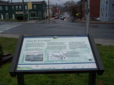
You are standing at the starting point of this country's first federal road building project, the National Road. A vision of George Washington as a means to develop the continent and to unite the country, his idea was championed by Thomas Jefferson and authorized by Congress in 1806.
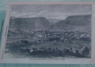
Nestled in the Allegheny Mountains, Cumberland sat on the edge of the frontier in the early 19th century. Crossing the mountainous landscape was challenging. The eastern continental divide was a barrier for westward expansion and trade in the Ohio Valley. Still, daring pioneers pushed westward.
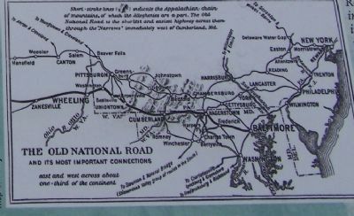
"Easily first among the several through highways running west from the Atlantic seaboard, and ranking with the Santa Fe and Oregon Trails of the far west, is the Old National Road, which though completed as a government project only from Cumberland, Maryland to Wheeling (then Virginia, now West Virginia) was connected up with the older pikes from Baltimore, Frederick and Hagerstown, and subsequently with the newer lines west of the Ohio River, making for all time the shortest and most natural way for road travel from tidewater at Chesapeake Bay to the junction of the Mississippi and Missouri Rivers at St. Louis, Missouri."
Robert Bruce traveled the National Road in 1916, and produced a guidebook that included "a series of detailed maps showing topography and principal points of historic interest." His insight ass those years ago continues to enlighten today's traveler on the historical significance of this great highway that for so many years was "a vital factor in the life, politics and industry of the country." Thank you, Mr. Bruce.
Topics and series. This historical marker is listed in these topic lists: Arts, Letters, Music • Roads & Vehicles. In addition, it is included in the Former U.S. Presidents: #03 Thomas Jefferson, and the The Historic National Road series lists. A significant historical year for this entry is 1806.
Location. 39° 38.985′ N, 78° 45.891′ W. Marker is in Cumberland, Maryland, in Allegany County. Marker is at the intersection of Greene Street and Bridge Street on Greene Street. Touch for map. Marker is in this post office area: Cumberland MD 21502, United States of America. Touch for directions.
Other nearby markers. At least 8 other markers are within walking distance of this marker. Riverside Park (here, next to this marker); Fort Cumberland Trail (here, next to this marker); National Road Monument (here, next to this marker); Headquarters of George Washington (a few steps from this marker); George Washington at Will’s Creek (a few steps from this marker); Col. Thomas Cresap (within shouting distance of this marker); The Old National Pike (within shouting distance of this marker); Col. Joshua Fry (within shouting distance of this marker). Touch for a list and map of all markers in Cumberland.
Credits. This page was last revised on March 24, 2024. It was originally submitted on April 6, 2009, by Bill Pfingsten of Bel Air, Maryland. This page has been viewed 1,846 times since then and 39 times this year. Photos: 1, 2, 3. submitted on April 6, 2009, by Bill Pfingsten of Bel Air, Maryland.


