Lincoln City in Spencer County, Indiana — The American Midwest (Great Lakes)
David Turnham (1803-1884)
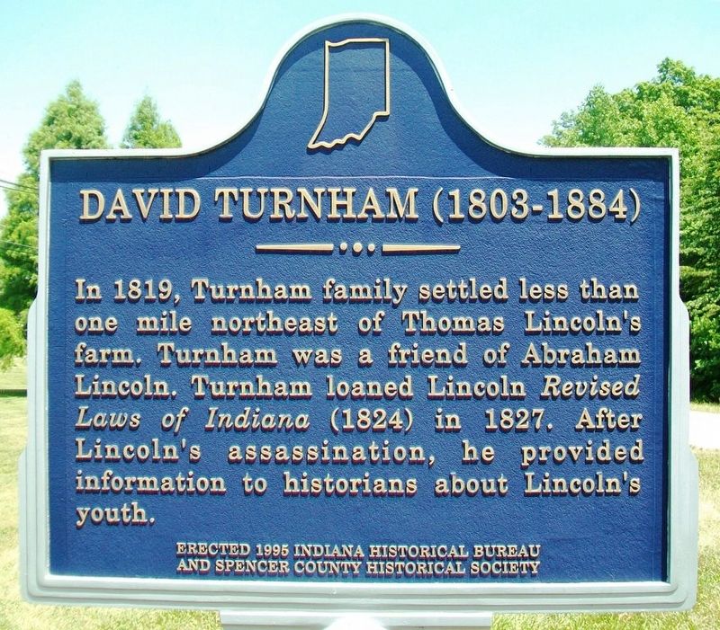
Photographed by William Fischer, Jr., June 25, 2016
1. David Turnham (1803-1884) Marker
Erected 1995 by Indiana Historical Bureau and Spencer County Historical Society. (Marker Number 74.1995.1.)
Topics and series. This historical marker is listed in these topic lists: Agriculture • Settlements & Settlers. In addition, it is included in the Former U.S. Presidents: #16 Abraham Lincoln, and the Indiana Historical Bureau Markers series lists. A significant historical year for this entry is 1819.
Location. 38° 7.094′ N, 86° 59.152′ W. Marker is in Lincoln City, Indiana, in Spencer County. It is at the intersection of State Road 162 and County Road E1600N, on the right when traveling west on State Road 162. The marker stands near the entrance to the Heritage Hills High School grounds. Touch for map. Marker is at or near this postal address: 3644 East County Rd 1600 N, Lincoln City IN 47552, United States of America. Touch for directions.

Regionally,
this page online
Other nearby markers. At least 8 other markers are within walking distance of this marker: Lincoln Boyhood Trails (approx. half a mile away); Boyhood Nature Trail (approx. half a mile away); Snakeroot (approx. 0.6 miles away); Now he belongs to the ages (approx. 0.6 miles away); Crop Fields (approx. 0.6 miles away); Thomas Lincoln Farm (approx. 0.6 miles away); Nancy Hanks Lincoln Grave (approx. 0.6 miles away); Cabin Site Memorial (approx. 0.6 miles away). Touch for a list and map of all markers in Lincoln City.
Also see . . .
1. "The Lincoln Inquiry," in Indiana Magazine of History by Ehrmann (1925). (Submitted on July 10, 2016, by William Fischer, Jr. of Reynoldsburg, Ohio.)
2. Lincoln Letter to Turnham (1860). (Submitted on July 10, 2016, by William Fischer, Jr. of Reynoldsburg, Ohio.)
3. The Sculptured Panels on the Lincoln Boyhood National Memorial.
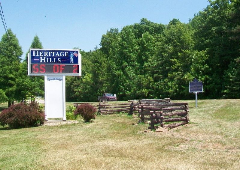
Photographed by William Fischer, Jr., June 25, 2016
2. David Turnham (1803-1884) Marker

Photographed by Jeff Leichsenring, July 24, 2026
3. David Turnham (1803-1884) Marker
Credits. This page was last revised on August 4, 2026. It was originally submitted on July 10, 2016, by William Fischer, Jr. of Reynoldsburg, Ohio. This page has been viewed 861 times since then and 82 times this year. Last updated on July 14, 2021, by Shane Oliver of Richmond, Virginia. Photos: 1, 2. submitted on July 10, 2016, by William Fischer, Jr. of Reynoldsburg, Ohio. 3. submitted on July 28, 2026, by Jeff Leichsenring of Garland, Texas. • Devry Becker Jones was the editor who published this page.
