Nebraska City in Otoe County, Nebraska — The American Midwest (Upper Plains)
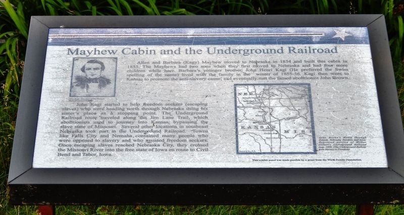
Mayhew Cabin and the Underground Railroad
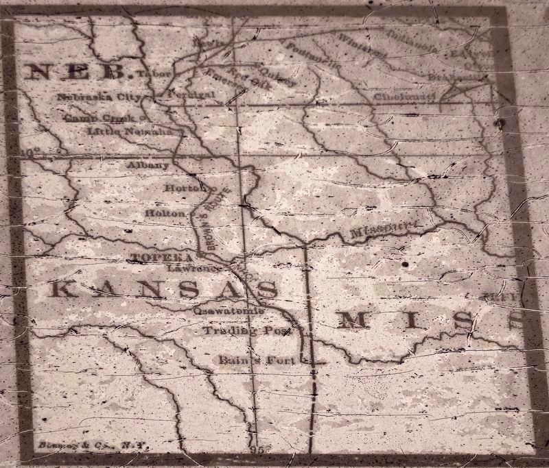
John Kagi started to help freedom seekers (escaping slaves) who were heading north through Nebraska using his sister’s place as a stopping point. The Underground Railroad route traveled along the Jim Lane Trail, which abolitionists used to journey into Kansas, bypassing the slave state of Missouri. Several other locations in southeast Nebraska took part in the Underground Railroad. Towns like Falls City and Nemaha contained many people who were opposed to slavery and who assisted freedom seekers. Once escaping slaves reached Nebraska City, they crossed the Missouri River into the free state of Iowa en route to Civil Bend and Tabor, Iowa.
Topics. This historical marker is listed in these topic lists: Abolition & Underground RR • African Americans • Roads & Vehicles. A significant historical year for this entry is 1855.
Location. 40° 40.397′ N, 95° 52.202′ W. Marker is in Nebraska City, Nebraska, in Otoe County. Marker is on 4th Corso (Nebraska Route 2) west of South 19th Street, on the right when traveling west. Marker is located directly in front of the Mayhew Cabin. Touch for map. Marker is at or near this postal address: 2012 4th Corso, Nebraska City NE 68410, United States of America. Touch for directions.
Other nearby markers. At least 8 other markers are within walking distance of this marker. Mayhew Cabin, 1855 (a few steps from this marker); Nebraska City (about 500 feet away, measured in a direct line); This ELI Windmill (approx. 0.4 miles away); Nebraska City Museum of Firefighting (approx. half a mile away); Nebraska City Volunteer Fire Dept. (approx. half a mile away); Pioneer Masons of Nebraska Territory (approx. 0.6 miles away); Mother Church of Methodism in Nebraska (approx. 0.7 miles away); First United Methodist Church Original 1855 Wall (approx. 0.7 miles away). Touch for a list and map of all markers in Nebraska City.
Related markers. Click here for a list of markers that are related to this marker. Mayhew Cabin
Also see . . . John Henri Kagi. The Kagy families’ views on slavery and John’s newly-formed association with John Brown is likely the reason that his sister’s cabin was used as a stop on the Underground Railroad. The Mayhews were never punished by authorities for helping the slaves, but Kagy was nearly arrested while visiting his sister in the winter of 1859 during his last trip through Nebraska City with fugitive slaves. Exactly how many slaves passed through the Mayhew’s homestead is unknown. (Submitted on July 14, 2021, by Cosmos Mariner of Cape Canaveral, Florida.)
Credits. This page was last revised on July 14, 2021. It was originally submitted on July 14, 2021, by Cosmos Mariner of Cape Canaveral, Florida. This page has been viewed 230 times since then and 55 times this year. Photos: 1, 2, 3, 4. submitted on July 14, 2021, by Cosmos Mariner of Cape Canaveral, Florida.


