Near Sturgis in Meade County, South Dakota — The American Midwest (Upper Plains)
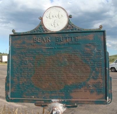
Bear Butte
Mountain of Plains Indians
— Cheyenne (Nowawaste) Sioux (Mato Paha) —
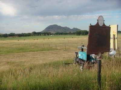
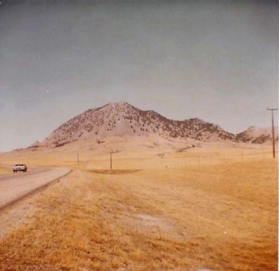
This 4,422 foot high volcanic bubble rises 1,200 feet above the plains, a guide for centuries to Indians, fur traders, soldiers, cowboys, and travelers. It was visited or passed by Verendrye, 1743; Lt. G. K. Warren, 1855; Hayden, the scientist and Reynolds, 1859; Custer, 1874; and since by a galaxy of geological scientists.
This was a sacred mountain to the Cheyenne, the first Indians known to white man to live adjacent to it and here Sweet Medicine, their spiritual leader, received four sacred Cheyenne arrows and the code of ethics many centuries ago. Many a prayer has been said on its rugged slopes and many a smoke signal from its lofty summit has told watchful eyes, of travelers on the Bismarck-Deadwood Trail to its north and other sojourners within its vista.
Near here in 1857 a great council of the Indians determined to hold the Black Hills inviolate from the white man and for two decades this policy dictated their defensive actions.
Custer's annihilation at the Little Big Horn in 1876; the establishment of Camp Sturgis, July 1, 1878 on its Northwest slope spelled the passing of the red man and his brother the buffalo. Today Bear Butte stands, an outpost of the Hills, still a shrine to the Cheyenne, who come here to worship and a monument to man made history and to natures weird handiwork.
Erected 1955 by Meade County Commissioners and State Highway Commission. (Marker Number 80.)
Topics and series. This historical marker is listed in these topic lists: Landmarks • Native Americans. In addition, it is included in the National Historic Landmarks, and the South Dakota State Historical Society Markers series lists. A significant historical date for this entry is July 1, 1790.
Location. 44° 24.982′ N, 103° 26.467′ W. Marker is near Sturgis, South Dakota, in Meade County. Marker is on 206th Street (South Dakota Route 34) 0.2 miles west of 131st Street (South Dakota Route 79), on the left when traveling east. Touch for map. Marker is in this post office area: Sturgis SD 57785, United States of America. Touch for directions.
Other nearby markers. At least 8 other markers are within 3 miles of this marker, measured as the crow flies. 8 Inch Towed Howitzer (M115) (approx. 1˝ miles away); Fourth Cavalry Group Veterans Memorial (approx. 1˝ miles away); Fort Meade Museum (approx. 1˝ miles away); It Started Here (approx. 1.6 miles away); Charles D. Roberts (approx. 1.6 miles away); Bear Butte (Mato Paha) Indian Camp (approx. 2.1 miles away); Civilian Conservation Corps Camps (approx. 2.1 miles away); Charles Nolin (approx. 2.7 miles away). Touch for a list and map of all markers in Sturgis.
Also see . . . Bear Butte State Park. South Dakota Fish, Game, and Park website entry (Submitted on November 8, 2021, by Larry Gertner of New York, New York.)
Credits. This page was last revised on November 8, 2021. It was originally submitted on August 11, 2010, by William J. Toman of Green Lake, Wisconsin. This page has been viewed 1,479 times since then and 25 times this year. Last updated on July 16, 2021. Photos: 1, 2, 3. submitted on August 12, 2010, by William J. Toman of Green Lake, Wisconsin. 4. submitted on August 10, 2010, by Mike Stroud of Bluffton, South Carolina. • Mark Hilton was the editor who published this page.


