Nantucket in Nantucket County, Massachusetts — The American Northeast (New England)
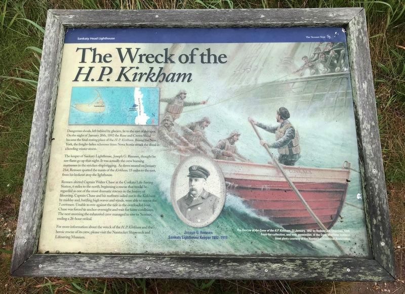
The Wreck of the H.P. Kirkham
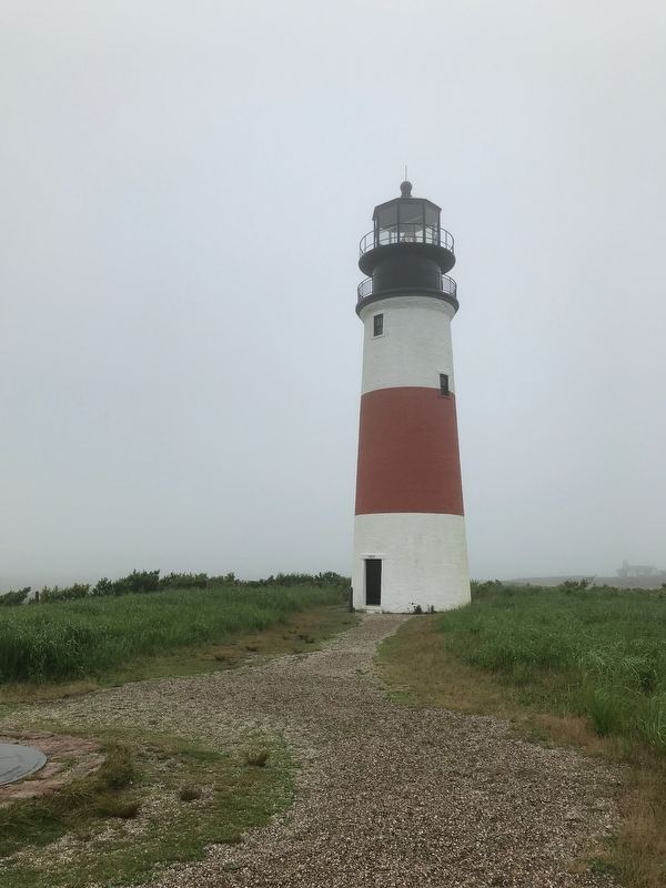
The keeper of Sankaty Lighthouse, Joseph G. Remsen, thought he saw flares go up that night. It was actually the crew burning mattresses in the stricken ship's rigging. As dawn neared on January 21st, Remsen spotted the masts of the Kirkham, 15 miles to the east, from his lookout atop the lighthouse.
Remsen alerted Captain Walter Chase at the Coskata Life-Saving Station, 6 miles to the north, beginning a rescue that would be regarded as one of the most dramatic rescues in the history of lifesaving. Captain Chase and his surfmen sailed out to the Kirkham by midday and, battling high waves and winds, were able to rescue the 7 crewmen. Unable to row against the tide in the overloaded boat, Chase was forced to anchor overnight and wait for fairer conditions. The next morning the exhausted crew managed to row to 'Sconset, ending a 26-hour ordeal.
For more information about the wreck of the H.P. Kirkham and the heroic rescue of is crew, please visit the Nantucket Shipwreck and Lifesaving Museum.
Erected by The 'Sconset Trust.
Topics. This historical marker is listed in these topic lists: Disasters • Waterways & Vessels. A significant historical date for this entry is January 20, 1892.
Location. 41° 17.055′ N, 69° 57.951′ W. Marker is in Nantucket, Massachusetts, in Nantucket County. Marker can be reached from Baxter Road. The marker is located on the property of the Sankaty Head Lighthouse, near the lighthouse itself. Touch for map. Marker is at or near this postal address: 122 Baxter Road, Nantucket MA 02554, United States of America. Touch for directions.
Other nearby markers. At least 8 other markers are within 7 miles of this marker, measured as the crow flies. Sankaty Head Geology (about 300 feet away, measured in a direct line); Sankaty Head Lighthouse (about 400 feet away); Desert Shield And Desert Storm Memorial (approx. 6.9 miles away); Nantucket World War II Monument (approx. 6.9 miles away); Korean Conflict, World War I, and Vietnam Era Memorial (approx. 6.9 miles away); Thomas Turner Square (approx. 6.9 miles away); R.H. Macy (approx. 7 miles away); "Town’s Meridian Line"… (approx. 7 miles away). Touch for a list and map of all markers in Nantucket.
Additional keywords. The Wreck of the H.P. Kirkham
Credits. This page was last revised on August 14, 2021. It was originally submitted on July 17, 2021. This page has been viewed 310 times since then and 29 times this year. Photos: 1, 2. submitted on July 17, 2021. 3. submitted on August 12, 2021. • Bill Pfingsten was the editor who published this page.


