Near Forestburg in Sanborn County, South Dakota — The American Midwest (Upper Plains)
Forestburg Roadside Park
Along the Old Dacotah Trail
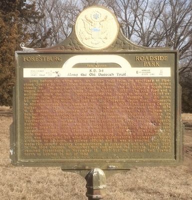
Photographed by Ruth VanSteenwyk, February 21, 2016
1. Forestburg Roadside Park Marker
this page online
Erected 1958 by Tom M. Brisbine, Woonsocket and State Highway Commission. (Marker Number 136.)
Topics and series. This historical marker is listed in these topic lists: Indigenous Peoples and Communities • Settlements & Settlers. In addition, it is included in the South Dakota State Historical Society Markers series list. A significant historical date for this entry is November 5, 1875.
Location. 44° 1.653′ N, 98° 7.286′ W. Marker is near Forestburg, South Dakota, in Sanborn County. It is on State Highway 34 0.7 miles west of 405th Ave., on the right when traveling west. Touch for map. Marker is in this post office area: Artesian SD 57314, United
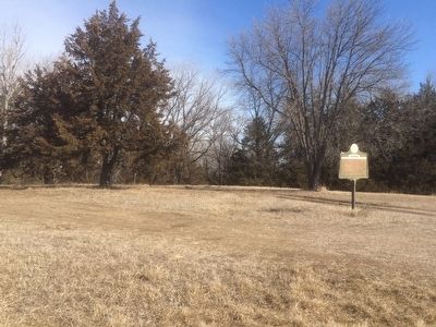
Photographed by Ruth VanSteenwyk, February 21, 2016
2. Forestburg Roadside Park Marker

Regionally, this marker is in East River and specifically in the James River Valley. It is also in the American Lewis & Clark Corridor, on the prairies, and on the Northern Plains. Globally, it is in North America, the Western Hemisphere, the Western World, and the Anglosphere. Historically, it finds itself in what was once Rupert’s Land and also the Louisiana Purchase.
Other nearby markers. At least 4 other markers are within 10 miles of this marker, measured as the crow flies: Ruskin Park (approx. 1.8 miles away); Col. W. H. Nobles (approx. 7.2 miles away); Sanborn County Veterans Memorial (approx. 8 miles away); In Memorium (approx. 10 miles away).
Credits. This page was last revised on July 17, 2021. It was originally submitted on February 23, 2016, by Ruth VanSteenwyk of Aberdeen, South Dakota. This page has been viewed 1,071 times since then and 53 times this year. Last updated on July 17, 2021. Photos: 1, 2. submitted on February 23, 2016, by Ruth VanSteenwyk of Aberdeen, South Dakota. • Bill Pfingsten was the editor who published this page.
