Silverton in San Juan County, Colorado — The American Mountains (Southwest)
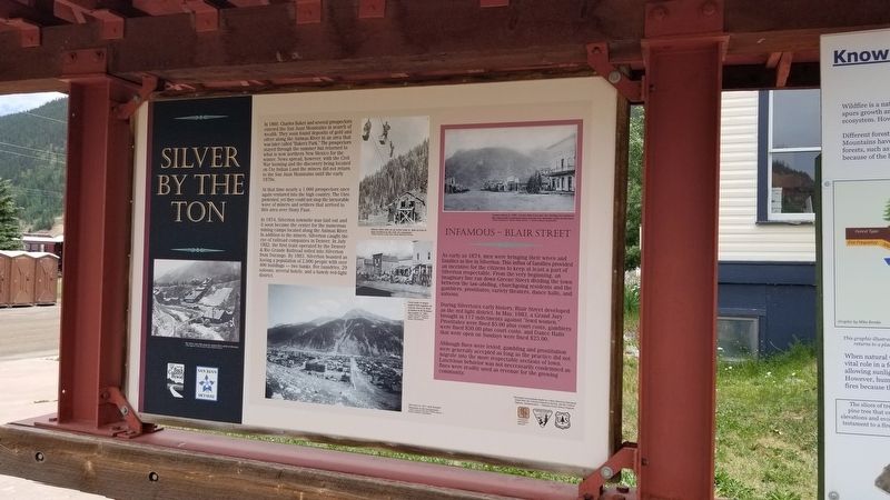
Silver By The Ton
In 1860, Charles Baker and several prospectors entered the San Juan Mountains in search of wealth. They soon found deposits of gold and silver along the Animas River in an area that was later called "Baker's Park." The prospectors stayed through the summer but returned to what is now northern New Mexico for the winter. News spread, however, with the Civil War looming and the discovery being located on Ute Indian Land the miners did not return to the San Juan Mountains until the early 1870s.
At that time nearly a 1,000 prospectors once again ventured into the high country. The Utes protested, yet they could not stop the inexorable wave of miners and settlers that arrived to this area over Stony Pass.
In 1874, Silverton townsite was laid out and it soon became the center for the numerous mining camps located along the Animas River. In addition to the miners, Silverton caught the eye of railroad companies in Denver. In July 1882, the first train operated by the Denver & Rio Grande Railroad rolled into Silverton from Durango. By 1883, Silverton boasted as having a population of 2,000 people with over 400 buildings - two banks, five laundries, 29 saloons, several hotels, and a bawdy red-light district.
Infamous - Blair Street
As early as 1874, men were bringing their wives and families to live in Silverton. This influx of families provided an incentive for the citizens to keep at least a part of Silverton respectable. From the very beginning, an imaginary line ran down Greene Street dividing the town between the law-abiding, churchgoing residents and the gamblers, prostitutes, variety theaters, dance halls, and saloons.
During Silverton's early history, Blair Street developed as the red light district. In May, 1883, a Grand Jury brought in 117 indictments against "lewd women." Prostitutes were fined $5.00 plus court costs, gamblers were fined $30.00 plus court costs, and Dance Halls that were open on Sundays were fined $25.00.
Although fines were levied, gambling and prostitution were generally accepted as long as the practice did not migrate into the more respectable sections of town. Lascivious behavior was not neccessarily condemned as fines were readily used as revenue for the growing community.
Captions
1. The Silver Lake Mill along the Animas River north of Silverton.
-Photo courtesy of San Juan County Historical Society
2. Miners often rode on an aerial tram to gain access to mine perched on the side of a mountain.
-Photo courtesy of San Juan County Historical Society
3. Pack train of mules, loaded with supplies on Greene Street in front of Haines & McNicholas Mercantile in 1881.
-Photo
courtesy of Denver Public Library - Western History Department
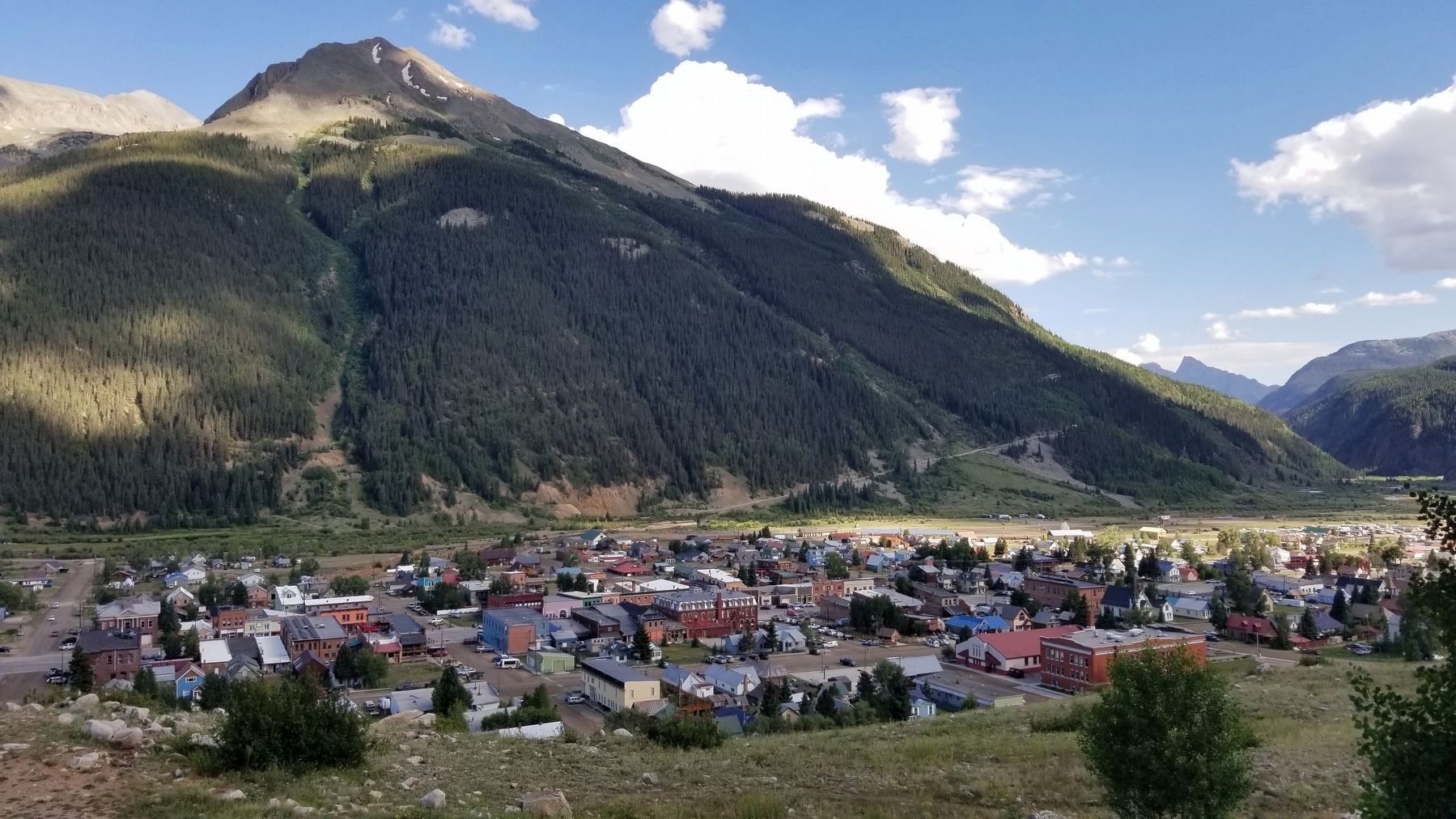
4. Silverton in 1911 with Kendall Mountain in the background.
-Photo courtesy of Denver Public Library - Western History Department
5. Greene Street in 1883. Greene Street became the dividing line between the respectable residential areas and the less desirable parts of Silverton.
-Photo courtesy of Denver Public Library-Western History Department
Reverse Side
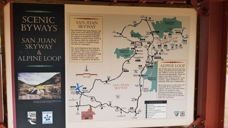
Scenic Byways
San Juan Skyway
The 236-mile San Juan Skyway."one of the most scenic drives in America," will take you on a journey through the history of southwest Colorado. In addition to scenic vistas, travel on the skyway offers an exposure to ancient cultures, Victorian towns, and diverse landcapes.
The paved highways that form the San Juan Skyway are accessible to all vehicles. The route crosses a number of high-elevation passes with sharp switchbacks and sheer dropoffs. Safety, awareness, and courtesy is required by all drivers.
Alpine Loop
The 65-mile route between Lake City, Ouray, and Silverton was built in the late 1800s to access the mineral rich San Juan Mountains. Today, the Alpine Loop offers visitors an Weminuche intimate view of ghost towns, scenic Wilderness wonders, alpine wildflowers, and remnants of the area's mining history.
Most
of the gravel or dirt routes are accessible by two-wheel-drive vehicles, however, four-wheel-drive vehicles are needed to cross Cinnamon and Engineer passes. Developed services on the Alpine Loop can be found only in Silverton. Lake City, and Ouray.
Erected by Colorado Historical Society, Federal Highway Administration and National Scenic Byway Program.
Topics. This historical marker is listed in these topic lists: Industry & Commerce • Railroads & Streetcars • Roads & Vehicles. A significant historical month for this entry is July 1882.
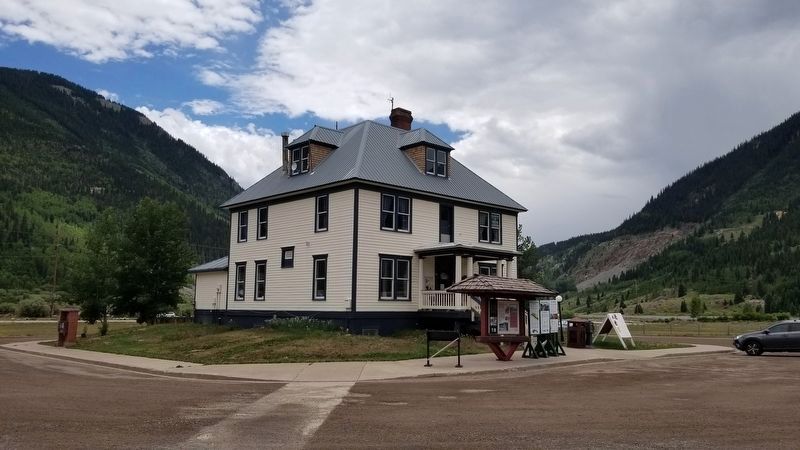
Location. 37° 48.303′ N, 107° 40.182′ W. Marker is in Silverton, Colorado, in San Juan County. Marker is at the intersection of Greene Street (County Highway 110) and Mineral Street, on the right when traveling north on Greene Street. The marker is located in front of the Silverton Vistors Center. Touch for map. Marker is at or near this postal address: 414 Greene Street, Silverton CO 81433, United States of America. Touch for directions.
Other nearby markers. At least 8 other markers are within walking distance of this marker. Silverton's Railroads (here, next to this marker); Shaft "Can" Skip (within shouting distance of this marker); Swivel End-Dump Car (within shouting distance of this marker); Silverton (approx. 0.3 miles away); Hard Rock Resiliency (approx. 0.3 miles away); Rails Into the San Juans (approx. 0.3 miles away); 1069 Greene (approx. half a mile away); 1060 Reese (approx. half a mile away). Touch for a list and map of all markers in Silverton.
Credits. This page was last revised on July 18, 2021. It was originally submitted on July 18, 2021, by James Hulse of Medina, Texas. This page has been viewed 130 times since then and 23 times this year. Photos: 1, 2, 3, 4. submitted on July 18, 2021, by James Hulse of Medina, Texas.


