Mount Pleasant in Maury County, Tennessee — The American South (East South Central)
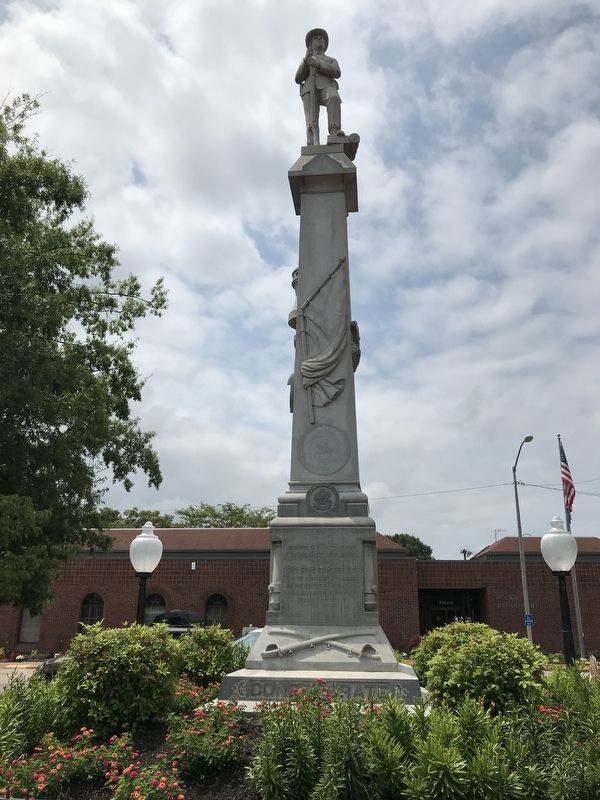
Mount Pleasant Confederate Memorial
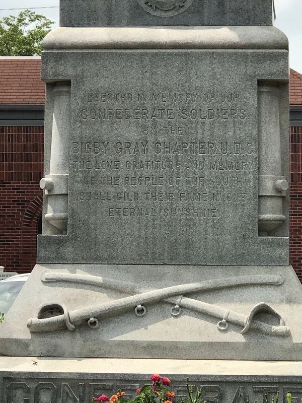
Confederate soldiers
by the
Bigby Gray Chapter, U.D.C.
The love, gratitude and memory
of the people of the South
shall gild their fame in one
eternal sunshine
(south face)
enshrined them immortal
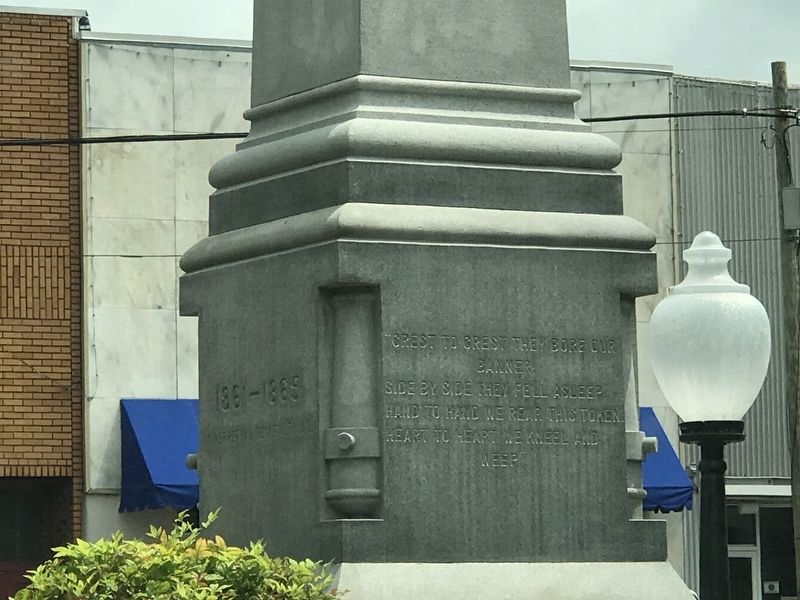
(west face)
banner
side by side they fell asleep
hand to hand we rear this token
heart to heart we kneel and
weep
(north face)
In perpetual remembrance
Erected 1907 by Bigby Gray Chapter, United Daughters of the Confederacy.
Topics and series. This memorial is listed in this topic list: War, US Civil. In addition, it is included in the United Daughters of the Confederacy series list.
Location. 35° 32.057′ N, 87° 12.436′ W. Marker is in Mount Pleasant, Tennessee, in Maury County. Memorial is at the intersection of South Main Street (Tennessee Route 166) and Hay Long Avenue, on the right when traveling south on South Main Street. Memorial is in a small park. Touch for map. Marker is in this post office area: Mount Pleasant TN 38474, United States of America. Touch for directions.
Other nearby markers. At least 8 other markers are within 5 miles of this marker, measured as the crow flies. The Bigby Greys (here, next to this marker); Mount Pleasant Commercial Historic District (within shouting distance of this marker); Breckenridge Hatter's Shop (about 500 feet away, measured in a direct line); Highland Hall (about 700 feet away); Clarke Training School (approx. 0.3 miles away); Rattle and Snap Plantation (approx. 3.6 miles away); St. John's Episcopal Church (approx. 4.7 miles away); Delaying Forrest (approx. 4.7 miles away). Touch for a list and map of all markers in Mount Pleasant.
Credits. This page was last revised on July 18, 2021. It was originally submitted on July 18, 2021. This page has been viewed 346 times since then and 40 times this year. Photos: 1, 2, 3. submitted on July 18, 2021.


