Near Roxbury in Charles City County, Virginia — The American South (Mid-Atlantic)
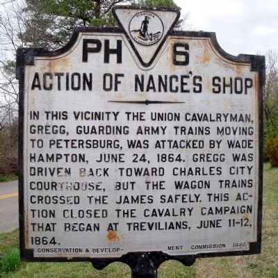
Action of Nance's Shop
Erected 1932 by Conservation & Development Commission. (Marker Number PH-6.)
Topics and series. This historical marker is listed in this topic list: War, US Civil. In addition, it is included in the Virginia Department of Historic Resources (DHR) series list. A significant historical date for this entry is June 24, 1911.
Location. 37° 25.919′ N, 77° 9.04′ W. Marker is near Roxbury, Virginia, in Charles City County. Marker is on Old Union Road (Virginia Route 603) 0.7 miles west of Barnetts Road (Virginia Route 609), on the left when traveling west. Touch for map. Marker is in this post office area: Charles City VA 23030, United States of America. Touch for directions.
Other nearby markers. At least 8 other markers are within 5 miles of this marker, measured as the crow flies. Roxbury (approx. 0.9 miles away); John Smith Captured by Virginia Indians (approx. 1.9 miles away); Long Bridge (approx. 3.2 miles away); Letitia Christian Tyler (approx. 3.6 miles away); a different marker also named Long Bridge (approx. 3.6 miles away); Seven Days Battles (approx. 3.9 miles away); Old Quaker Settlement - Adkins Store (approx. 3.9 miles away); White Oak Swamp (approx. 4.1 miles away).
Also see . . . CWSAC Battle Summary. Saint Mary’s Church (Nance's Shop, Samaria Church). (Submitted on April 8, 2009, by Bernard Fisher of Richmond, Virginia.)
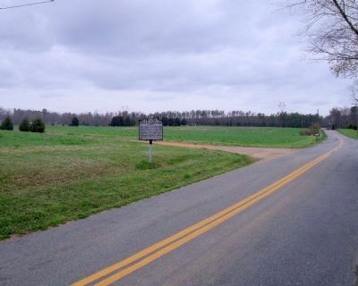
Photographed By Bernard Fisher, April 2, 2009
2. Action of Nance's Shop Marker on Old Union Road (facing west).
Maj Gen Wade Hampton's five Confederate brigades attacked, from the west, two Union brigades under Brig Gen Davies. After several hours, the Federals gave way and were pursued back towards Charles City Courthouse.
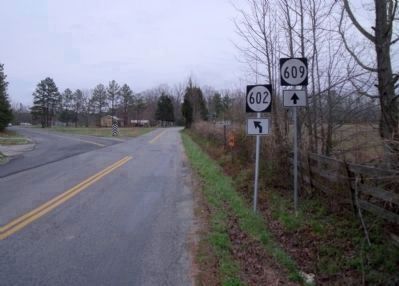
Photographed By Bernard Fisher, April 2, 2009
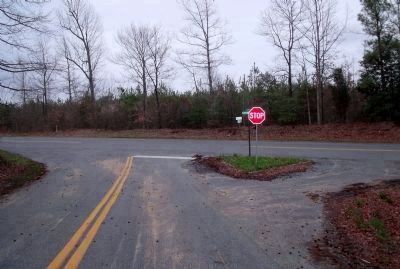
4. Vicinity of Samaria Church (facing south): Barnetts Rd & Lot Cary Rd.
Intersection of Rt 609 to Harrison's Landing and Rt 602 to Charles City Courthouse. Union troopers, under Brig Gen Henry E Davies Jr, were screening the movement of a 900 wagon escort along the James River. On June 24, 1864 they came up the Courthouse road, pushed west, and entrenched. That evening, they would fall back along this same road as Confederate cavalry pursued.
Credits. This page was last revised on November 3, 2021. It was originally submitted on April 8, 2009, by Bernard Fisher of Richmond, Virginia. This page has been viewed 2,368 times since then and 73 times this year. Photos: 1, 2, 3, 4. submitted on April 8, 2009, by Bernard Fisher of Richmond, Virginia. 5, 6, 7, 8, 9. submitted on August 7, 2012, by Gardner Phillips of Richmond, Us.
