Carbondale in Lackawanna County, Pennsylvania — The American Northeast (Mid-Atlantic)
The First Underground Anthracite Mine
"The D&H"
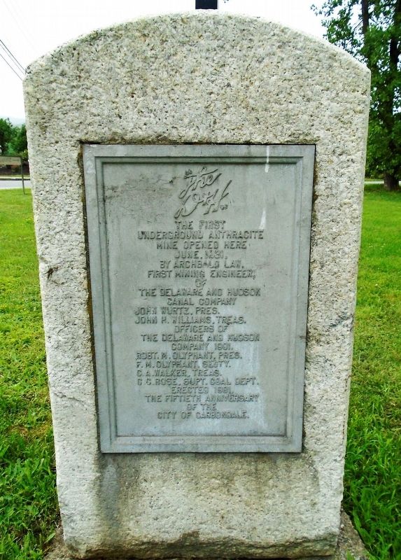
Photographed by William Fischer, Jr., July 18, 2021
1. The First Underground Anthracite Mine Marker
underground anthracite mine
opened here June, 1831,
by Archbald Law,
first mining engineer.
of
The Delaware and Hudson
Canal Company
Officers of
The Delaware and Hudson Company 1901.
Robt. M. Olyphant, Pres.
F.M. Olyphant, Secty. • C.A. Walker, Treas.
C.C. Rose, Supt. Coal Dept.
Erected 1901.
The fiftieth anniversary
of the
City of Carbondale.
Erected 1901 by The Delaware and Hudson Company.
Topics. This historical marker is listed in these topic lists: Industry & Commerce • Railroads & Streetcars • Waterways & Vessels. A significant historical month for this entry is June 1831.
Location. 41° 34.265′ N, 75° 30.351′ W. Marker is in Carbondale, Pennsylvania, in Lackawanna County. It is on 7th Avenue west of the railroad tracks, on the right when traveling west. Marker is in Anthracite Park. Touch for map. Marker is in this post office area: Carbondale PA 18407, United States of America. Touch for directions.

Regionally, this marker is in the Wyoming Valley and in Greater Scranton and Wilkes-Barre. It is also in the American Northeast, in the Mid-Atlantic, in Appalachia, and specifically
this page online
Other nearby markers. At least 8 other markers are within walking distance of this marker: America's First Underground Anthracite Mine (here, next to this marker); Site of the First Deep Underground Anthracite Mine in America (here, next to this marker); Delaware & Hudson Passenger Station (about 500 feet away, measured in a direct line); Carbondale (approx. 0.2 miles away); McCawley Park: Carbondale's UFO (approx. 0.2 miles away); a different marker also named Carbondale (approx. 0.2 miles away); Carbondale's 100th Anniversary (approx. 0.2 miles away); Patrolman William F. McAndrew (approx. 0.2 miles away). Touch for a list and map of all markers in Carbondale.
Also see . . . A Walk Through the Rise and Fall of Anthracite Might (Lauver, 2001). (Submitted on July 19, 2021, by William Fischer, Jr. of Reynoldsburg, Ohio.)
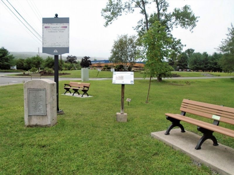
Photographed by William Fischer, Jr., July 18, 2021
2. The First Underground Anthracite Mine Markers
Credits. This page was last revised on July 19, 2021. It was originally submitted on July 19, 2021, by William Fischer, Jr. of Reynoldsburg, Ohio. This page has been viewed 791 times since then and 70 times this year. Photos: 1, 2. submitted on July 19, 2021, by William Fischer, Jr. of Reynoldsburg, Ohio.
