
Kingsport in Hawkins County, Tennessee — The American South (East South Central)
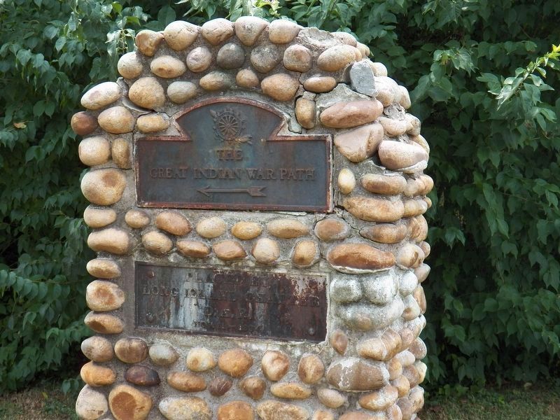
The Great Indian Warpath
Photographed by John Wayman, July 20, 2021
1. Great Indian Warpath Marker
Great Indian Warpath
←
Erected 1934 by Long Island Chapter, DAR.
Topics and series. This historical marker is listed in these topic lists: Indigenous Peoples and Communities • Roads & Vehicles. In addition, it is included in the Daughters of the American Revolution (DAR) series list. A significant historical year for this entry is 1934.
Location. 36° 32.972′ N, 82° 37.066′ W. Marker is in Kingsport, Tennessee, in Hawkins County. It is at the intersection of Netherland Inn Road and Canongate Road, on the right when traveling east on Netherland Inn Road. The marker is visible using Google Earth Street View. Touch for map. Marker is at or near this postal address: 101 Canongate Rd, Kingsport TN 37660, United States of America. Touch for directions.

Regionally, this marker is in East Tennessee and in the Tri-Cities Area. It is also in the American South, specifically in the Upper South, in Appalachia, and specifically in Southern Appalachia. Globally, it is in North America, the Western Hemisphere, the Western World, and the Anglosphere. Historically, it finds itself in what was once the original
this page online
Other nearby markers. At least 8 other markers are within 2 miles of this marker, measured as the crow flies: Battle of Kingsport (approx. 0.3 miles away); a different marker also named Battle of Kingsport (approx. 0.3 miles away); Colonel Gilbert Christian (approx. 1.3 miles away); Flatboat (approx. 1.3 miles away); Old Kingsport Presbyterian Church (approx. 1.3 miles away); The Boat Yard (approx. 1.3 miles away); The Old Schoolhouse (approx. 1.3 miles away); Netherland Inn / King's Boat Yard (approx. 1.3 miles away). Touch for a list and map of all markers in Kingsport.
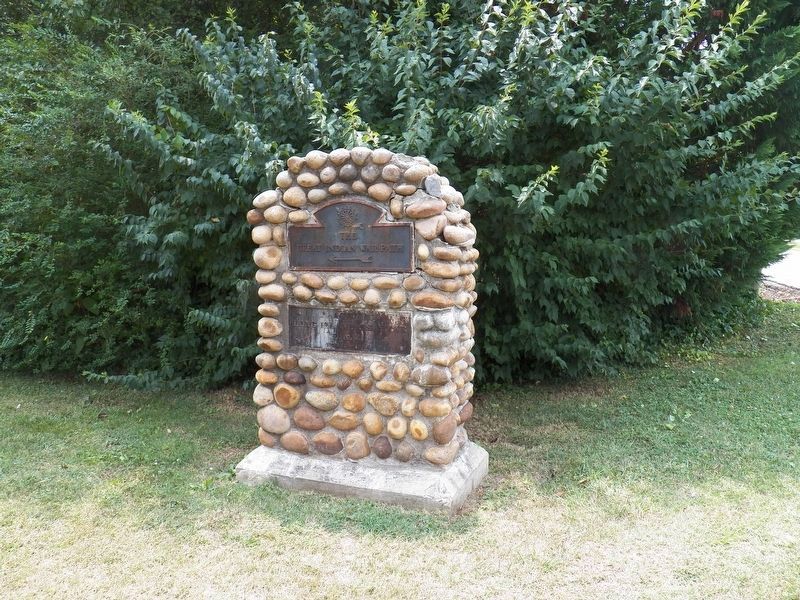
More about this marker. The marker is identical to the Great Indian Warpath markers on Stone Drive in front of the fire station and the marker on West Sullivan Street. Marker has rusty cast iron plaques affixed to a monument made of concrete and 2”-3” river rocks.
Photographed by John Wayman, July 20, 2021
2. The Great Indian Warpath Marker
Credits. This page was last revised on January 9, 2023. It was originally submitted on July 19, 2021, by John Wayman of Kingsport, Tennessee. This page has been viewed 1,333 times since then and 90 times this year. Last updated on July 23, 2021, by John Wayman of Kingsport, Tennessee. Photos: 1, 2. submitted on July 23, 2021, by John Wayman of Kingsport, Tennessee. • J. Makali Bruton was the editor who published this page.
