Near Falls Church in Fairfax County, Virginia — The American South (Mid-Atlantic)
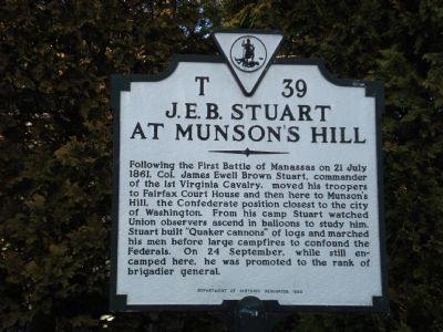
J.E.B. Stuart at Munson’s Hill
Erected 1992 by Department of Historic Resources. (Marker Number T-39.)
Topics and series. This historical marker is listed in this topic list: War, US Civil. In addition, it is included in the Virginia Department of Historic Resources (DHR) series list. A significant historical date for this entry is July 21, 1861.
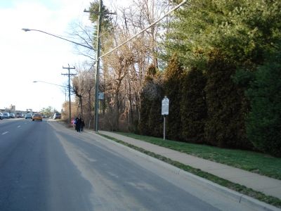
Location. 38° 51.54′ N, 77° 8.688′ W. Marker is near Falls Church, Virginia, in Fairfax County. Marker is on Leesburg Pike (Virginia Route 7) 0.1 miles west of Lakeside View Drive, on the right when traveling west. Touch for map. Marker is at or near this postal address: 6117 Leesburg Pike, Falls Church VA 22044, United States of America. Touch for directions.
Other nearby markers. At least 8 other markers are within walking distance of this marker. Bailey’s Crossroads Civil War Engagements (approx. 0.7 miles away); Original Federal Boundary Stone, District of Columbia, Southwest 7 (approx. 0.7 miles away); This Is Upton Hill! (approx. 0.8 miles away); Moses Ball Grant (approx. 0.9 miles away); Bailey’s Crossroads (approx. 0.9 miles away); Lincoln Reviews Troops at Bailey's Cross Roads (approx. 0.9 miles away); Original Federal Boundary Stone, District of Columbia, Southwest 8 (approx. 0.9 miles away); Named Stones (1989) (approx. one mile away). Touch for a list and map of all markers in Falls Church.
Also see . . . Bailey’s Cross Roads. (Submitted on July 19, 2007, by Roger Dean Meyer of Yankton, South Dakota.)
Credits. This page was last revised on July 7, 2021. It was originally submitted on July 19, 2007, by Roger Dean Meyer of Yankton, South Dakota. This page has been viewed 3,508 times since then and 161 times this year. Photos: 1, 2. submitted on July 19, 2007, by Roger Dean Meyer of Yankton, South Dakota. • J. J. Prats was the editor who published this page.

