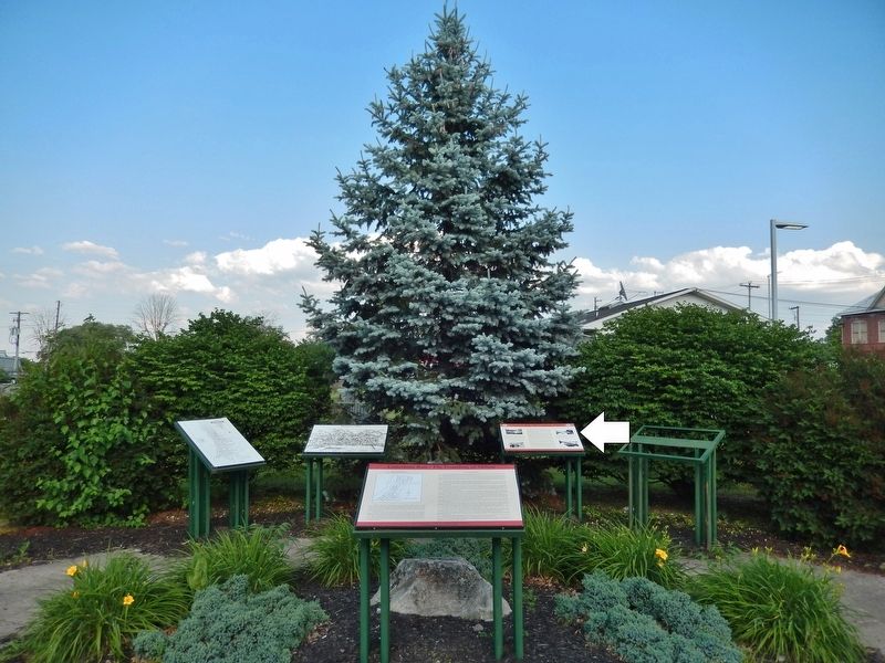
Milton in Northumberland County, Pennsylvania — The American Northeast (Mid-Atlantic)
The West Branch of the Pennsylvania Canal System
Limestone Run / The Founding of Milton
Inscription.
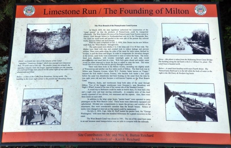
In March 1828, the state legislature authorized the construction of the "canal system" so that the products of Pennsylvania could be transported effectively. The West Branch Division of the Pennsylvania Canal System started at Muncy, went through Milton to Northumberland and on to the Chesapeake Bay. The canal ran north-south and parallel to the west side of the present day railroad tracks, between Filbert and Arch Streets.
With the canal completed on Oct. 2, 1830, John Deeter ran his new Milton-made boat, the "West Branch," through town.
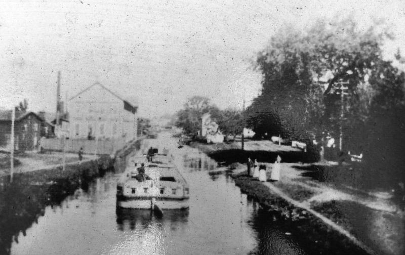
The early canals were ditches 3 to 5 feet deep and 15 to 40 feet wide. The ditches were lined with clay and crushed rock to reduce leakage and prevent erosion. There were paths along the sides of the canal for mule teams, hitched by towline, to pull the boats and barges. In order to compensate for elevation changes in the terrain, canal locks were constructed to raise or lower the boats. The stone-lined lock chambers, with wooden watertight gates at each end, would accommodate one canal boat at a time. With both gates closed and sealed, water would be either removed to lower the boat or added to raise the boat. The water would flow in or out of the lock by gravity through a reservoir.
There were three locks in the Milton vicinity, including one slightly south of Watsontown and another one four miles south of Milton. The third lock was in Milton near Cameron Avenue, where W.C. Fortney, better known as "Cappy," manned the lock tender's house. Fortney, who became lock tender a few years before the canal was abandoned, had been boating on the canal from the time he was eight years old and later became a well-known Captain on the West Branch Canal.
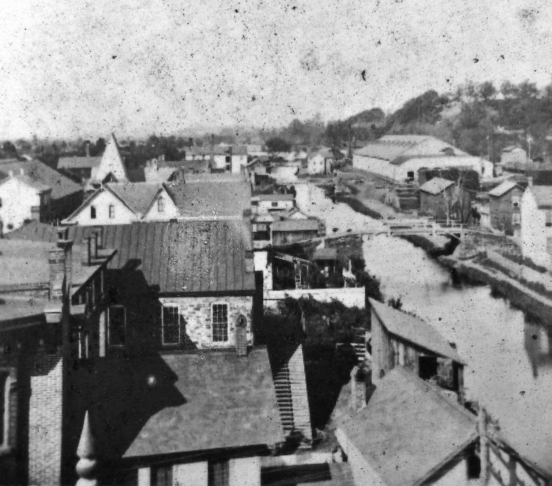
Wharves, docks, and warehouses lined both sides of the canal through Milton. Two of the biggest warehouses were Sweeney's, near Broadway and Nagle's Wharf, located at the rear of the current site of the Standard Journal.
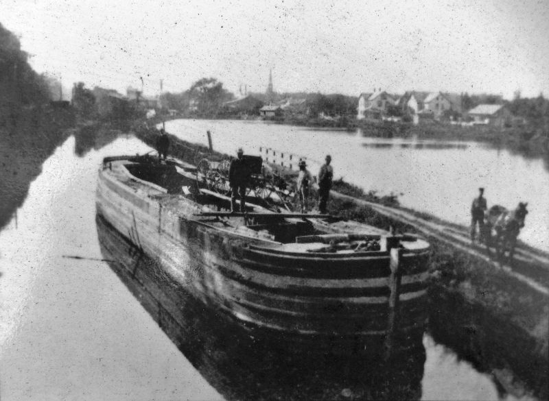
A round trip to Baltimore could be made in twelve days, if a boat had a day and a night crew and kept moving continually. A complete crew of this kind usually consisted of two drivers, two steersmen and the captain. Also, there were three mules on each shift.
In addition to the large cargo boats, "packet boats" were operated to carry passengers on the West Branch Canal. These boats were elaborately equipped and upholstered. Divided into compartments to insure the privacy and comfort of the passengers, they were considerably speedier than the freight barges. Relays of mules were changed at intervals so that speed could be maintained.
On July 4, 1834, Capt. John M, Huff loaded his packet boat, the "George Washington," with more than one hundred Miltonians for a
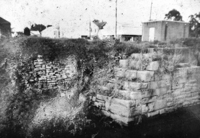
2. Marker detail: Canal Aqueduct Ruins
A present day view of the remains of the Canal “aqueduct,” (waterway bridge), which once passed over Limestone Run, 70 yards east of this site. The smaller stones are actually the aqueduct remains while the larger, squared boulders are the remains of a railroad bridge later placed on the canal right-of-way after it was abandoned and filled.
The West Branch Canal was closed in 1901. The era of the canal boat came to an end because canal transportation was not able to compete with the railroads.
Erected by Milton Historic Downtown Walking Tour.
Topics and series. This historical marker is listed in these topic lists: Industry & Commerce • Waterways & Vessels. In addition, it is included in the Pennsylvania Canal series list. A significant historical date for this entry is October 2, 1830.
Location. 41° 1.031′ N, 76° 51.269′ W. Marker is in Milton, Pennsylvania, in Northumberland County. Marker is on Arch Street (Pennsylvania Route 405) north of Race Street, on the right when traveling north. Located in a small pedestrian plaza beside the sidewalk, near Limestone Run. Touch for map. Marker is in this post office area: Milton PA 17847, United States of America. Touch for directions.
Other nearby markers. At least 8 other markers are within walking distance of this marker. The Founding of Milton (here, next to this marker); Samuel J. Shimer & Sons / Milton Manufacturing Co. (about 500 feet away, measured in a direct line); Chef Boy-Ar-Dee (about 500 feet away); Milton Car Works / ACF Industries (about 500 feet away); Other Industries of Milton (about 500 feet away); Rotary Centennial Park (about 600 feet away); a different
marker also named Rotary Centennial Park (about 700 feet away); On This Site Stood the Second Stone House in Milton (about 700 feet away). Touch for a list and map of all markers in Milton.
Related markers. Click here for a list of markers that are related to this marker. Milton Historic Downtown Walking Tour
Also see . . .
1. West Branch Canal. The transportation of goods, services and people was a rough and inefficient undertaking in the Susquehanna Valley in the early 1800s. This would change with the advent of the West Branch Canal in the 1830s. The creation of a canal system was postponed because of the tribulations of the Revolutionary War and later the birth pangs of nationhood. Finally, on Feb. 26, 1826, the Pennsylvania General Assembly authorized the creation of a canal system, looking to duplicate the success of New York’s Erie Canal. (Submitted on July 30, 2021, by Cosmos Mariner of Cape Canaveral, Florida.)
2. Milton Canal History. In 1829, the Muncy Line of the West Branch of the Pennsylvania Canal was started. With pick and shovel, wheelbarrows, dump wagons, and horses pulling scoops or drag lines, tremendous manpower and horsepower produced a continuous ditch with water that connected
the remote parts of Pennsylvania with the cities of the east. (Submitted on July 30, 2021, by Cosmos Mariner of Cape Canaveral, Florida.)
Credits. This page was last revised on December 19, 2023. It was originally submitted on July 30, 2021, by Cosmos Mariner of Cape Canaveral, Florida. This page has been viewed 341 times since then and 39 times this year. Photos: 1, 2, 3, 4, 5, 6. submitted on July 30, 2021, by Cosmos Mariner of Cape Canaveral, Florida.
