Near Blue Earth in Faribault County, Minnesota — The American Midwest (Upper Plains)
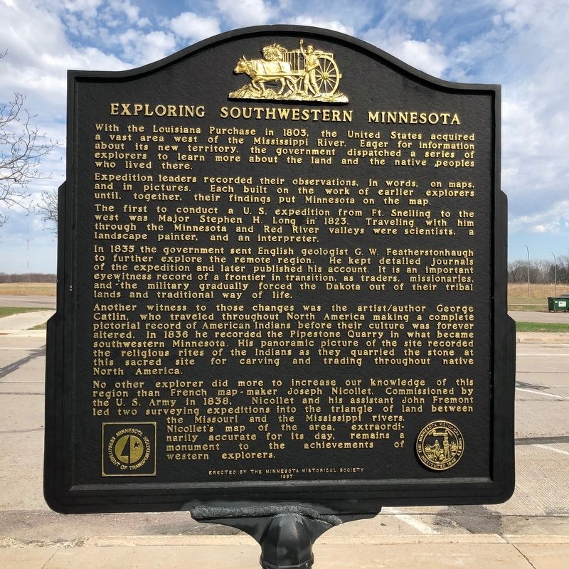
Exploring Southwestern Minnesota
Photographed by Ruth VanSteenwyk, April 21, 2019
1. Exploring Southwestern Minnesota Marker
Expedition leaders recorded their observations in words, on maps, and in pictures. Each built on the work of earlier explorers until, together, their findings put Minnesota on the map.
The first to conduct a U.S. expedition form Ft. Snelling to the west was Major Stephen H. Long in 1823. Traveling with him through the Minnesota and Red River valleys were scientists, a landscape painter, and an interpreter.
In 1835 the government sent English geologist G.W. Featherstonhough to further explore the remote region. He kept detailed journals of the expedition and later published his account. It is an important eyewitness record of a frontier in transition, as traders, missionaries, and the military gradually forced the Dakota out of their tribal lands and traditional way of life.
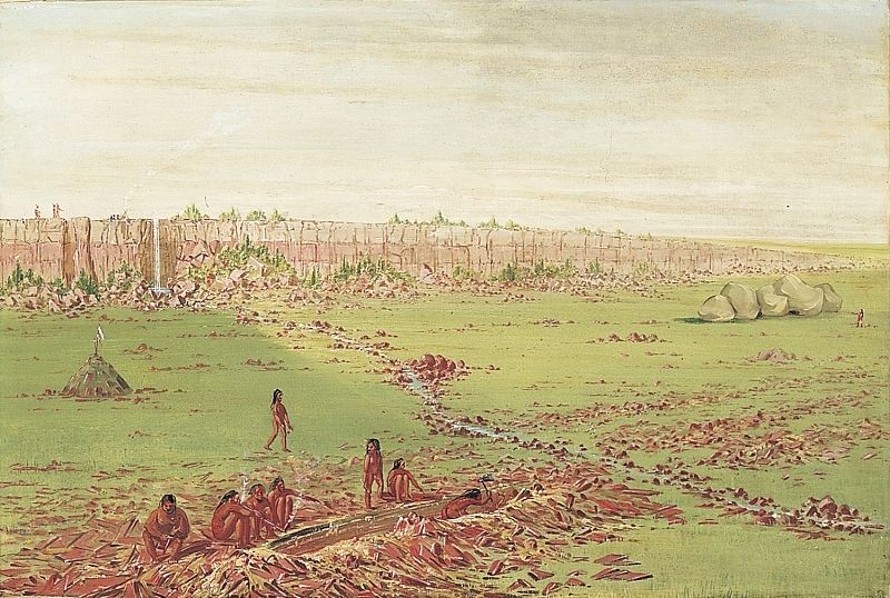
Another witness to those changes was the artist/author George Catlin,
this page online
No other explorer did more to increase our knowledge of this region than French map-maker Joseph Nicollet. Commissioned by the U.S. Army in 1838, Nicollet and his assistant John Fremont led two surveying expeditions into the triangle of land between the Missouri and the Mississippi rivers. Nicollet's map of the area, extraordinarily accurate for its day, remains a monument to the achievements of western explorers.
Erected 1997 by Minnesota Historical Society.
Topics and series. This historical marker is listed in these topic lists: Arts, Letters, Music • Exploration • Indigenous Peoples and Communities • Settlements & Settlers. In addition, it is included in the Minnesota Historical Society series list. A significant historical year for this entry is 1803.
Location. 43° 39.529′ N,
Photographed by Ruth VanSteenwyk, April 21, 2019
2. Exploring Southwestern Minnesota Marker

Regionally, this marker is in Southwest Minnesota. It is also in the American Midwest and in the Corn Belt. Globally, it is in North America, the Western Hemisphere, the Western World, and the Anglosphere. Historically, it finds itself in what was once Rupert’s Land, the territory of the Mississippian Culture, and the Louisiana Purchase.
Other nearby markers. At least 8 other markers are within 2 miles of this marker, measured as the crow flies: A Golden Dedication for I-90 (a few steps from this marker); Water Wisdom (within shouting distance of this marker); The Prairie's Gifts (approx. 0.4 miles away); A Golden Dedication for I-90 / Minnesota Agriculture (approx. 0.4 miles away); Minnesota Agriculture (approx. 0.9 miles away); a different marker also named Exploring Southwestern Minnesota
George Catlin (image courtesy of the Smithsonian American Art Museum), circa 1836
3. Pipestone Quarry on the Coteau des Prairies
Credits. This page was last revised on December 11, 2024. It was originally submitted on April 29, 2019, by Ruth VanSteenwyk of Aberdeen, South Dakota. This page has been viewed 628 times since then and 36 times this year. Last updated on August 1, 2021. Photos: 1, 2. submitted on April 29, 2019, by Ruth VanSteenwyk of Aberdeen, South Dakota. 3. submitted on April 29, 2019. • Mark Hilton was the editor who published this page.
