Wapakoneta in Auglaize County, Ohio — The American Midwest (Great Lakes)
Wapakoneta
(Wapaughkonnetta)
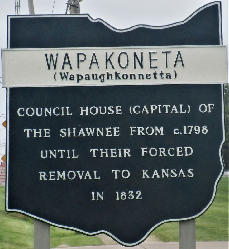
Photographed by Rev. Ronald Irick, July 30, 2021
1. Wapakoneta Marker
Erected by Ohio Historical Society, Ohio Department of Transportation, and Ohio Bicentennial Commission.
Topics and series. This historical marker is listed in these topic lists: Indigenous Peoples and Communities • Settlements & Settlers. In addition, it is included in the Ohio Historical Society / The Ohio History Connection series list. A significant historical year for this entry is 1798.
Location. 40° 35.015′ N, 84° 12.188′ W. Marker is in Wapakoneta, Ohio, in Auglaize County. It is on Lincoln Avenue (Ohio Route 501) 0.1 miles south of Redskin Trail, on the right when traveling south. Touch for map. Marker is at or near this postal address: 1244 Lincoln Hwy, Wapakoneta OH 45895, United States of America. Touch for directions.

Regionally, this marker is in the Till Plains. It is also in the American Midwest and in the Corn Belt. Globally, it is in North America, the Western Hemisphere, the Western World, and the Anglosphere. Historically, it finds itself in what was once the Haudenosaunee (Iroquois) Confederacy,
this page online
Other nearby markers. At least 8 other markers are within one mile of this marker, measured as the crow flies: Cpl. Christian Schnell (within shouting distance of this marker); The Shannon Stock Company (approx. 0.9 miles away); Wapakoneta Commercial Historic District (approx. one mile away); 1874 Casper Rhine Boots And Shoe Store (approx. one mile away); The Charles F. Herbst Building (1905) (approx. one mile away); The Nagel Block (1908) (approx. one mile away); Gold Star Families Memorial Monument (approx. one mile away); Apollow 11 Mission and the First Moon Walk (approx. one mile away). Touch for a list and map of all markers in Wapakoneta.
Additional keywords. Trail of Tears; Forced Removal
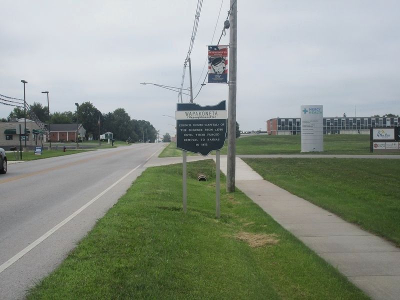
Photographed by Rev. Ronald Irick, July 30, 2021
2. Wapakoneta Marker
Credits. This page was last revised on August 7, 2021. It was originally submitted on August 2, 2021, by Rev. Ronald Irick of West Liberty, Ohio. This page has been viewed 791 times since then and 39 times this year. Photos: 1, 2. submitted on August 2, 2021, by Rev. Ronald Irick of West Liberty, Ohio. • Devry Becker Jones was the editor who published this page.
