Charleston in Kanawha County, West Virginia — The American South (Appalachia)
The Block Historic District / Midland Trail

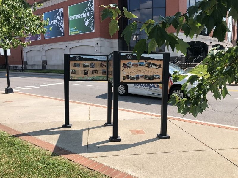
Photographed By Devry Becker Jones (CC0), July 30, 2021
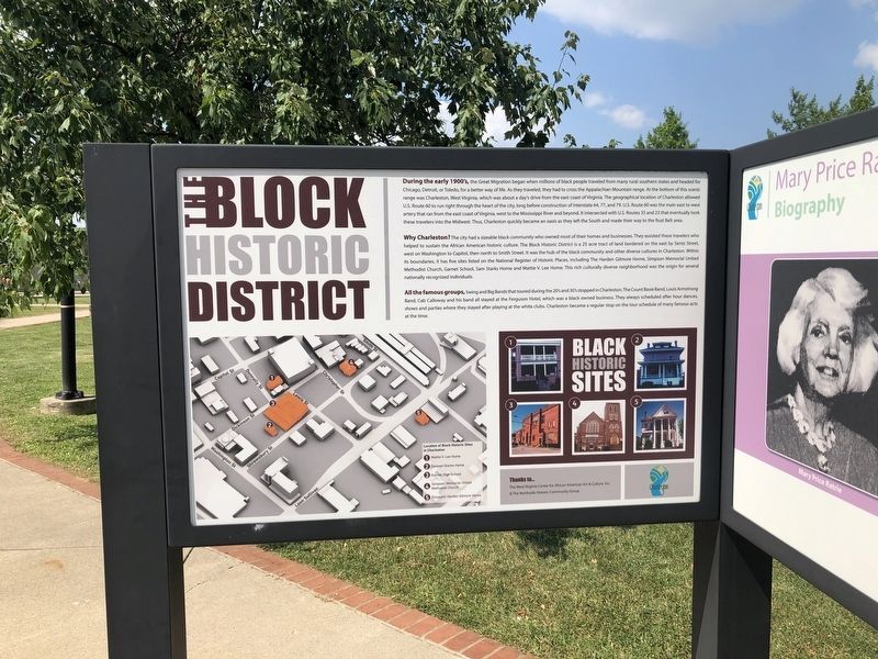
1. The Block Historic District side of the marker
The Block Historic District
During the early 1900's, the Great Migration began when millions of black people traveled from many rural southern states and headed for Chicago, Detroit, or Toledo, for a better way of life. As they traveled, they had to cross the Appalachian Mountain range. At the bottom of this scenic range was Charleston, West Virginia, which was about a day's drive from the east coast of Virginia. The geographical location of Charleston allowed U.S. Route 60 to run right through the heart of the city, long before construction of Interstate 64, 77, and 79. U.S. Route 60, was the main east to west artery that ran from the east coast of Virginia, west to the Mississippi River and beyond. It intersected with U.S. Routes 35 and 23 that eventually took these travelers into the Midwest. Thus, Charleston quickly became an oasis as they left the South and made their way to the Rust Belt area.
Why Charleston? The city had a sizeable black community who owned most of their homes and businesses. They assisted these travelers who helped to sustain the AFrican American historic culture. The Block Historic District is a 25 acre tract of land bordered on the east by Sentz Street, west on Washington to Capitol, then north to Smith Street. It was the hub of the black community and other diverse cultures in Charleston. Within its boundaries, it has five sites listed on the National Register of Historic Place, including The Harden Gilmore Home, Simpson Memorial United Methodist Church, Garnet School, Sam Starks Home and Mattie V. Lee Home. This rich culturally diverse neighborhood was the origin for several nationally recognized individuals.
All the famous groups, Swing and Big BAnds that toured during the 20's and 30's stopped in Charleston. The Count Basie Band, Louis Armstrong Band, Cab Calloway and his band all stayed at the Ferguson Hotel, which was a black owned business. They always scheduled after hour dances, shows and parties where they stayed after playing at the white clubs. Charleston became a regular stop on the tour schedule of many famous acts of the time.
Black Historic Sites
Location of Black Historic Sites in Charleston
1. Mattie V. Lee Home
2. Samuel Starks Home
3. Garnet High School
4. Simpson Memorial United Methodist Church
5. Elizabeth Harden Gilmore Home
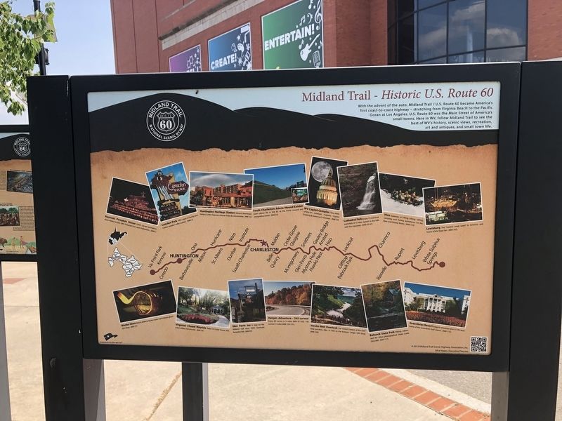
Midland Trail - Historic U.S. Route 60
With the advent of the auto, Midland Trail / U.S. Route 60 became America's first coast-to-coast highway — stretching from Virginia Beach to the Pacific Ocean at Los Angeles. U.S. Route 60 was the Main Street of America's small towns. Here
[Captions:]
Kenova's Pumpkin House 3,000 carved pumpkins draw visitors to this 1891 Victorian Icon each Halloween.
Camden Park 100+ years of family fun! Classic wooden roller coaster.
Huntington Heritage Station Vibrant downtown Visitors Center features unique shops & a locomotive.
South Charleston Adena Mound Exhibit Learn about life in 500 BC at the burial mound and interpretive center.
WV Capitol Complex Tour state-of-the-art museum, majestic Capitol Building & Governor's mansion.
Cathedral Falls Enjoy 12 seasonal waterfalls in 5 miles. Splash in the falls with the minnows.
Hico Gateway to hiking, biking, rafting, camping, and fishing adventures on the New and Gauley Rivers.
Lewisburg The "coolest small town" in America, and home of WV State Fair.
Blenko Glass Watch skilled artisans make hand-blown glass! Gift Shop.
Virginia's Chapel Wayside Relax in Cedar Grove, the area's oldest community.
Glen Ferris Inn A stop on the Midland Trail since 1839. Overlooks Kanawha Falls.
Hairpin Adventure - 245 curves! Enjoy 89 curves

Photographed By Devry Becker Jones (CC0), July 30, 2021
3. The Block Historic District / Midland Trail Marker
Hawks Nest Overlook The "Grand Canyon of the East." Ride gondola, bike, or hike to the bottom. Lodge. Gift Shop.
Babcock State Park Hiking, cabins, and the often-photographed Glade Creek Grist Mill.
Greenbriar Resort Elegant relaxation since 1778. Now home of the Greenbriar Golf Classic.
Erected 2013 by Charleston Area Alliance; The West Virginia Center for African American Art & Culture, Inc. & The Northside Historic Community Group; America's Byways; Midland Trail Scenic Highway Association, Inc.
Topics. This historical marker is listed in these topic lists: African Americans • Roads & Vehicles • Settlements & Settlers. A significant historical year for this entry is 1891.
Location. 38° 20.926′ N, 81° 37.753′ W. Marker is in Charleston, West Virginia, in Kanawha County. Marker is on Washington Street East (U.S. 60) just west of Sentz Street, on the right when traveling west. Touch for map. Marker is at or near this postal address: 1108 Washington St E, Charleston WV 25301, United States of America. Touch for directions.
Other nearby markers. At least 8 other markers are within walking distance of this marker. Mary Price Ratrie Greenspace / Illustrated History of the Midland Trail (here, next to this marker); Charleston Trails / Illustrated History of the Midland Trail (here, next to this marker); Mary Price Ratrie Greenspace (within shouting distance of this marker); The Block (about 600 feet away, measured in a direct line); Garnet High School (approx. 0.2 miles away); World War I Memorial (approx. 0.2 miles away); Saint John's Episcopal Church (approx. 0.2 miles away); Mattie V. Lee Home, Inc. (approx. 0.2 miles away). Touch for a list and map of all markers in Charleston.
Credits. This page was last revised on August 2, 2021. It was originally submitted on August 2, 2021, by Devry Becker Jones of Washington, District of Columbia. This page has been viewed 161 times since then and 9 times this year. Photos: 1, 2, 3. submitted on August 2, 2021, by Devry Becker Jones of Washington, District of Columbia.
