Near Raymond in Hinds County, Mississippi — The American South (East South Central)
King of Battle
Photographed by Mark Hilton, July 30, 2021
1. King of Battle Marker
Inscription.
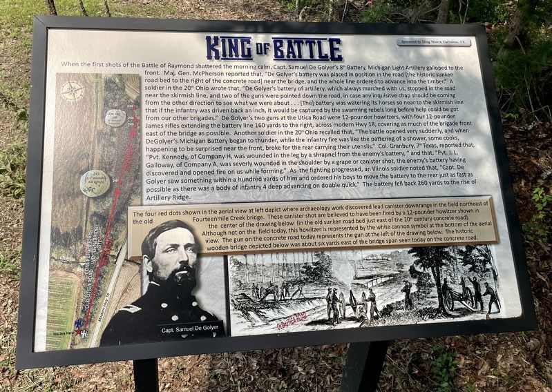
When the first shots of the Battle of Raymond shattered the morning calm, Capt. Samuel De Golyer's 8th Battery, Michigan Light Artillery galloped to the
front. Maj. Gen. McPherson reported that, "De Golyer's battery was placed in position in the road (the historic sunken road bed to the right of the concrete road) near the bridge, and the whole line ordered to advance into the timber.” A soldier in the 20th Ohio wrote that, “De Golyer's battery of artillery, which always marched with us, stopped in the road near the skirmish line, and two of the guns were pointed down the road, in case any inquisitive chap should be coming from the other direction to see what we were about ... [The] battery was watering its horses so near to the skirmish line that if the infantry was driven back an inch, it would be captured by the swarming rebels long before help could be got from our other brigades." De Golyer's two guns at the Utica Road were 12-pounder howitzers, with four 12-pounder James rifles extending the battery line 160 yards to the right, across modern Hwy 18, covering as much of the brigade front east of the bridge as possible.
Click or scan to see this page online
Another soldier in the 20th Ohio recalled that, “The battle opened very suddenly, and when DeGolyer's Michigan Battery began to thunder, while the infantry fire was like the pattering of a shower, some cooks, happening to be surprised near the front, broke for the rear carrying their utensils.” Col. Granbury, 7th Texas, reported that, "Pvt. Kennedy, of Company H, was wounded in the leg by a shrapnel from the enemy's battery," and that, "Pvt. J. L. Galloway, of Company A, was severly [sic] wounded in the shoulder by a grape or canister shot, the enemy's battery having discovered and opened fire on us while forming." As the fighting progressed, an Illinois soldier noted that, “Capt. DeGolyer saw something within a hundred yards of him and ordered his boys to move the battery to the rear just as fast as possible as there was a body of infantry 4 deep advancing on double quick.” The battery fell back 260 yards to the rise of Artillery Ridge.
Inset
The four red dots shown in the aerial view at left depict where archaeology work discovered lead canister downrange in the field northeast of the old Fourteenmile Creek bridge. These canister
Photographed by Mark Hilton, July 30, 2021
2. King of Battle Marker
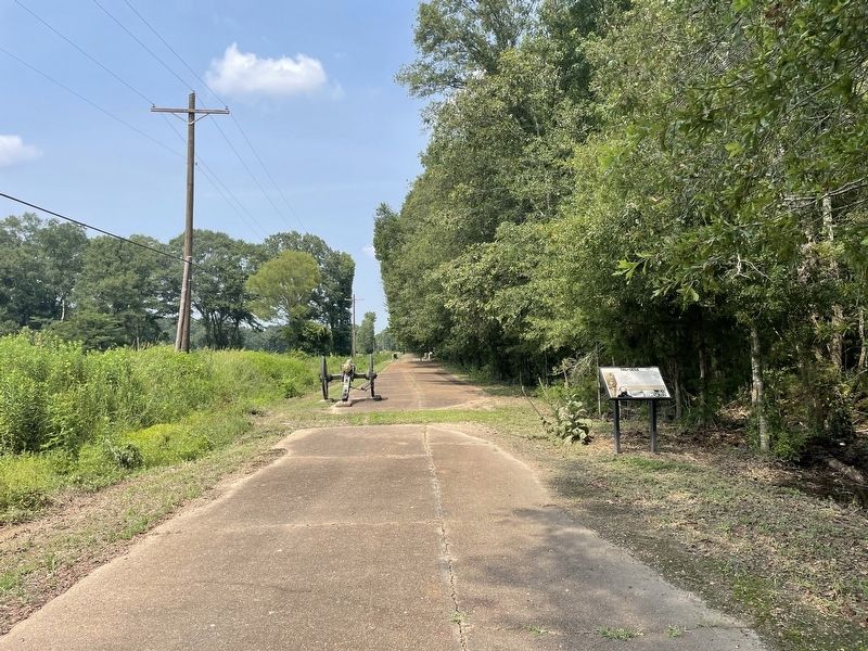
shot are believed to have been fired by a 12-pounder howitzer shown in the center of the drawing below (in the old sunken road bed just east of the 20th century concrete road). Although not on the field today, this howitzer is represented by the white cannon symbol at the bottom of the aerial view. The gun on the concrete road today represents the gun at the left of the drawing below. The historic wooden bridge depicted below was about six yards east of the bridge span seen today on the concrete road.
Erected 2016 by by the Friends of Raymond Battlefield.
Topics. This historical marker is listed in this topic list: War, US Civil.
Location. 32° 14.397′ N, 90° 26.747′ W. Marker is near Raymond, Mississippi, in Hinds County. It can be reached from Mississippi Route 18 one mile Old Port Gibson Road, on the right when traveling south. Touch for map. Marker is in this post office area: Raymond MS 39154, United States of America. Touch for directions.
Regionally, this marker is in Natchez Trace Corridor and in Greater Jackson. It is also in the American South and specifically in
Public domain
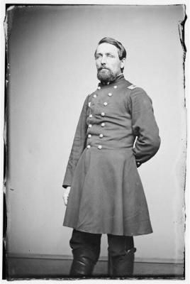
3. Union Captain Samuel DeGolyer
Died August 8, 1863, of wounds received in action at Vicksburg, May 28, 1863.
the Deep South. Globally, it is in North America, a Gulf of Mexico state, the Western Hemisphere, the Western World, and the Anglosphere. Historically, it finds itself in what was once the territory of the Mississippian Culture, one of the Confederate States of America, and the Antebellum South.
Credits. This page was last revised on August 2, 2021. It was originally submitted on August 2, 2021, by Mark Hilton of Montgomery, Alabama. This page has been viewed 535 times since then and 37 times this year. Photos:1, 2, 3. submitted on August 2, 2021, by Mark Hilton of Montgomery, Alabama.