New Madrid in New Madrid County, Missouri — The American Midwest (Upper Plains)
The King's Road
The Spanish and El Camino Real
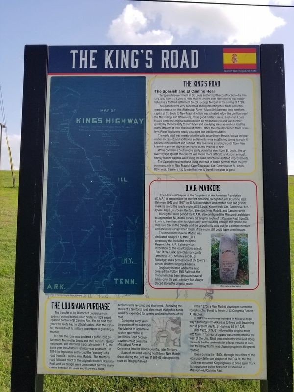
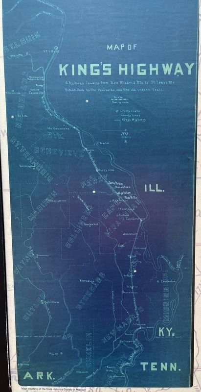
The Spanish Government in St. Louis authorized the construction of a military road from St. Louis to New Madrid shortly after New Madrid was established as a fortified settlement by Col. George Morgan in the spring of 1789.
The Spanish were very concerned about protecting their trade and commerce interests on the Mississippi River. A land link between their northern capital at St. Louis to New Madrid, which was situated below the confluence of the Mississippi and Ohio rivers, made good military sense. Historian Louis Houck wrote the original road followed an old Indian trail and was further guided by the necessity to skirt bogs and low-lying areas as-well-as ford the many streams at their shallowest points. Once the road descended from Crowley's Ridge it followed nearly a straight line into New Madrid.
The early road was merely a bridle path according to Houck, but as the population increased and additional settlements were established along its route it became more distinct and defined. The road was extended south from New Madrid to present day Caruthersville (Little Prairie) in 1794.
While commerce could move easily down the river from St. Louis, the up- river voyage against the current was much more difficult; and, soon enough, heavily loaded wagons were using the road, which necessitated improvements.
The Spanish required those using the road to obtain permits from the post commandants in New Madrid, Cape Girardeau, Ste. Genevieve or St. Louis. Otherwise, travelers had to use the river to travel from post to post.
D.A.R. MARKERS
The Missouri Chapter of the Daughters of the American Revolution (D.A.R.) is responsible for the first historical recognition of El Camino Real. Between 1915 and 1917 the D.A.R. purchased and erected nine red granite markers along the road's route at St. Louis, Kimmswick, Ste. Genevieve, Perryville, Cape Girardeau, Benton, Sikeston, New Madrid, and Caruthersville.
During the same period the D.A.R. also petitioned the Missouri Legislature to appropriate $5,000 to survey the original route of El Camino Real from St. Louis to Caruthersville. Unfortunately, after passing through the House, the measure died in the Senate and the opportunity was lost for a comprehensive and accurate survey when much of the route still could have been located.
The monument in New Madrid was dedicated on April 11, 1916, in a ceremony that included the State Regent, Mrs. J. R. Salisbury; an invocation by the local Catholic priest, Rev. D. W. Clark; speeches by county attorneys J. S. Smalley and R. S. Rutledge; and a procession of the town's school children singing America.
Originally located where the road crossed the Cotton Belt Railroad, the monument has been relocated several times over the past century, but always placed along the original route.
The Louisiana Purchase
The transfer of the District of Louisiana from Spanish control to the United States in 1803 ended Spanish control of El Camino Rio. For the next four years the route had no official status. With the transfer, the road lost its military importance in guarding a frontier.
In 1807 the route was declared a public road by Governor Meriwether Lewis and the Louisiana Territorial judges, and it became a postal route in 1812, the same year the Missouri Territory was organized. In 1814 the legislature authorized the "opening" of a road from St. Louis to New Madrid. This territorial road followed much of the original route of El Camino Real, and, as bridges were constructed over the many creeks between St. Louis and Crowley's Ridge, sections were rerouted and shortened. Achieving the status of a territorial road also meant that public funds would be expended for upkeep and maintenance of the road.
During the early years the portion of the road from New Madrid to Commerce is often referred to as the Illinois Road because travelers could cross the Mississippi River at Commerce into the Illinois Country, later Territory.
Maps
of the road leading north from New Madrid drawn during the Civil War (1861-65) designate the route as Telegraph Road.
In the 1870s a New Madrid developer named the route Hatcher Street to honor U. S. Congress Robert A. Hatcher.
In 1922 the route was included in Missouri High-way 9 running from Arkansas to Iowa until becoming part of present day U.S. Highway 61 in 1926.
Until 1928, U.S. 61 followed the original route into town. That year a bypass was constructed to the west of the city. Until then, residents who lived along the route had to contend with a large volume of dust that the heavy traffic was churning up from the gravel roadbed.
It was during the 1950s, through the efforts of the local Lucy Jefferson chapter of the D.A.R., that the route was renamed Kingshighway to once again mark its importance as the first road established in Missouri El Camino Real.
Topics and series. This historical marker is listed in these topic lists: Colonial Era • Roads & Vehicles • Settlements & Settlers. In addition, it is included in the Daughters of the American Revolution series list. A significant historical date for this entry is April 11, 1916.
Location. 36° 35.021′ N, 89° 31.921′ W. Marker is in New Madrid, Missouri, in New Madrid County. Marker is at the intersection of Water Street and King's Highway, on the right when traveling north on Water Street. Touch for map. Marker is in this post office area: New Madrid MO 63869, United States of America. Touch for directions.
Other nearby markers. At least 8 other markers are within walking distance of this marker. They Passed This Way (approx. 0.2 miles away); Water Route to Indian Territory (approx. 0.2 miles away); Higgerson School (approx. 0.3 miles away); New Madrid (approx. 0.3 miles away); Fort Bankhead (approx. 0.3 miles away); Bissell's Submergible Saw (approx. 0.3 miles away); Battle of Island No. 10 (approx. 0.3 miles away); New Madrid & Island No. Ten (approx. 0.3 miles away). Touch for a list and map of all markers in New Madrid.
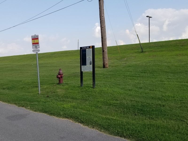
More about this marker. Located on the levee, at the southern terminus of King's Highway.
Related markers. Click here for a list of markers that are related to this marker. Surviving Red Granite Markers erected by the D.A.R. for the King's Highway (El Camino Real)
Additional commentary.
1.
The New Madrid Kings Road DAR marker mentioned above was moved in 1999.
It is now located at the corner of Kings highway and Scott Street (36° 35.315 W 089° 31.992) in New Madrid. The stone marks the El Camino Real in Missouri, a historic trail connecting Spanish settlements in cities like New Madrid, Ste. Geneviev, and St. Louis.
Text of the marker, which is a brown granite vertical marker, reads:
New Madrid / Cape Girardeau / Ste. Genevieve / St. Louis
Erected By The Missouri Daughters Of The American Revolution
A.D. 1915
— Submitted March 19, 2024, by Carolyn Sanders of Plano, Texas.
Credits. This page was last revised on March 20, 2024. It was originally submitted on August 6, 2021, by Cajun Scrambler of Assumption, Louisiana. This page has been viewed 299 times since then and 90 times this year. Photos: 1, 2. submitted on August 6, 2021, by Cajun Scrambler of Assumption, Louisiana. 3. submitted on March 20, 2024, by Craig Swain of Leesburg, Virginia.


