Near Ouray in Ouray County, Colorado — The American Mountains (Southwest)
The Treasury Tunnel

Photographed by James Hulse, July 9, 2021
1. The Treasury Tunnel Marker
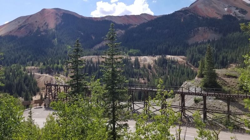
This is the eastern end of the Idarado Mine. As one of the San Juans' larger mines, it contains nearly 100 miles of underground tunnels. Miners would enter here at the Treasury Tunnel and ride the underground trams to their work station. The western end of the mine complex is at Pandora, about 2 miles from Telluride. The Idarado Mine produced until the 1980s. And reclamation work is presently under way.
Erected by Ouray County Historical Society.
Topics. This historical marker is listed in these topic lists: Industry & Commerce • Roads & Vehicles.
Location. 37° 54.905′ N, 107° 42.031′ W. Marker is near Ouray, Colorado, in Ouray County. It is on Million Dollar Highway (U.S. 550) 2 miles south of County Highway 30, on the right when traveling north. The marker is located on the Idarado Mine Trestle. Touch for map. Marker is in this post office area: Ouray CO 81427, United States of America. Touch for directions.

Regionally, this marker is in the Western Slope. It is also in the American Mountain West. Globally, it is in North America, the Rocky Mountains,
this page online
Other nearby markers. At least 8 other markers are within walking distance of this marker: Mine Reclamation Improves Water Quality (a few steps from this marker); The Yankee Girl (within shouting distance of this marker); Boom Towns (within shouting distance of this marker); The Idarado Mine (within shouting distance of this marker); Reclaiming the Land (within shouting distance of this marker); The Heart of the Red Mountains (within shouting distance of this marker); The Silverton Railroad (within shouting distance of this marker); Idarado Houses (about 500 feet away, measured in a direct line). Touch for a list and map of all markers in Ouray.
Also see . . . Idarado Mine.
The mine was a consolidation of several previously inactive mines interconnected via the Treasury Tunnel. The Treasury Tunnel was initially created in 1896 with the hope of connecting older mine workings to allow for drainage and exploiting ore deposits thought to exist between the mines of Red Mountain and Telluride. The tunnel operated for about 10 years with limited success. In 1939(Submitted on August 8, 2021, by James Hulse of Medina, Texas.)several companies merged and secured the mining rights to many of the inactive mines on the west side of the Red Mountain Valley, utilizing the old Treasury Tunnel. Many of the interconnected mines had been some of the district's best producers before closing due to low metal prices and inability to pump the deep mines dry. The operation was named Idarado and in all, some 80 miles of underground workings were created or connected. Source: WikipediaPhotographed by James Hulse, July 9, 20212. The Treasury Tunnel Marker and Trestle

Photographed by James Hulse, July 9, 2021
3. The Treasury Tunnel Marker is on the Idarado Mine Trestle

Photographed by James Hulse, July 9, 2021
4. The tracks and the end portion of the covered section of the Treasury Tunnel

Photographed by James Hulse, July 9, 2021
5. The end of the line of the Treasury Tunnel by the road
Credits. This page was last revised on August 8, 2021. It was originally submitted on August 8, 2021, by James Hulse of Medina, Texas. This page has been viewed 2,670 times since then and 249 times this year. Photos: 1, 2, 3, 4, 5. submitted on August 8, 2021, by James Hulse of Medina, Texas.
