
Inner Harbor in Baltimore, Maryland — The American Northeast (Mid-Atlantic)
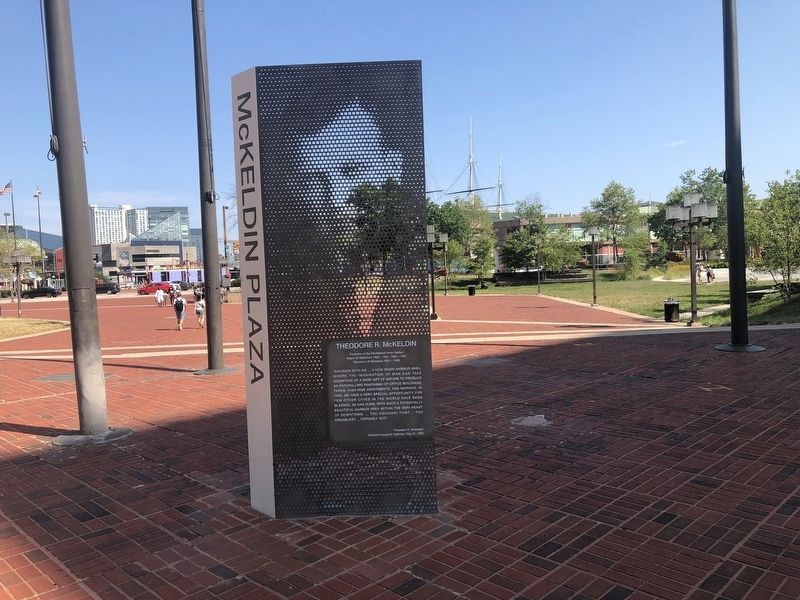
Theodore R. McKeldin
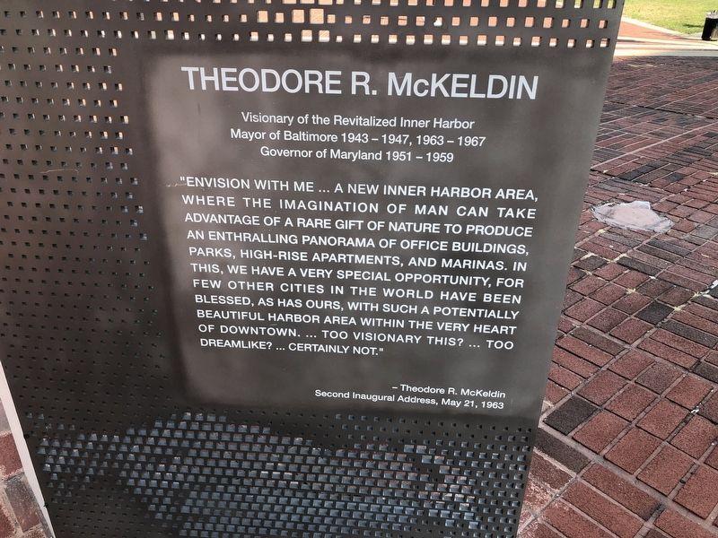
Mayor of Baltimore 1943-1947, 1963-1967
Governor of Maryland 1951-1957
"Envision with me … a new Inner Harbor area, where the imagination of man can take advantage of a rare gift of nature to produce an enthralling panorama of office buildings, parks, high-rise apartments, and marinas. In this, we will have a very special opportunity, for few other cities in the world have been blessed, as has ours, with such a potentially beautiful harbor area within the very heart of downtown. … Too visionary this? … Too dreamlike? … Certainly not."
— Theodore R. McKeldin
Second Inaugural Address, May 21, 1963
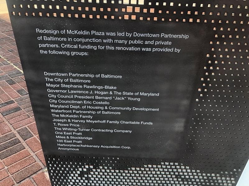
Erected by Downtown Partnership of Baltimore in conjunction with many public and private partners.
Topics. This historical marker is listed in these topic lists: Government & Politics • Industry & Commerce • Notable Places • Waterways & Vessels. A significant historical date for this entry is May 21, 1963.
Location. 39° 17.186′ N, 76° 36.801′ W. Marker is in Baltimore, Maryland. It is in the Inner Harbor. It is at the intersection of East Pratt Street and Light Street
this page online

Regionally, this marker is in Central Maryland. It is also in the American Mid-Atlantic, in the Chesapeake Bay Region, and on the Eastern Seaboard. Globally, it is in the North Atlantic Region, North America, the Western Hemisphere, the Western World, and the Anglosphere. Historically, it finds itself in what was once one of the original Thirteen Colonies and also the Antebellum South.
Other nearby markers. At least 8 other markers are within walking distance of this marker: Baltimore Riot Trail (a few steps from this marker); McKeldin Square (a few steps from this marker); City Center (within shouting distance of this marker); McKeldin Plaza (within shouting distance of this marker); Welcome (about 400 feet away, measured in a direct line); Mob Scene (about 400 feet away); Our Baltimore (about 600 feet away); The Ship's Head (about 600 feet away). Touch for a list and map of all markers in Baltimore.
Another
Photographed by Devry Becker Jones (CC0), August 8, 2021
2. Donor plaque on the reverse side of the display
Credits. This page was last revised on August 8, 2021. It was originally submitted on August 8, 2021, by Devry Becker Jones of Washington, District of Columbia. This page has been viewed 313 times since then and 30 times this year. Photos: 1, 2, 3. submitted on August 8, 2021, by Devry Becker Jones of Washington, District of Columbia.
